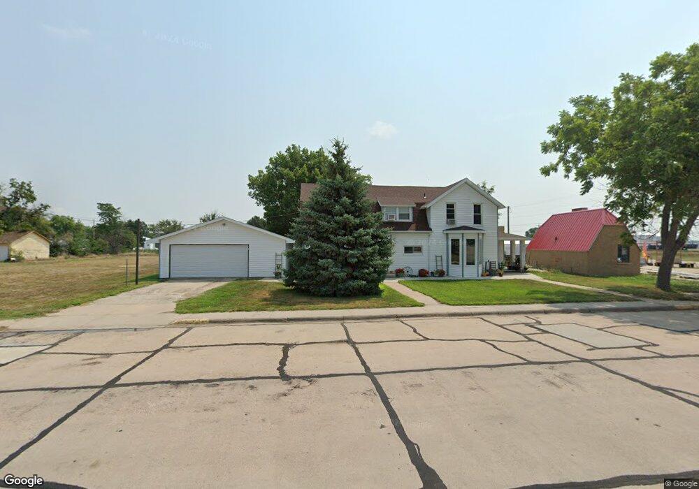
123 Maple St Sutherland, NE 69165
Estimated Value: $129,000 - $150,000
4
Beds
2
Baths
2,153
Sq Ft
$65/Sq Ft
Est. Value
About This Home
This home is located at 123 Maple St, Sutherland, NE 69165 and is currently estimated at $140,303, approximately $65 per square foot. 123 Maple St is a home with nearby schools including Sutherland Elementary School and Sutherland High School.
Ownership History
Date
Name
Owned For
Owner Type
Purchase Details
Closed on
Feb 21, 2017
Sold by
Economy Co Rentals Llc
Bought by
Akb Enterprises Llc
Current Estimated Value
Home Financials for this Owner
Home Financials are based on the most recent Mortgage that was taken out on this home.
Original Mortgage
$88,327
Outstanding Balance
$72,612
Interest Rate
4.12%
Mortgage Type
Future Advance Clause Open End Mortgage
Estimated Equity
$67,691
Create a Home Valuation Report for This Property
The Home Valuation Report is an in-depth analysis detailing your home's value as well as a comparison with similar homes in the area
Purchase History
We collect this data history from publicly available records. To have your information removed, we recommend requesting removal directly through your county’s website.
| Date | Buyer | Sale Price | Title Company |
|---|---|---|---|
| Akb Enterprises Llc | $85,000 | Title Services Of The Plains |
Source: Public Records
Mortgage History
We collect this data history from publicly available records. To have your information removed, we recommend requesting removal directly through your county’s website.
| Date | Status | Borrower | Loan Amount |
|---|---|---|---|
| Open | Akb Enterprises Llc | $88,327 |
Source: Public Records
Tax History
| Year | Tax Paid | Tax Assessment Tax Assessment Total Assessment is a certain percentage of the fair market value that is determined by local assessors to be the total taxable value of land and additions on the property. | Land | Improvement |
|---|---|---|---|---|
| 2025 | $1,692 | $120,183 | $19,812 | $100,371 |
| 2024 | $1,697 | $108,960 | $15,205 | $93,755 |
| 2023 | $1,697 | $95,113 | $15,205 | $79,908 |
| 2022 | $1,589 | $83,816 | $15,205 | $68,611 |
| 2021 | $1,562 | $83,816 | $15,205 | $68,611 |
| 2020 | $1,639 | $86,874 | $7,118 | $79,756 |
| 2019 | $1,577 | $86,874 | $7,118 | $79,756 |
| 2018 | $1,083 | $59,855 | $6,910 | $52,945 |
| 2017 | $1,055 | $59,855 | $6,910 | $52,945 |
| 2016 | $1,372 | $77,700 | $6,910 | $70,790 |
| 2014 | $1,475 | $70,345 | $6,910 | $63,435 |
Source: Public Records
Map
Nearby Homes
- 630 Pine St
- 1232 1st St Unit Sutherland NE 69165
- 1021 Locust St
- 431 Linden St
- 440 Linden St
- 0 Linden Lots
- 1311 South St
- 441 W County Rd
- 851 Cobbler Ln
- 35210 W Walker Rd
- 109 E 2nd St
- 103 Bronco Rd
- 117 E Bronco Rd
- 608 N Patterson Ct
- 521 E 2nd St
- 17986 W Antelope Rd
- 17986 W Antelope Rd Unit Hershey NE 69143
- 3751 N Trinity Rd
- 308 W 4th St
- 104 Birch St
Your Personal Tour Guide
Ask me questions while you tour the home.