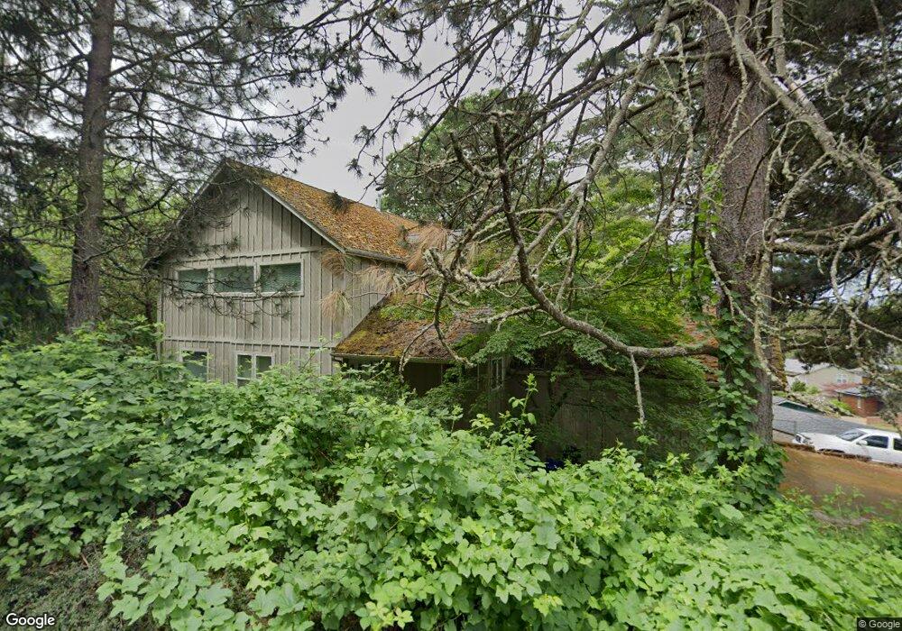
1230 Crenshaw Rd Eugene, OR 97401
Cal Young NeighborhoodEstimated Value: $766,000 - $878,000
6
Beds
4
Baths
2,648
Sq Ft
$312/Sq Ft
Est. Value
About This Home
This home is located at 1230 Crenshaw Rd, Eugene, OR 97401 and is currently estimated at $826,139, approximately $311 per square foot. 1230 Crenshaw Rd is a home located in Lane County with nearby schools including Willagillespie Elementary School, Cal Young Middle School, and Sheldon High School.
Ownership History
Date
Name
Owned For
Owner Type
Purchase Details
Closed on
Oct 15, 2025
Sold by
Kaltenberg Anton T
Bought by
Anton Kaltenberg Revocable Trust and Kaltenberg
Current Estimated Value
Purchase Details
Closed on
Jun 5, 2025
Sold by
Kaltenberg Family Trust and Kaltenberg Anton Theodor
Bought by
Kaltenberg Anton T
Purchase Details
Closed on
Aug 23, 2004
Sold by
Bartlett Amelia A
Bought by
Kaltenberg Family Trust
Create a Home Valuation Report for This Property
The Home Valuation Report is an in-depth analysis detailing your home's value as well as a comparison with similar homes in the area
Home Values in the Area
Average Home Value in this Area
Purchase History
| Date | Buyer | Sale Price | Title Company |
|---|---|---|---|
| Anton Kaltenberg Revocable Trust | -- | None Listed On Document | |
| Kaltenberg Anton T | -- | None Listed On Document | |
| Kaltenberg Family Trust | $320,000 | American Title Group |
Source: Public Records
Tax History
| Year | Tax Paid | Tax Assessment Tax Assessment Total Assessment is a certain percentage of the fair market value that is determined by local assessors to be the total taxable value of land and additions on the property. | Land | Improvement |
|---|---|---|---|---|
| 2025 | $8,050 | $413,176 | -- | -- |
| 2024 | $7,950 | $401,142 | -- | -- |
| 2023 | $7,950 | $389,459 | -- | -- |
| 2022 | $7,448 | $378,116 | $0 | $0 |
| 2021 | $6,995 | $367,103 | $0 | $0 |
| 2020 | $7,020 | $356,411 | $0 | $0 |
| 2019 | $6,780 | $346,031 | $0 | $0 |
| 2018 | $6,382 | $326,168 | $0 | $0 |
| 2017 | $6,096 | $326,168 | $0 | $0 |
| 2016 | $5,938 | $316,668 | $0 | $0 |
| 2015 | $5,774 | $307,445 | $0 | $0 |
| 2014 | $5,658 | $322,821 | $0 | $0 |
Source: Public Records
Map
Nearby Homes
- 0 Crenshaw Rd Unit 740506614
- 1230 Debrick Rd
- 1376 Brickley Rd
- 0 Butte Ln
- 410 Spyglass Dr
- 1282 Evening Star Ln
- 1230 Evening Star Ln
- 516 Spyglass Dr
- 1328 Spyglass Dr
- 982 Shaughnessy Ln
- 0 Piper Ln Unit Lot 1
- 0 Piper Ln Unit Lot 3
- 0 Piper Ln Unit Lot 2
- 0 Piper Ln Unit Lot 5
- 996 Sherwood Place
- 1500 Norkenzie Rd Unit 12
- 875 Sand Ave
- 1625 Monterey Ln
- 0 Cal Young Rd Unit Lot 4
- 1332 Jeppesen Ave
- 1166 Crenshaw Rd
- 1174 Crenshaw Rd Unit 6
- 1188 Crenshaw Rd Unit 5
- 1260 Crenshaw Rd
- 1218 Crenshaw Rd
- 1235 Crenshaw Rd
- 1290 Clinton Dr
- 1215 Crenshaw Rd
- 1212 Crenshaw Rd
- 1270 Clinton Dr
- 1221 Crenshaw Rd
- 1261 Crenshaw Rd
- 1255 Crenshaw Rd
- 1257 Crenshaw Rd
- 1260 Clinton Dr
- 1269 Crenshaw Rd
- 1263 Crenshaw Rd
- 1209 Crenshaw Rd
- 1274 Crenshaw Rd
- 1253 Crenshaw Rd
Your Personal Tour Guide
Ask me questions while you tour the home.