1231 Cedar Dr Unit Bldg-Unit Birmingham, MI 48009
Estimated Value: $1,660,000 - $2,099,000
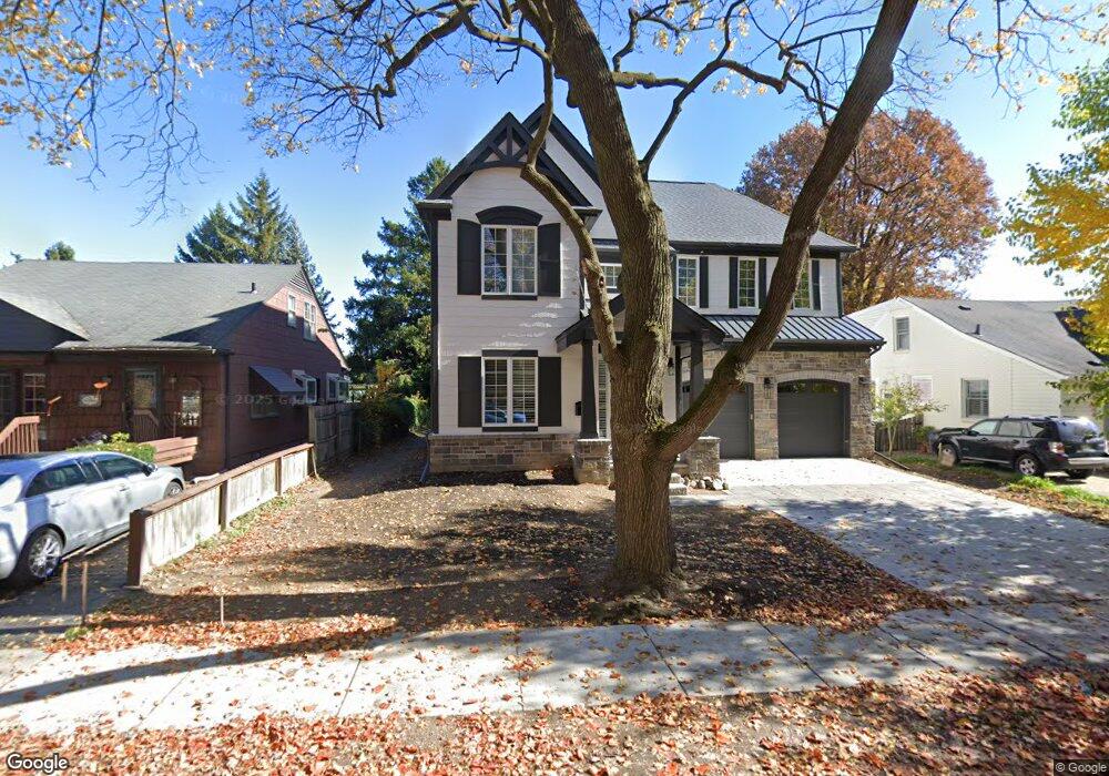
About This Home
This home is located at 1231 Cedar Dr Unit Bldg-Unit, Birmingham, MI 48009 and is currently estimated at $1,954,712, approximately $577 per square foot. 1231 Cedar Dr Unit Bldg-Unit is a home located in Oakland County with nearby schools including Pierce Elementary School, Derby Middle School, and Ernest W. Seaholm High School.
Ownership History
We collect this data history from publicly available records. To have your information removed, we recommend requesting removal directly through your county’s website.
Purchase Details
Purchase Details
Purchase Details
Purchase Details
Purchase Details
Purchase Details
Purchase Details
Home Values in the Area
Average Home Value in this Area
Purchase History
We collect this data history from publicly available records. To have your information removed, we recommend requesting removal directly through your county’s website.
| Date | Buyer | Sale Price | Title Company |
|---|---|---|---|
| -- | None Listed On Document | ||
| -- | None Listed On Document | ||
| -- | None Listed On Document | ||
| -- | Equity Title | ||
| $400,000 | Devon Title Agency | ||
| $400,000 | Devon Title Agency | ||
| $375,000 | None Available | ||
| -- | None Available |
Tax History
We collect this data history from publicly available records. To have your information removed, we recommend requesting removal directly through your county’s website.
| Year | Tax Paid | Tax Assessment Tax Assessment Total Assessment is a certain percentage of the fair market value that is determined by local assessors to be the total taxable value of land and additions on the property. | Land | Improvement |
|---|---|---|---|---|
| 2025 | $30,829 | $781,000 | $0 | $0 |
| 2024 | $30,061 | $739,360 | $0 | $0 |
| 2023 | $25,836 | $640,940 | $0 | $0 |
| 2022 | $31,146 | $610,350 | $0 | $0 |
| 2021 | $30,027 | $595,900 | $0 | $0 |
| 2020 | $3,836 | $105,600 | $0 | $0 |
| 2019 | $5,039 | $95,600 | $0 | $0 |
| 2018 | $5,045 | $95,600 | $0 | $0 |
| 2017 | $5,912 | $204,980 | $0 | $0 |
| 2016 | $5,923 | $199,680 | $0 | $0 |
| 2015 | -- | $189,500 | $0 | $0 |
| 2014 | -- | $178,240 | $0 | $0 |
| 2011 | -- | $124,080 | $0 | $0 |
Map
- 1259 Cedar Dr
- 283 E Lincoln St
- 1094 Lincoln Ct
- 631 Humphrey Ave
- 1245 S Bates St
- 350 Catalpa Dr
- 575 E Lincoln St
- 945 Henrietta St
- 512 George St
- 1284 S Bates St
- 1408 S Bates St
- 1323 Washington Blvd
- 875 S Bates St
- 832 Humphrey Ave
- 907 Ann St
- 967 Ann St
- 787 Ann St
- 751 S Bates St
- 1497 Stanley Blvd
- 512 Wallace St
- 1245 Cedar Dr
- 1275 Cedar Dr
- 1231 Cedar (Lot Only)
- 1295 Cedar Dr
- 1231 Cedar Dr
- 1248 Edgewood Rd
- 1248 Edgewood Rd Unit LOW
- 1248 Edgewood-Lower
- 1248 Edgewood-Upper
- 1215 Cedar Dr
- 1311 Cedar Dr
- 1260 Edgewood Rd
- 1212 Edgewood Rd
- 1272 Edgewood Rd
- 1256 Cedar Dr
- 1268 Cedar Dr
- 1238 Cedar Dr
- 1204 Edgewood Rd
- 1331 Cedar Dr
- 1193 Cedar Dr
Ask me questions while you tour the home.