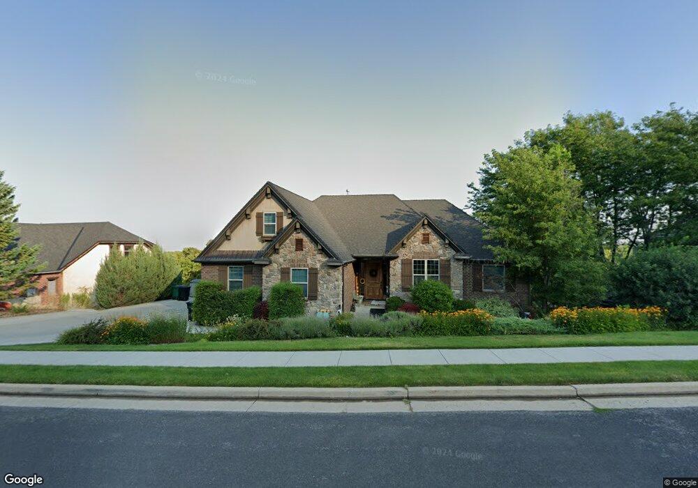
1233 Aspen Dr Logan, UT 84341
Hillcrest NeighborhoodEstimated Value: $660,000 - $873,142
6
Beds
5
Baths
4,391
Sq Ft
$182/Sq Ft
Est. Value
About This Home
This home is located at 1233 Aspen Dr, Logan, UT 84341 and is currently estimated at $800,036, approximately $182 per square foot. 1233 Aspen Dr is a home located in Cache County with nearby schools including Hillcrest Elementary School, Mount Logan Middle School, and Logan High School.
Ownership History
Date
Name
Owned For
Owner Type
Purchase Details
Closed on
May 22, 2023
Sold by
Salisbury Blake C and Salisbury Laura J
Bought by
Blake C Salisbury And Laura J Salisbury Revoc and Salisbury
Current Estimated Value
Purchase Details
Closed on
Jun 22, 2020
Sold by
Bessinger David and Bessinger Darcie
Bought by
Salisbury Blake C and Salisbury Laura J
Purchase Details
Closed on
Aug 2, 2017
Sold by
Bessinger David
Bought by
Bessinger David and Bessinger Darcie
Purchase Details
Closed on
Aug 1, 2017
Sold by
Woolstenhume Dave R and Woolstenhume Karen Jo
Bought by
Bessinger David
Purchase Details
Closed on
Jun 6, 2007
Sold by
Cook Matthew
Bought by
Record Christopher Michael and Record Catherine June
Home Financials for this Owner
Home Financials are based on the most recent Mortgage that was taken out on this home.
Original Mortgage
$341,000
Interest Rate
6.14%
Mortgage Type
New Conventional
Purchase Details
Closed on
May 31, 2006
Sold by
Gerszewski Donald and Gerszewski Marnae
Bought by
Cook Matthew
Home Financials for this Owner
Home Financials are based on the most recent Mortgage that was taken out on this home.
Original Mortgage
$21,250
Interest Rate
10%
Mortgage Type
Unknown
Create a Home Valuation Report for This Property
The Home Valuation Report is an in-depth analysis detailing your home's value as well as a comparison with similar homes in the area
Home Values in the Area
Average Home Value in this Area
Purchase History
| Date | Buyer | Sale Price | Title Company |
|---|---|---|---|
| Blake C Salisbury And Laura J Salisbury Revoc | -- | None Listed On Document | |
| Salisbury Blake C | -- | Hickman Land Title Co | |
| Bessinger David | -- | None Available | |
| Bessinger David | -- | None Available | |
| Record Christopher Michael | -- | Advanced Title | |
| Cook Matthew | -- | Summit Title & Escrow |
Source: Public Records
Mortgage History
| Date | Status | Borrower | Loan Amount |
|---|---|---|---|
| Previous Owner | Record Christopher Michael | $341,000 | |
| Previous Owner | Cook Matthew | $21,250 | |
| Previous Owner | Cook Matthew | $436,000 |
Source: Public Records
Tax History
| Year | Tax Paid | Tax Assessment Tax Assessment Total Assessment is a certain percentage of the fair market value that is determined by local assessors to be the total taxable value of land and additions on the property. | Land | Improvement |
|---|---|---|---|---|
| 2025 | $3,612 | $467,115 | $0 | $0 |
| 2023 | $3,898 | $465,465 | $0 | $0 |
| 2022 | $3,953 | $440,715 | $0 | $0 |
| 2021 | $3,817 | $657,455 | $105,000 | $552,455 |
| 2020 | $3,776 | $585,396 | $105,000 | $480,396 |
| 2019 | $3,947 | $585,396 | $105,000 | $480,396 |
| 2018 | $3,943 | $533,925 | $105,000 | $428,925 |
| 2017 | $3,791 | $271,425 | $0 | $0 |
| 2016 | $3,930 | $270,015 | $0 | $0 |
| 2015 | $3,914 | $270,015 | $0 | $0 |
| 2014 | $3,538 | $270,015 | $0 | $0 |
| 2013 | -- | $270,015 | $0 | $0 |
Source: Public Records
Map
Nearby Homes
- 1156 Circle View Dr
- 1405 N Aspen Dr
- 1451 N Aspen Dr
- 1424 N 1640 E
- 1475 N Aspen Dr Unit 16
- 1440 N 1600 E
- 1902 E 1500 N
- 1512 E 1260 N
- 1535 E 1385 N
- 1133 N 1520 E
- 1491 N 1600 E
- 1586 N Sharptail Cir
- 1551 E 1455 N
- 1901 Southpointe Ct
- 1949 Deer Crest Cir Unit 49
- 1959 Deer Crest Cir
- 1441 Ellendale Ave
- 1720 N 1850 E
- 1672 N 1560 E
- 1335 N 1275 Ln E Unit 55
- 1261 Aspen Dr
- 1215 Aspen Dr
- 1228 Aspen Dr
- 1246 Aspen Dr
- 1244 N 1800 E
- 1568 Aspen Dr
- 1264 Aspen Dr
- 1203 Aspen Dr
- 1200 Aspen Dr
- 1213 Cedar Heights Dr
- 1235 Cedar Heights Dr
- 1197 Cedar Heights Dr
- 1197 Cedar Heights Dr Unit 301
- 1257 Cedar Heights Dr
- 1282 Aspen Dr
- 1229 N 1800 E
- 1195 Aspen Dr
- 1269 Cedar Heights Dr
- 1185 Cedar Heights Dr
- 1190 Aspen Dr
Your Personal Tour Guide
Ask me questions while you tour the home.