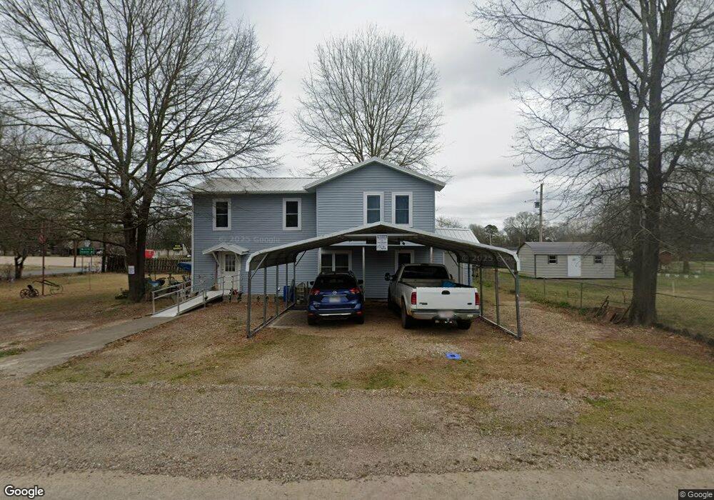
1235 N Maple Ave Murfreesboro, AR 71958
Estimated Value: $110,491 - $161,000
Studio
2
Baths
1,672
Sq Ft
$82/Sq Ft
Est. Value
About This Home
This home is located at 1235 N Maple Ave, Murfreesboro, AR 71958 and is currently estimated at $136,873, approximately $81 per square foot. 1235 N Maple Ave is a home located in Pike County with nearby schools including Murfreesboro Elementary School, Murfreesboro High School, and Harvest Time Christian Academy.
Ownership History
Date
Name
Owned For
Owner Type
Purchase Details
Closed on
Dec 5, 2018
Bought by
Holt Robert
Current Estimated Value
Purchase Details
Closed on
Oct 27, 2012
Bought by
Holt Robert
Purchase Details
Closed on
Oct 9, 2010
Bought by
Holt
Purchase Details
Closed on
Apr 10, 2006
Bought by
Winton
Purchase Details
Closed on
May 8, 2001
Bought by
Winton
Purchase Details
Closed on
Jul 3, 2000
Bought by
Robbins and Robbins Winton
Create a Home Valuation Report for This Property
The Home Valuation Report is an in-depth analysis detailing your home's value as well as a comparison with similar homes in the area
Purchase History
| Date | Buyer | Sale Price | Title Company |
|---|---|---|---|
| Holt Robert | $35,000 | -- | |
| Holt Robert | -- | -- | |
| Holt | -- | -- | |
| Winton | $25,000 | -- | |
| Winton | -- | -- | |
| Robbins | -- | -- |
Source: Public Records
Tax History
| Year | Tax Paid | Tax Assessment Tax Assessment Total Assessment is a certain percentage of the fair market value that is determined by local assessors to be the total taxable value of land and additions on the property. | Land | Improvement |
|---|---|---|---|---|
| 2025 | $386 | $10,030 | $1,150 | $8,880 |
| 2024 | $386 | $10,030 | $1,150 | $8,880 |
| 2023 | $386 | $10,030 | $1,150 | $8,880 |
| 2022 | $11 | $10,030 | $1,150 | $8,880 |
| 2021 | $11 | $8,160 | $1,150 | $7,010 |
| 2020 | $11 | $8,160 | $1,150 | $7,010 |
| 2019 | $11 | $8,160 | $1,150 | $7,010 |
| 2018 | $19 | $8,160 | $1,150 | $7,010 |
| 2017 | $369 | $8,160 | $1,150 | $7,010 |
| 2015 | -- | $7,810 | $1,150 | $6,660 |
| 2014 | -- | $7,260 | $1,150 | $6,110 |
| 2013 | -- | $7,260 | $1,150 | $6,110 |
Source: Public Records
Map
Nearby Homes
- 1456 N Washington Ave
- 409 E 13th St
- 205 3rd Ave
- 49 Arkansas 27
- 406 W Dickson St
- 102 W Haislip St
- 1860 N Hwy 19
- 616 W Main
- 904 3rd Ave
- 863 Arkansas 27
- 1701 S Washington Ave
- 2026 Arkansas 19
- TBD N Hwy 19
- 1251 Highland Ave
- tbd Arkansas 301
- 228 Old Factory Site Rd
- 228 Old Factory Site Rd Rd
- 2 Brian Harris Dr
- TBD Quail Ln
- Tbd Old Factory Site Rd
- 1235 N Maple Ave
- 1223 N Maple Ave
- 1230 N Maple Ave
- 209 W 13th St
- 1221 N Maple Ave
- 1221 N Maple Ave
- 0 W 13th St
- 1218 N Maple Ave
- 1127 N Maple Ave
- 312 W 13th St
- 311 W 13th St
- 1116 N Maple Ave
- 1304 N Washington Ave
- 1105 N Maple Ave
- 1114 N Maple Ave
- 1308 N Washington Ave
- 1405 N Maple Ave
- 203 W 11th St
- 100 Edgewood St
- 1406 N Maple Ave
Your Personal Tour Guide
Ask me questions while you tour the home.