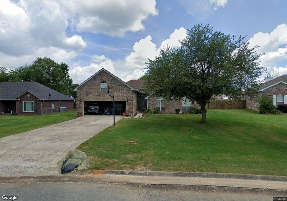
1237 Commons Dr Jacksonville, AR 72076
Estimated Value: $315,000 - $387,000
About This Home
This home is located at 1237 Commons Dr, Jacksonville, AR 72076 and is currently estimated at $351,667, approximately $117 per square foot. 1237 Commons Dr is a home located in Pulaski County with nearby schools including Bayou Meto Elementary School, Jacksonville Middle School, and Jacksonville High School.
Ownership History
We collect this data history from publicly available records. To have your information removed, we recommend requesting removal directly through your county’s website.
Purchase Details
Purchase Details
Home Financials for this Owner
Home Financials are based on the most recent Mortgage that was taken out on this home.Purchase Details
Home Financials for this Owner
Home Financials are based on the most recent Mortgage that was taken out on this home.Purchase Details
Home Financials for this Owner
Home Financials are based on the most recent Mortgage that was taken out on this home.Home Values in the Area
Average Home Value in this Area
Purchase History
We collect this data history from publicly available records. To have your information removed, we recommend requesting removal directly through your county’s website.
| Date | Buyer | Sale Price | Title Company |
|---|---|---|---|
| $28,500 | United Abstract & Title Co | ||
| $28,500 | United Abstract & Title Co | ||
| $235,000 | First National Title Company | ||
| $23,000 | First National Title |
Mortgage History
We collect this data history from publicly available records. To have your information removed, we recommend requesting removal directly through your county’s website.
| Date | Status | Borrower | Loan Amount |
|---|---|---|---|
| Previous Owner | $149,160 | ||
| Previous Owner | $234,500 | ||
| Previous Owner | $148,700 |
Tax History
We collect this data history from publicly available records. To have your information removed, we recommend requesting removal directly through your county’s website.
| Year | Tax Paid | Tax Assessment Tax Assessment Total Assessment is a certain percentage of the fair market value that is determined by local assessors to be the total taxable value of land and additions on the property. | Land | Improvement |
|---|---|---|---|---|
| 2025 | $3,097 | $50,438 | $5,200 | $45,238 |
| 2024 | $2,714 | $50,438 | $5,200 | $45,238 |
| 2023 | $2,714 | $50,438 | $5,200 | $45,238 |
| 2022 | $3,004 | $50,438 | $5,200 | $45,238 |
| 2021 | $2,731 | $44,480 | $6,300 | $38,180 |
| 2020 | $2,731 | $44,480 | $6,300 | $38,180 |
| 2019 | $2,731 | $44,480 | $6,300 | $38,180 |
| 2018 | $2,731 | $44,480 | $6,300 | $38,180 |
| 2017 | $2,393 | $44,480 | $6,300 | $38,180 |
| 2016 | $2,347 | $43,630 | $6,920 | $36,710 |
| 2015 | $2,347 | $43,630 | $6,920 | $36,710 |
| 2014 | $2,347 | $43,630 | $6,920 | $36,710 |
Map
- 113 Shawnee Place
- 116 Arapaho Place
- 104 Foxdell Cir
- 114 Foxdell Cir
- 1003 Latigo Trail
- 905 Stirrup Place
- 32 Woodland Ct
- 10 Woodland Dr
- 2810 Gray Fox Ln
- 108 Dale Dr
- 104 Dale Dr
- 7824 T P White Dr
- 2706 Northeastern Ave
- 1909 Madden Rd
- 618 Madden Rd
- 1008 Ferrell Dr
- 0 N 1st St
- 00 N 1st St
- 1609 Hunters Chase Rd
- 1012 Barbara St
- 1235 Commons Dr
- 1239 Commons Dr
- 0 Commons Unit 15034403
- 0 Commons Unit 17020164
- 0 Commons Unit 1406 Lost Creek Dr
- 0 Commons
- 1233 Commons Dr
- 3804 John Harden Dr
- 1241 Commons Dr
- 1236 Commons Dr
- 3708 John Harden Dr
- 1238 Commons Dr
- 3808 John Harden Dr
- 1231 Commons Dr
- 1230 Commons Dr
- 1243 Commons Dr
- 1703 Puritan Dr
- 1600 Quince Hill Rd
- 1229 Commons Dr
- 1242 Commons Dr
Ask me questions while you tour the home.