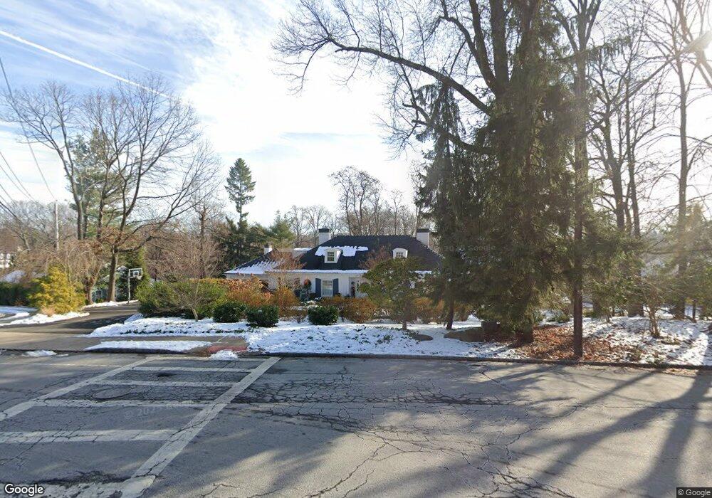
124 Stonebridge Rd Montclair, NJ 07042
Estimated Value: $1,838,504 - $2,830,000
Studio
--
Bath
4,113
Sq Ft
$538/Sq Ft
Est. Value
About This Home
This home is located at 124 Stonebridge Rd, Montclair, NJ 07042 and is currently estimated at $2,212,876, approximately $538 per square foot. 124 Stonebridge Rd is a home located in Essex County with nearby schools including Nishuane School, Hillside School, and Bradford School.
Ownership History
Date
Name
Owned For
Owner Type
Purchase Details
Closed on
Sep 16, 2019
Sold by
Mcdonagh Christopher W and Mcdonagh Andrea
Bought by
Mcdonald Robert P and Mcdonald Jaime W
Current Estimated Value
Home Financials for this Owner
Home Financials are based on the most recent Mortgage that was taken out on this home.
Original Mortgage
$1,096,000
Outstanding Balance
$949,484
Interest Rate
3.5%
Mortgage Type
Purchase Money Mortgage
Estimated Equity
$1,263,392
Purchase Details
Closed on
Apr 12, 2006
Purchase Details
Closed on
Nov 3, 1996
Sold by
Mcgrath Paul
Bought by
Mcdonagh Christopher and Mcdonagh Andrea
Home Financials for this Owner
Home Financials are based on the most recent Mortgage that was taken out on this home.
Original Mortgage
$330,000
Interest Rate
7.76%
Create a Home Valuation Report for This Property
The Home Valuation Report is an in-depth analysis detailing your home's value as well as a comparison with similar homes in the area
Home Values in the Area
Average Home Value in this Area
Purchase History
We collect this data history from publicly available records. To have your information removed, we recommend requesting removal directly through your county’s website.
| Date | Buyer | Sale Price | Title Company |
|---|---|---|---|
| Mcdonald Robert P | $1,370,000 | Prestige Title | |
| -- | -- | -- | |
| Mcdonagh Christopher | $530,000 | -- |
Source: Public Records
Mortgage History
We collect this data history from publicly available records. To have your information removed, we recommend requesting removal directly through your county’s website.
| Date | Status | Borrower | Loan Amount |
|---|---|---|---|
| Open | Mcdonald Robert P | $1,096,000 | |
| Previous Owner | Mcdonagh Christopher | $330,000 |
Source: Public Records
Tax History
| Year | Tax Paid | Tax Assessment Tax Assessment Total Assessment is a certain percentage of the fair market value that is determined by local assessors to be the total taxable value of land and additions on the property. | Land | Improvement |
|---|---|---|---|---|
| 2025 | $39,815 | $1,170,000 | $377,900 | $792,100 |
| 2024 | $39,546 | $1,170,000 | $377,900 | $792,100 |
| 2022 | $37,677 | $1,145,900 | $377,900 | $768,000 |
| 2021 | $37,024 | $1,145,900 | $377,900 | $768,000 |
| 2020 | $36,428 | $1,145,900 | $377,900 | $768,000 |
| 2019 | $36,050 | $1,145,900 | $377,900 | $768,000 |
| 2018 | $35,454 | $1,145,900 | $377,900 | $768,000 |
| 2017 | $36,638 | $981,200 | $345,400 | $635,800 |
| 2016 | $35,657 | $981,200 | $345,400 | $635,800 |
| 2015 | $34,597 | $981,200 | $345,400 | $635,800 |
| 2014 | $33,439 | $981,200 | $345,400 | $635,800 |
Source: Public Records
Map
Nearby Homes
- 24 Mountain Ave
- 27 Valley Way
- 45 Wilfred St
- 45 Wilfred St Unit 6
- 48 Wilfred St
- 29 Warman St
- 24 Fairmount Terrace
- 72 Valley Way
- 167 Harrison Ave
- 30 Virginia Ave
- 158 Maple St
- 16 Winfield St
- 10 Smith Manor Blvd Unit 815
- 10 Smith Manor Blvd Unit 121
- 10 Smith Manor Blvd Unit 804
- 10 Smith Manor Blvd Unit 114
- 10 Smith Manor Blvd Unit 211
- 10 Smith Manor Blvd Unit 418
- 10 Smith Manor Blvd
- 1108 Smith Manor Blvd
- 12 Locust Dr
- 259 S Mountain Ave
- 16 Locust Dr
- 251 S Mountain Ave
- 19 Locust Dr
- 105 Eagle Rock Way
- 256 S Mountain Ave
- 15 Locust Dr
- 262 S Mountain Ave
- 120 Stonebridge Rd
- 248 S Mountain Ave
- 4 Locust Dr
- 112 Eagle Rock Way
- 245 S Mountain Ave
- 9 Locust Dr
- 246 S Mountain Ave
- 246 S Mountain Ave
- 123 Stonebridge Rd
- 148 Eagle Rock Way
- 5 Locust Dr
Your Personal Tour Guide
Ask me questions while you tour the home.