Estimated Value: $191,064 - $583,000
Studio
--
Bath
1,198
Sq Ft
$379/Sq Ft
Est. Value
About This Home
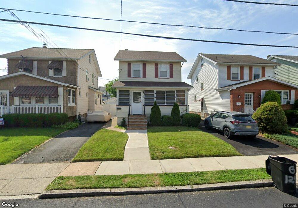
This home is located at 1245 Plane St, Union, NJ 07083 and is currently estimated at $453,516, approximately $378 per square foot. 1245 Plane St is a home located in Union County with nearby schools including Connecticut Farms Elementary School, Union High School, and St Michael Parish School.
Ownership History
Date
Name
Owned For
Owner Type
Purchase Details
Closed on
Mar 8, 2011
Sold by
Flitsch Brian and Flitsch Ellyn
Bought by
Arce Stephanie B
Current Estimated Value
Home Financials for this Owner
Home Financials are based on the most recent Mortgage that was taken out on this home.
Original Mortgage
$230,987
Outstanding Balance
$160,788
Interest Rate
5.07%
Mortgage Type
FHA
Estimated Equity
$292,728
Purchase Details
Closed on
Jul 29, 1996
Sold by
Flitsch Richard and Flitsch Kathleen
Bought by
Flitsch Brian
Create a Home Valuation Report for This Property
The Home Valuation Report is an in-depth analysis detailing your home's value as well as a comparison with similar homes in the area
Home Values in the Area
Average Home Value in this Area
Purchase History
We collect this data history from publicly available records. To have your information removed, we recommend requesting removal directly through your county’s website.
| Date | Buyer | Sale Price | Title Company |
|---|---|---|---|
| Arce Stephanie B | $237,000 | Prestige Title Agency Inc | |
| Flitsch Brian | $100,000 | -- |
Source: Public Records
Mortgage History
We collect this data history from publicly available records. To have your information removed, we recommend requesting removal directly through your county’s website.
| Date | Status | Borrower | Loan Amount |
|---|---|---|---|
| Open | Arce Stephanie B | $230,987 |
Source: Public Records
Tax History
| Year | Tax Paid | Tax Assessment Tax Assessment Total Assessment is a certain percentage of the fair market value that is determined by local assessors to be the total taxable value of land and additions on the property. | Land | Improvement |
|---|---|---|---|---|
| 2025 | $8,203 | $36,700 | $15,100 | $21,600 |
| 2024 | $7,953 | $36,700 | $15,100 | $21,600 |
| 2023 | $7,953 | $36,700 | $15,100 | $21,600 |
| 2022 | $7,676 | $36,700 | $15,100 | $21,600 |
| 2021 | $7,490 | $36,700 | $15,100 | $21,600 |
| 2020 | $7,341 | $36,700 | $15,100 | $21,600 |
| 2019 | $7,242 | $36,700 | $15,100 | $21,600 |
| 2018 | $7,119 | $36,700 | $15,100 | $21,600 |
| 2017 | $7,013 | $36,700 | $15,100 | $21,600 |
| 2016 | $6,842 | $36,700 | $15,100 | $21,600 |
| 2015 | $6,729 | $36,700 | $15,100 | $21,600 |
| 2014 | $6,578 | $36,700 | $15,100 | $21,600 |
Source: Public Records
Map
Nearby Homes
- 2044 High St
- 2047 Gless Ave
- 1244 Grandview Ave
- 1109 Overlook Terrace
- 2062 Emerson Ave
- 2011 Kay Ave
- 1334 Barbara Ave
- 1263 Coolidge Ave
- 1017 Grandview Ave
- 2024 Balmoral Ave
- 1217 Coolidge Ave
- 1875 Pilgrim Way
- 1135 Weber St
- 1397 Orange Ave
- 987 Floyd Terrace
- 1012 Falls Terrace
- 1841 Cider Mill Rd
- 271 Lansdowne Ave
- 937 Roosevelt Ave
- 1781 Union Ave
- 1243 Plane St
- 1239 Plane St
- 1253 Plane St
- 1237 Plane St
- 1237 Plane St Unit 1
- 1238 Kirkman Place
- 1242 Kirkman Place
- 1236 Kirkman Place
- 2026 High St
- 1234 Kirkman Place
- 1235 Plane St
- 1257 Plane St
- 1230 Kirkman Place
- 2020 High St
- 1231 Plane St
- 2042 High St
- 1244 Plane St
- 1248 Plane St
- 1242 Plane St
- 1238 Plane St
Your Personal Tour Guide
Ask me questions while you tour the home.