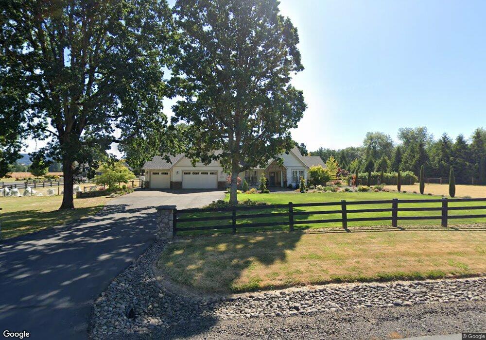
12450 Coyote Loop Rd Newberg, OR 97132
Estimated Value: $1,359,681 - $1,512,000
3
Beds
3
Baths
3,230
Sq Ft
$438/Sq Ft
Est. Value
About This Home
This home is located at 12450 Coyote Loop Rd, Newberg, OR 97132 and is currently estimated at $1,413,420, approximately $437 per square foot. 12450 Coyote Loop Rd is a home located in Yamhill County with nearby schools including Ewing Young Elementary School, Chehalem Valley Middle School, and Newberg Senior High School.
Ownership History
Date
Name
Owned For
Owner Type
Purchase Details
Closed on
Mar 7, 2016
Sold by
Lisle Edward A and Lisle Elaine
Bought by
David & Wanda Henderson Living Trust and Henderson Wanda Sue
Current Estimated Value
Purchase Details
Closed on
Sep 6, 2013
Sold by
Coyote Creek Group Llc
Bought by
Lisle Edward A and Lisle Elaine
Home Financials for this Owner
Home Financials are based on the most recent Mortgage that was taken out on this home.
Original Mortgage
$417,000
Interest Rate
4.27%
Mortgage Type
New Conventional
Purchase Details
Closed on
Sep 5, 2013
Sold by
J D Rainwater Inc
Bought by
Coyote Creek Group Llc
Home Financials for this Owner
Home Financials are based on the most recent Mortgage that was taken out on this home.
Original Mortgage
$417,000
Interest Rate
4.27%
Mortgage Type
New Conventional
Create a Home Valuation Report for This Property
The Home Valuation Report is an in-depth analysis detailing your home's value as well as a comparison with similar homes in the area
Purchase History
| Date | Buyer | Sale Price | Title Company |
|---|---|---|---|
| David & Wanda Henderson Living Trust | $791,000 | First American Title | |
| Lisle Edward A | $541,000 | First American Title | |
| Coyote Creek Group Llc | -- | First American Title |
Source: Public Records
Mortgage History
| Date | Status | Borrower | Loan Amount |
|---|---|---|---|
| Previous Owner | Lisle Edward A | $417,000 |
Source: Public Records
Tax History
| Year | Tax Paid | Tax Assessment Tax Assessment Total Assessment is a certain percentage of the fair market value that is determined by local assessors to be the total taxable value of land and additions on the property. | Land | Improvement |
|---|---|---|---|---|
| 2025 | $8,206 | $628,258 | -- | -- |
| 2024 | $7,929 | $609,959 | -- | -- |
| 2023 | $7,699 | $592,193 | $0 | $0 |
| 2022 | $7,545 | $574,945 | $0 | $0 |
| 2021 | $7,390 | $558,199 | $0 | $0 |
| 2020 | $6,590 | $541,941 | $0 | $0 |
| 2019 | $6,565 | $526,156 | $0 | $0 |
| 2018 | $6,685 | $510,831 | $0 | $0 |
| 2017 | $6,505 | $495,952 | $0 | $0 |
| 2016 | $6,389 | $481,507 | $0 | $0 |
| 2015 | $6,179 | $467,485 | $0 | $0 |
| 2014 | $5,335 | $425,970 | $0 | $0 |
Source: Public Records
Map
Nearby Homes
- 22405 NE Sunnycrest Rd
- 11650 NE Red Hills Rd
- 20805 NE Big Fir Ln
- 22305 NE Ilafern Ln
- 12655 Greenleaf Dr
- 0 NE Williamson Rd
- 10623 NE Fox Farm Rd
- 23895 NE Dillon Rd
- 20600 NE Overlook Dr
- 10580 NE Fox Farm Rd
- 0 NE Cullen Rd
- 19791 NE Sunnycrest Rd
- 601 W 1st St Unit 13
- 23495 NE Dayton Ave
- 1650 NE Chehalem Dr
- 242 NW Walnut Ave
- 129 Nicholas Way
- 0 NE Hagey Rd Unit 402531346
- 2319 Roger Smith Dr
- 287 SW Oliver Ct
- 12450 Coyote Loop
- 12350 NE Coyote Loop
- 12405 Coyote Loop
- 12505 Coyote Loop
- 12605 Coyote Loop
- 12705 Coyote Loop
- 12305 Coyote Loop
- 12250 Coyote Loop
- 12805 Coyote Loop
- 12205 Coyote Loop
- 12850 NE Red Hills Rd
- 0 Coyote Loop Rd Unit 16 10068019
- 0 Coyote Loop Rd Unit 15 10067849
- 0 Coyote Loop Rd Unit 4 10065821
- 0 Coyote Loop Rd Unit 16 10066012
- 0 Coyote Loop Rd Unit 15 10066010
- 0 Coyote Loop Rd Unit 14 10066008
- 0 Coyote Loop Rd Unit 13 10066000
- 0 Coyote Loop Rd Unit 2
- 0 Coyote Loop Rd Unit 9 10065982
Your Personal Tour Guide
Ask me questions while you tour the home.