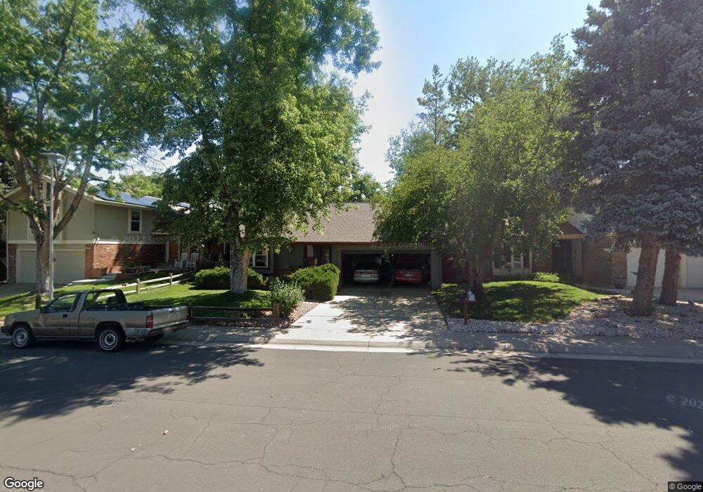
12454 E Amherst Cir Aurora, CO 80014
Dam East/West NeighborhoodEstimated Value: $432,628 - $529,000
2
Beds
2
Baths
1,312
Sq Ft
$374/Sq Ft
Est. Value
About This Home
This home is located at 12454 E Amherst Cir, Aurora, CO 80014 and is currently estimated at $490,907, approximately $374 per square foot. 12454 E Amherst Cir is a home located in Arapahoe County with nearby schools including Polton Community Elementary School, Prairie Middle School, and Overland High School.
Ownership History
Date
Name
Owned For
Owner Type
Purchase Details
Closed on
Mar 23, 1992
Sold by
Ramsey Dovie L Ramsey Robert D
Bought by
Ramsey Dovie L Ramsey Robert D
Current Estimated Value
Purchase Details
Closed on
May 25, 1989
Sold by
Sun Savings & Loan Assn
Bought by
Ramsey Dovie L Ramsey Robert D
Purchase Details
Closed on
Sep 19, 1988
Sold by
Dunne John A Dunne Rhoda E
Bought by
Sun Savings & Loan Assn
Purchase Details
Closed on
Jan 5, 1987
Sold by
Dunne John A Dunne Rhoda E
Bought by
Dunne John A Dunne Rhoda E
Purchase Details
Closed on
Dec 19, 1986
Sold by
Conversion Arapco
Bought by
Dunne John A Dunne Rhoda E
Purchase Details
Closed on
Jul 4, 1776
Bought by
Conversion Arapco
Create a Home Valuation Report for This Property
The Home Valuation Report is an in-depth analysis detailing your home's value as well as a comparison with similar homes in the area
Home Values in the Area
Average Home Value in this Area
Purchase History
We collect this data history from publicly available records. To have your information removed, we recommend requesting removal directly through your county’s website.
| Date | Buyer | Sale Price | Title Company |
|---|---|---|---|
| Ramsey Dovie L Ramsey Robert D | -- | -- | |
| Ramsey Dovie L Ramsey Robert D | -- | -- | |
| Sun Savings & Loan Assn | -- | -- | |
| Dunne John A Dunne Rhoda E | -- | -- | |
| Dunne John A Dunne Rhoda E | -- | -- | |
| Conversion Arapco | -- | -- |
Source: Public Records
Tax History
| Year | Tax Paid | Tax Assessment Tax Assessment Total Assessment is a certain percentage of the fair market value that is determined by local assessors to be the total taxable value of land and additions on the property. | Land | Improvement |
|---|---|---|---|---|
| 2025 | $1,876 | $30,669 | -- | -- |
| 2024 | $1,654 | $30,612 | -- | -- |
| 2023 | $1,654 | $30,612 | $0 | $0 |
| 2022 | $1,263 | $24,388 | $0 | $0 |
| 2021 | $1,271 | $24,388 | $0 | $0 |
| 2020 | $1,275 | $24,904 | $0 | $0 |
| 2019 | $1,240 | $24,904 | $0 | $0 |
| 2018 | $989 | $20,484 | $0 | $0 |
| 2017 | $975 | $20,484 | $0 | $0 |
| 2016 | $730 | $17,385 | $0 | $0 |
| 2015 | $705 | $17,385 | $0 | $0 |
| 2014 | -- | $12,792 | $0 | $0 |
| 2013 | -- | $14,010 | $0 | $0 |
Source: Public Records
Map
Nearby Homes
- 12414 E Amherst Cir
- 13202 E Linvale Place
- 12851 E Vassar Dr
- 2888 S Ursula St
- 2858 S Vaughn Way
- 2864 S Vaughn Way
- 2905 S Vaughn Way
- 2598 S Vaughn Way Unit B
- 3023 S Ursula Cir Unit 302
- 3021 S Ursula Cir Unit 301
- 2552 S Troy Ct
- 2938 S Revere St
- 2558 S Vaughn Way Unit D
- 2693 S Xanadu Way Unit C
- 12347 E Bates Cir
- 12210 E Vassar Dr
- 2496 S Vaughn Way Unit D
- 12592 E Cornell Cir
- 3022 S Wheeling Way Unit 309
- 3022 S Wheeling Way Unit 311
- 12452 E Amherst Cir
- 12468 E Amherst Cir
- 12450 E Amherst Cir
- 12470 E Amherst Cir
- 12448 E Amherst Cir
- 12453 E Amherst Cir
- 12467 E Amherst Cir
- 2801 S Ursula Ct
- 12451 E Amherst Cir
- 12469 E Amherst Cir
- 2805 S Ursula Ct
- 12472 E Amherst Cir
- 12446 E Amherst Cir
- 12449 E Amherst Cir
- 13010 E Linvale Place
- 2807 S Ursula Ct
- 12471 E Amherst Cir
- 13012 E Linvale Place
- 12455 E Amherst Cir
- 12447 E Amherst Cir
Your Personal Tour Guide
Ask me questions while you tour the home.