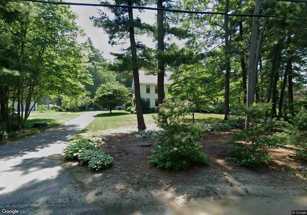
125 Canoe Tree St Marshfield, MA 02050
Estimated Value: $1,317,357 - $1,410,000
4
Beds
3
Baths
3,752
Sq Ft
$368/Sq Ft
Est. Value
About This Home
This home is located at 125 Canoe Tree St, Marshfield, MA 02050 and is currently estimated at $1,379,339, approximately $367 per square foot. 125 Canoe Tree St is a home located in Plymouth County with nearby schools including Eames Way School, Furnace Brook Middle School, and Marshfield High School.
Ownership History
Date
Name
Owned For
Owner Type
Purchase Details
Closed on
Mar 22, 2024
Sold by
Peck Paul C and Peck Jean T
Bought by
Payl & Jean Peck Ret and Peck
Current Estimated Value
Purchase Details
Closed on
Sep 1, 2004
Sold by
Reich James F
Bought by
Reich James F and Oconnor Ellen A
Home Financials for this Owner
Home Financials are based on the most recent Mortgage that was taken out on this home.
Original Mortgage
$410,000
Interest Rate
6.01%
Mortgage Type
Purchase Money Mortgage
Purchase Details
Closed on
Mar 19, 1998
Sold by
Pike Robert W and Pike Terri W
Bought by
Peck Paul C and Peck Jean T
Purchase Details
Closed on
Sep 25, 1997
Sold by
Seadrift Dev Corp
Bought by
Pike Robert W and Pike Terri W
Create a Home Valuation Report for This Property
The Home Valuation Report is an in-depth analysis detailing your home's value as well as a comparison with similar homes in the area
Home Values in the Area
Average Home Value in this Area
Purchase History
| Date | Buyer | Sale Price | Title Company |
|---|---|---|---|
| Payl & Jean Peck Ret | -- | None Available | |
| Payl & Jean Peck Ret | -- | None Available | |
| Reich James F | -- | -- | |
| Reich James F | -- | -- | |
| Peck Paul C | $40,000 | -- | |
| Peck Paul C | $40,000 | -- | |
| Pike Robert W | $316,800 | -- |
Source: Public Records
Mortgage History
| Date | Status | Borrower | Loan Amount |
|---|---|---|---|
| Previous Owner | Pike Robert W | $200,000 | |
| Previous Owner | Pike Robert W | $410,000 |
Source: Public Records
Tax History
| Year | Tax Paid | Tax Assessment Tax Assessment Total Assessment is a certain percentage of the fair market value that is determined by local assessors to be the total taxable value of land and additions on the property. | Land | Improvement |
|---|---|---|---|---|
| 2025 | $12,253 | $1,237,700 | $420,700 | $817,000 |
| 2024 | $11,871 | $1,142,500 | $398,900 | $743,600 |
| 2023 | $10,897 | $996,500 | $346,100 | $650,400 |
| 2022 | $10,897 | $841,500 | $267,200 | $574,300 |
| 2021 | $10,345 | $784,300 | $267,200 | $517,100 |
| 2020 | $9,683 | $726,400 | $223,600 | $502,800 |
| 2019 | $9,337 | $697,800 | $223,600 | $474,200 |
| 2018 | $9,203 | $688,300 | $223,600 | $464,700 |
| 2017 | $8,967 | $653,600 | $223,600 | $430,000 |
| 2016 | $8,672 | $624,800 | $223,600 | $401,200 |
| 2015 | $8,176 | $615,200 | $223,600 | $391,600 |
| 2014 | $8,187 | $616,000 | $212,700 | $403,300 |
Source: Public Records
Map
Nearby Homes
- 480 Pleasant St
- 1155 Main St
- 60 Samuel Curtis Way
- 316 Summer St
- 29 Shepherd's Path
- 889 Old Main Street Extension
- 273 Church St
- 3 Summer St
- 4 Summer St
- 2167 Main St
- 32 Carolyn Cir
- 685 Highland St
- 566 Holly Rd
- 487 Main St
- 848 Plain St Unit 41
- 848 Plain St Unit 23
- 451 School St Unit 2-5
- 451 School St Unit 5-2
- 95 Stony Brook Ln
- 341 Furnace St
- 125 Canoe Tree St
- 113 Canoe Tree St
- 103 Canoe Tree St
- 118 Canoe Tree St
- 106 Canoe Tree St
- 93 Canoe Tree St
- 129 Canoe Tree St
- 150 Canoe Tree St
- 87 Canoe Tree St
- 87 Canoe Tree St
- 92 Canoe Tree St
- 29 Ambrosia Way
- 166 Canoe Tree St
- 133 Canoe Tree St
- 1488 Main St
- 77 Canoe Tree St
- 50 Rugani Ave
- 42 Windchime Ln
- 1506 Main St
- 1436 Main St
Your Personal Tour Guide
Ask me questions while you tour the home.