R
Seller's Agent in 2023
Rich Burgett
Land Company

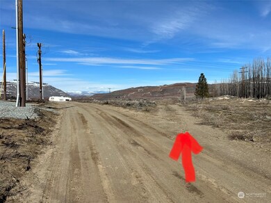
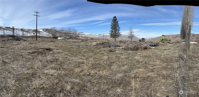
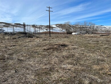
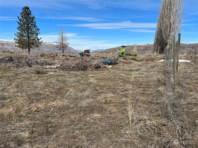
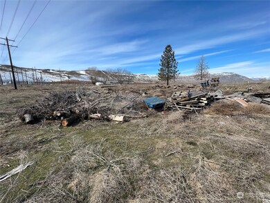
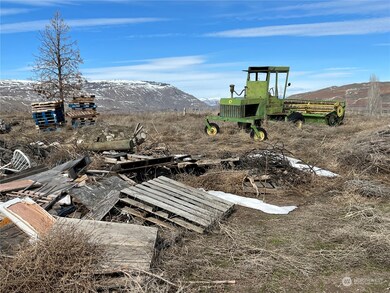
This property is just South of Bridgeport on SR 17 and is elevated, so has great 360 views, predominantly to the Northwest across the Columbia River, Brewster Flat, the Okanogan Divide and the Cascades in the distance. Dyer Hill and Waterville Plateau lie to the West. East you will see the top of Chief Joseph Dam. The property has about 7 1/2 acres total. Of that, about 4 1/3 acres are level with a gully on the Northwest portion of about 3 1/4 acres. What used to be irrigated orchard land was burned in fires of 2020. Consult Douglas County Planning for development questions. Also, PUD regarding removal of downed power line.
Last Agent to Sell the Property
Rich Burgett
Land Company License #95273 Listed on: 03/17/2023
Last Buyer's Agent
Rich Burgett
Land Company License #95273 Listed on: 03/17/2023
Source: Northwest Multiple Listing Service (NWMLS)
MLS#: 2044466
| Date | Event | Price | List to Sale | Price per Sq Ft |
|---|---|---|---|---|
| 06/21/2023 06/21/23 | Sold | $83,250 | -15.9% | -- |
| 05/03/2023 05/03/23 | Pending | -- | -- | -- |
| 03/17/2023 03/17/23 | For Sale | $99,000 | -- | -- |
R
Seller's Agent in 2023
Rich Burgett
Land Company
Source: Northwest Multiple Listing Service (NWMLS)
MLS Number: 2044466
Disclaimer: Certain information contained herein is derived from information provided by parties other than Homes.com. All information provided is deemed reliable, but is not guaranteed to be accurate and should be independently verified.
![]() All data is obtained from various sources and may not have been verified by broker or MLS GRID. Supplied Open House Information is subject to change without notice. All information should be independently reviewed and verified for accuracy. Properties may or may not be listed by the office/agent presenting the information. Listing information is provided by the Northwest Multiple Listing Service (NWMLS). Property information is based on available data that may include MLS information, county records, and other sources. Listings marked with the 3 tree icon and provided by NWMLS. All properties are subject to prior sale or withdrawal. IDX information is provided exclusively for consumers’ personal noncommercial use, that it may not be used for any purpose other than to identify prospective properties consumers may be interested in purchasing, that the data is deemed reliable but is not guaranteed by MLS GRID. ©2026 NWMLS.
All data is obtained from various sources and may not have been verified by broker or MLS GRID. Supplied Open House Information is subject to change without notice. All information should be independently reviewed and verified for accuracy. Properties may or may not be listed by the office/agent presenting the information. Listing information is provided by the Northwest Multiple Listing Service (NWMLS). Property information is based on available data that may include MLS information, county records, and other sources. Listings marked with the 3 tree icon and provided by NWMLS. All properties are subject to prior sale or withdrawal. IDX information is provided exclusively for consumers’ personal noncommercial use, that it may not be used for any purpose other than to identify prospective properties consumers may be interested in purchasing, that the data is deemed reliable but is not guaranteed by MLS GRID. ©2026 NWMLS.
Based on information submitted to the MLS GRID
Ask me questions while you tour the home.
