1250 Souders Ave Elburn, IL 60119
Estimated Value: $549,315 - $574,000
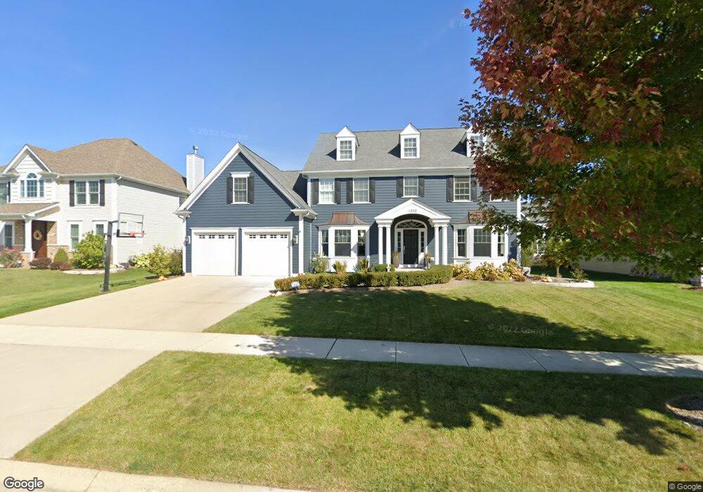
About This Home
This home is located at 1250 Souders Ave, Elburn, IL 60119 and is currently estimated at $559,829, approximately $206 per square foot. 1250 Souders Ave is a home located in Kane County with nearby schools including Kaneland Blackberry Creek Elementary School, Harter Middle School, and Kaneland High School.
Ownership History
We collect this data history from publicly available records. To have your information removed, we recommend requesting removal directly through your county’s website.
Purchase Details
Home Financials for this Owner
Home Financials are based on the most recent Mortgage that was taken out on this home.Home Values in the Area
Average Home Value in this Area
Purchase History
We collect this data history from publicly available records. To have your information removed, we recommend requesting removal directly through your county’s website.
| Date | Buyer | Sale Price | Title Company |
|---|---|---|---|
| $433,500 | Chicago Title Insurance Co |
Mortgage History
We collect this data history from publicly available records. To have your information removed, we recommend requesting removal directly through your county’s website.
| Date | Status | Borrower | Loan Amount |
|---|---|---|---|
| Open | $310,000 |
Tax History
We collect this data history from publicly available records. To have your information removed, we recommend requesting removal directly through your county’s website.
| Year | Tax Paid | Tax Assessment Tax Assessment Total Assessment is a certain percentage of the fair market value that is determined by local assessors to be the total taxable value of land and additions on the property. | Land | Improvement |
|---|---|---|---|---|
| 2024 | $11,711 | $144,436 | $17,164 | $127,272 |
| 2023 | $11,288 | $130,357 | $15,491 | $114,866 |
| 2022 | $11,903 | $131,140 | $14,217 | $116,923 |
| 2021 | $11,472 | $125,516 | $13,607 | $111,909 |
| 2020 | $11,265 | $122,574 | $13,288 | $109,286 |
| 2019 | $11,273 | $120,775 | $13,093 | $107,682 |
| 2018 | $11,151 | $117,328 | $13,093 | $104,235 |
| 2017 | $11,154 | $115,994 | $12,944 | $103,050 |
| 2016 | $11,854 | $119,659 | $12,602 | $107,057 |
| 2015 | -- | $110,502 | $8,711 | $101,791 |
| 2014 | -- | $109,455 | $11,167 | $98,288 |
| 2013 | -- | $109,455 | $11,167 | $98,288 |
Map
- 1200 Independence Ave
- 1140 Independence Ave
- 990 Citizen Ave
- 834 Citizen Ave
- 692 Independence Ave
- 635 Independence Ave
- 1010 Sears Cir
- 1N164 Stargrass Ln
- 886 Simpson Ave
- 16 Derek Dr
- #11 Derek Dr
- Lot #12 Derek Dr
- Lot #5 Derek Dr
- Lot #6 Derek Dr
- Lot #7 Derek Dr
- 0S790 Rowe Rd
- Lot 9 Rowe Rd
- 721 Cherry Cir
- Lot 11 E Blackberry Crossing Cir
- 305 Stetzer St
- 1238 Souders Ave
- 1276 Souders Ave
- 1277 Lance Ave
- 1259 Lance Ave
- 1289 Lance Ave
- 1212 Souders Ave
- 1225 Souders Ave
- 1241 Souders Ave
- 1269 Souders Ave
- 1235 Lance Ave
- 1203 Souders Ave
- 1030 Settler St
- Lot 945 Settler St
- 1198 Souders Ave
- Lot 994 Souders Ave
- 1211 Lance Ave
- L1119 Lance Ave
- 1281 Souders Ave
- 1288 Souders Ave
- 1193 Souders Ave
Ask me questions while you tour the home.