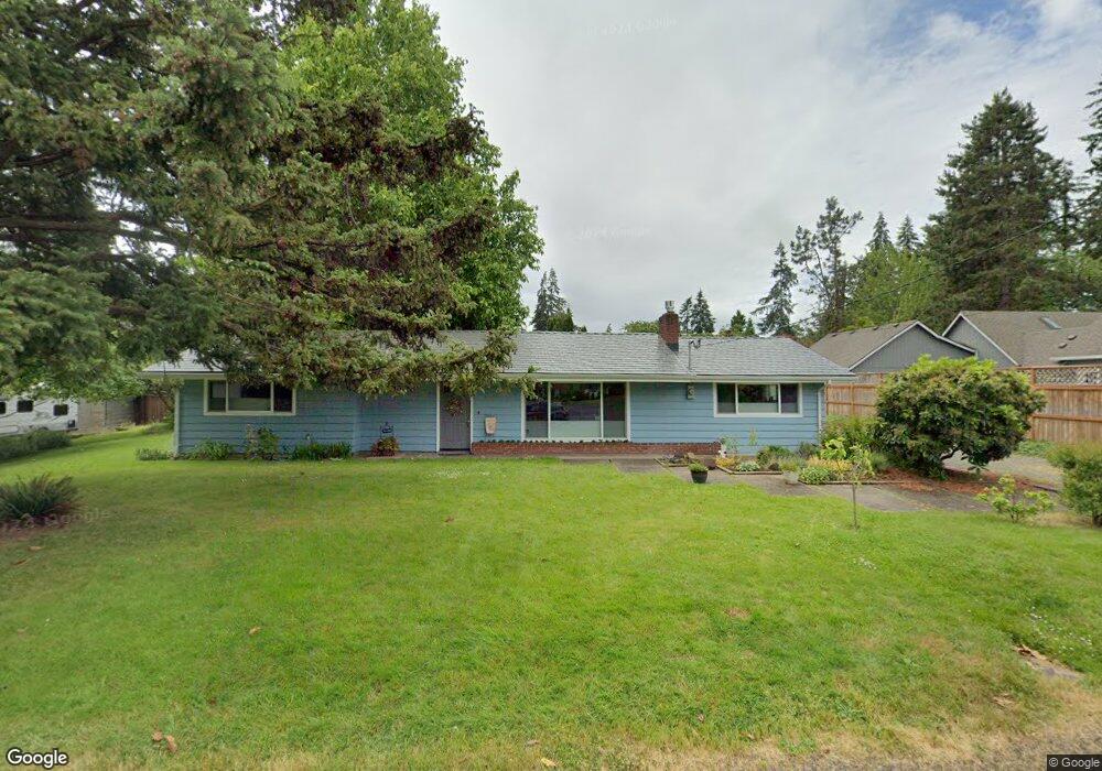
1252 Bond Ln Eugene, OR 97401
Cal Young NeighborhoodEstimated Value: $439,614 - $509,000
3
Beds
1
Bath
1,496
Sq Ft
$318/Sq Ft
Est. Value
About This Home
This home is located at 1252 Bond Ln, Eugene, OR 97401 and is currently estimated at $475,154, approximately $317 per square foot. 1252 Bond Ln is a home located in Lane County with nearby schools including Willagillespie Elementary School, Cal Young Middle School, and Sheldon High School.
Ownership History
Date
Name
Owned For
Owner Type
Purchase Details
Closed on
Oct 12, 2018
Sold by
Fancher Joseph E
Bought by
Fancher Joseph E and Brockett Karen Lee
Current Estimated Value
Purchase Details
Closed on
May 15, 2009
Sold by
Fancher Jennifer S
Bought by
Fancher Joseph E
Home Financials for this Owner
Home Financials are based on the most recent Mortgage that was taken out on this home.
Original Mortgage
$135,000
Interest Rate
4.82%
Mortgage Type
New Conventional
Create a Home Valuation Report for This Property
The Home Valuation Report is an in-depth analysis detailing your home's value as well as a comparison with similar homes in the area
Home Values in the Area
Average Home Value in this Area
Purchase History
| Date | Buyer | Sale Price | Title Company |
|---|---|---|---|
| Fancher Joseph E | -- | None Available | |
| Fancher Joseph E | -- | Western Title |
Source: Public Records
Mortgage History
| Date | Status | Borrower | Loan Amount |
|---|---|---|---|
| Closed | Fancher Joseph E | $135,000 |
Source: Public Records
Tax History
| Year | Tax Paid | Tax Assessment Tax Assessment Total Assessment is a certain percentage of the fair market value that is determined by local assessors to be the total taxable value of land and additions on the property. | Land | Improvement |
|---|---|---|---|---|
| 2025 | $4,260 | $218,619 | -- | -- |
| 2024 | $4,207 | $212,252 | -- | -- |
| 2023 | $4,207 | $206,070 | $0 | $0 |
| 2022 | $3,941 | $200,068 | $0 | $0 |
| 2021 | $3,701 | $194,241 | $0 | $0 |
| 2020 | $3,714 | $188,584 | $0 | $0 |
| 2019 | $3,333 | $170,101 | $0 | $0 |
| 2018 | $3,137 | $160,337 | $0 | $0 |
| 2017 | $2,997 | $160,337 | $0 | $0 |
| 2016 | $2,887 | $155,667 | $0 | $0 |
| 2015 | $2,769 | $151,133 | $0 | $0 |
| 2014 | $2,689 | $146,731 | $0 | $0 |
Source: Public Records
Map
Nearby Homes
- 0 Piper Ln Unit Lot 1
- 0 Piper Ln Unit Lot 3
- 0 Piper Ln Unit Lot 2
- 0 Piper Ln Unit Lot 5
- 1332 Jeppesen Ave
- 1500 Norkenzie Rd Unit 12
- 2281 Ridgeway Dr
- 996 Sherwood Place
- 1328 Spyglass Dr
- 1625 Monterey Ln
- 1376 Brickley Rd
- 1230 Debrick Rd
- 1165 Skylark Ln
- 410 Spyglass Dr
- 0 Butte Ln
- 0 Crenshaw Rd Unit 740506614
- 1810 Minda Dr
- 2280 Tabor St
- 0 Cal Young Rd Unit Lot 4
- 1943 Monterey Ln
- 1235 Fir Acres Dr
- 1249 Fir Acres Dr
- 1286 Bond Ln
- 1245 Fir Acres Dr
- 1615 Williamsburg Way
- 1610 Williamsburg Way
- 1290 Bond Ln
- 1223 Piper Ln
- 1235 Piper Ln
- 1225 Bond Ln
- 1244 Bond Ln
- 1283 Fir Acres Dr
- 1241 Piper Ln
- 1220 Fir Acres Lot
- 1253 Piper Ln
- 1625 Williamsburg Way
- 1247 Piper Ln
- 1620 Williamsburg Way
- 1292 Bond Ln
- 1259 Piper Ln
Your Personal Tour Guide
Ask me questions while you tour the home.