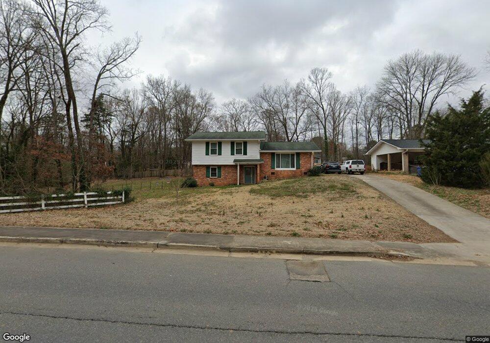
1253 Ebinport Rd Rock Hill, SC 29732
Estimated Value: $202,000 - $339,348
3
Beds
2
Baths
1,997
Sq Ft
$143/Sq Ft
Est. Value
About This Home
This home is located at 1253 Ebinport Rd, Rock Hill, SC 29732 and is currently estimated at $285,087, approximately $142 per square foot. 1253 Ebinport Rd is a home located in York County with nearby schools including Richmond Drive Elementary School, W.C. Sullivan Middle School, and Rock Hill High School.
Ownership History
Date
Name
Owned For
Owner Type
Purchase Details
Closed on
Jan 16, 2024
Sold by
Taylor Thomas L
Bought by
Moore Pamela Denise
Current Estimated Value
Purchase Details
Closed on
Apr 12, 2012
Sold by
Associate Reformed Presbyterian Foundati
Bought by
Taylor Thomas L and Moore Pamela Denise
Home Financials for this Owner
Home Financials are based on the most recent Mortgage that was taken out on this home.
Original Mortgage
$44,000
Interest Rate
3.96%
Mortgage Type
New Conventional
Purchase Details
Closed on
Apr 11, 2012
Sold by
Love Alice L
Bought by
Associate Reformed Presbyterian Foundati
Home Financials for this Owner
Home Financials are based on the most recent Mortgage that was taken out on this home.
Original Mortgage
$44,000
Interest Rate
3.96%
Mortgage Type
New Conventional
Purchase Details
Closed on
Feb 2, 2012
Sold by
Love Alice L
Bought by
Associate Reformed Presbyterian Foundati
Create a Home Valuation Report for This Property
The Home Valuation Report is an in-depth analysis detailing your home's value as well as a comparison with similar homes in the area
Home Values in the Area
Average Home Value in this Area
Purchase History
| Date | Buyer | Sale Price | Title Company |
|---|---|---|---|
| Moore Pamela Denise | $35,000 | None Listed On Document | |
| Taylor Thomas L | $69,000 | -- | |
| Associate Reformed Presbyterian Foundati | -- | -- | |
| Associate Reformed Presbyterian Foundati | -- | -- |
Source: Public Records
Mortgage History
| Date | Status | Borrower | Loan Amount |
|---|---|---|---|
| Previous Owner | Taylor Thomas L | $44,000 |
Source: Public Records
Tax History
| Year | Tax Paid | Tax Assessment Tax Assessment Total Assessment is a certain percentage of the fair market value that is determined by local assessors to be the total taxable value of land and additions on the property. | Land | Improvement |
|---|---|---|---|---|
| 2025 | $1,012 | $4,708 | $889 | $3,819 |
| 2024 | $679 | $4,094 | $1,157 | $2,937 |
| 2023 | $681 | $4,094 | $1,157 | $2,937 |
| 2022 | $685 | $4,094 | $1,157 | $2,937 |
| 2021 | -- | $4,094 | $1,157 | $2,937 |
| 2020 | $687 | $4,094 | $0 | $0 |
| 2019 | $586 | $3,560 | $0 | $0 |
| 2018 | $585 | $3,560 | $0 | $0 |
| 2017 | $564 | $3,560 | $0 | $0 |
| 2016 | $559 | $3,560 | $0 | $0 |
| 2014 | $607 | $3,560 | $1,360 | $2,200 |
| 2013 | $607 | $3,460 | $1,360 | $2,100 |
Source: Public Records
Map
Nearby Homes
- 1355 Ebinport Rd
- 128 Front Porch Dr
- 1427 Hollythorne Dr
- 1246 Jenkins St
- 1412 Ebinport Rd
- 1512 Hollythorne Dr
- 1530 Hollythorne Dr
- 1359 Deas St
- 1439 Woodhurst Dr
- 1406 Woodhurst Dr
- 1459 Gregson Ct
- 1799 Overbrook Dr
- 1352 Steed St
- 1097 Cherry Meadow Ln
- 1058 Farm Pond Ln Unit 1B
- 1311 Mount Gallant Rd
- 1106 Chandler Dr Unit 104
- 2133 Farlow St
- 2068 Franklin St
- 1112 Chandler Dr Unit 101
- 1263 Ebinport Rd
- 1246 Roundtree Cir
- 1258 Roundtree Cir
- 1248 Ebinport Rd
- 1256 Ebinport Rd
- 1305 Ebinport Rd
- 1240 Ebinport Rd
- 1227 Ebinport Rd
- 1228 Roundtree Cir
- 1264 Roundtree Cir
- 1228 Ebinport Rd
- 1226 Roundtree Cir
- 1255 Roundtree Cir
- 1239 Roundtree Cir
- 1314 Ebinport Rd
- 1269 Roundtree Cir
- 1270 Roundtree Cir
- 1220 Ebinport Rd
- 1746 Marett Boulevard Extension
- 1216 Roundtree Cir
Your Personal Tour Guide
Ask me questions while you tour the home.