1254 Thurston Dr Columbus, OH 43227
Shady Lane NeighborhoodEstimated Value: $178,258 - $233,000
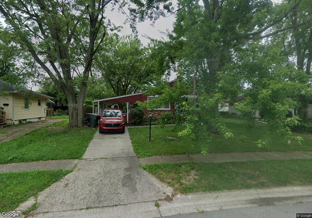
About This Home
This home is located at 1254 Thurston Dr, Columbus, OH 43227 and is currently estimated at $204,815, approximately $193 per square foot. 1254 Thurston Dr is a home located in Franklin County with nearby schools including Shady Lane Elementary School, Sherwood Middle School, and Walnut Ridge High School.
Ownership History
We collect this data history from publicly available records. To have your information removed, we recommend requesting removal directly through your county’s website.
Purchase Details
Purchase Details
Purchase Details
Purchase Details
Purchase Details
Home Values in the Area
Average Home Value in this Area
Purchase History
We collect this data history from publicly available records. To have your information removed, we recommend requesting removal directly through your county’s website.
| Date | Buyer | Sale Price | Title Company |
|---|---|---|---|
| $65,000 | First Ohio Title Ins | ||
| -- | None Available | ||
| $66,000 | -- | ||
| $51,000 | -- | ||
| $46,600 | -- |
Tax History
We collect this data history from publicly available records. To have your information removed, we recommend requesting removal directly through your county’s website.
| Year | Tax Paid | Tax Assessment Tax Assessment Total Assessment is a certain percentage of the fair market value that is determined by local assessors to be the total taxable value of land and additions on the property. | Land | Improvement |
|---|---|---|---|---|
| 2025 | $2,849 | $62,170 | $19,570 | $42,600 |
| 2024 | $2,849 | $62,170 | $19,570 | $42,600 |
| 2023 | $2,814 | $62,160 | $19,565 | $42,595 |
| 2022 | $1,548 | $29,120 | $7,420 | $21,700 |
| 2021 | $1,731 | $29,120 | $7,420 | $21,700 |
| 2020 | $1,724 | $29,120 | $7,420 | $21,700 |
| 2019 | $1,432 | $23,030 | $5,950 | $17,080 |
| 2018 | $1,389 | $23,030 | $5,950 | $17,080 |
| 2017 | $1,432 | $23,030 | $5,950 | $17,080 |
| 2016 | $1,485 | $22,410 | $5,850 | $16,560 |
| 2015 | $1,348 | $22,410 | $5,850 | $16,560 |
| 2014 | $1,351 | $22,410 | $5,850 | $16,560 |
| 2013 | $784 | $26,355 | $6,860 | $19,495 |
Map
- 4530 Amesbury Rd
- 4467 Grimsby Rd
- 1407 Simpson Dr
- 1301 Bernhard Rd
- 1085 Shady Lane Rd
- 4303 Colby Ave
- 4260 E Mound St
- 1547 Duffield Dr
- 4829 Mcallister Ave
- 1422 Benson Dr
- 1585 Shady Lane Rd
- 844 Westphal Ave
- 4487 Dundee Ave
- 1010 Rose Place
- 4492 Keeler Dr
- 4636 Dundee Ave
- 1654 Wilton Dr
- 1646 Clyde Place
- 4956 Betsy Dr
- 4615-4617 Langley Ave Unit 17
- 1234 Maetzel Dr
- 1226 Maetzel Dr
- 1250 Thurston Dr
- 1218 Maetzel Dr
- 1258 Thurston Dr
- 1210 Maetzel Dr
- 1233 Maetzel Dr
- 1225 Huntly Dr
- 1225 Maetzel Dr
- 1217 Huntly Dr
- 1233 Huntly Dr
- 1241 Maetzel Dr
- 1217 Maetzel Dr
- 1262 Maetzel Dr
- 1209 Huntly Dr
- 1262 Thurston Dr
- 1239 Huntly Dr
- 1249 Maetzel Dr
- 1201 Huntly Dr
- 1209 Maetzel Dr
Ask me questions while you tour the home.