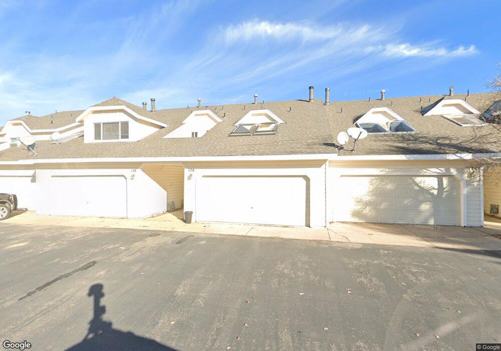
126 Fox Point Loop Rd Evanston, WY 82930
Estimated Value: $226,000 - $246,000
3
Beds
3
Baths
1,471
Sq Ft
$160/Sq Ft
Est. Value
About This Home
This home is located at 126 Fox Point Loop Rd, Evanston, WY 82930 and is currently estimated at $235,581, approximately $160 per square foot. 126 Fox Point Loop Rd is a home located in Uinta County with nearby schools including Evanston High School and Evanston Child Development Center.
Ownership History
Date
Name
Owned For
Owner Type
Purchase Details
Closed on
Feb 16, 2009
Sold by
Kent Kimberly N and Kent Mark G
Bought by
Arr Donald G and Arr Jennifer A
Current Estimated Value
Home Financials for this Owner
Home Financials are based on the most recent Mortgage that was taken out on this home.
Original Mortgage
$127,550
Outstanding Balance
$79,804
Interest Rate
4.91%
Mortgage Type
New Conventional
Estimated Equity
$155,777
Purchase Details
Closed on
May 21, 2007
Sold by
Hankin Barry and Hankin Marcie
Bought by
Kent Kimberly N and Kent Marh G
Purchase Details
Closed on
Apr 6, 2006
Sold by
Nelson David M and Nelson Constance M
Bought by
Hankin Barry and Hankin Marcie
Home Financials for this Owner
Home Financials are based on the most recent Mortgage that was taken out on this home.
Original Mortgage
$71,600
Interest Rate
6.21%
Mortgage Type
Purchase Money Mortgage
Create a Home Valuation Report for This Property
The Home Valuation Report is an in-depth analysis detailing your home's value as well as a comparison with similar homes in the area
Purchase History
| Date | Buyer | Sale Price | Title Company |
|---|---|---|---|
| Arr Donald G | -- | None Available | |
| Kent Kimberly N | -- | None Available | |
| Hankin Barry | -- | None Available |
Source: Public Records
Mortgage History
| Date | Status | Borrower | Loan Amount |
|---|---|---|---|
| Open | Arr Donald G | $127,550 | |
| Previous Owner | Hankin Barry | $71,600 |
Source: Public Records
Tax History
| Year | Tax Paid | Tax Assessment Tax Assessment Total Assessment is a certain percentage of the fair market value that is determined by local assessors to be the total taxable value of land and additions on the property. | Land | Improvement |
|---|---|---|---|---|
| 2025 | $989 | $11,284 | $1,556 | $9,728 |
| 2024 | $989 | $14,546 | $2,075 | $12,471 |
| 2023 | $902 | $13,333 | $1,318 | $12,015 |
| 2022 | $710 | $10,422 | $1,111 | $9,311 |
| 2021 | $686 | $10,063 | $1,111 | $8,952 |
| 2020 | $726 | $10,654 | $1,038 | $9,616 |
| 2019 | $654 | $9,619 | $1,038 | $8,581 |
| 2018 | $53 | $8,239 | $926 | $7,313 |
| 2017 | $559 | $8,229 | $917 | $7,312 |
| 2016 | $563 | $8,274 | $917 | $7,357 |
| 2015 | -- | $10,036 | $917 | $9,119 |
| 2014 | -- | $9,637 | $0 | $0 |
Source: Public Records
Map
Nearby Homes
- 104 Windy Ridge Ct
- 213 Grandview Citcle
- 106 Grandview
- 193 Southridge Rd
- 209 Jared Ln
- 130 Skyline Dr
- 46 City View Dr
- 240 Darby Ln
- 113 Butterfield Rd
- 2921 Wyoming 150
- 48 Aspen Grove Aspen Grove Dr E O 10
- 232 Toponce Dr
- 130 Silver Sage Dr
- 132 Silver Sage Dr
- 105 Zuni Ct
- 200 S Valley Lot 7 Dr
- 200 S Valley Lot 12 Dr
- 428 Thayer Cir
- 223 Barber Ave
- 221 Barber Ave
- 124 Fox Point Loop Rd
- 124 Fox Point Loop Rd Unit Fox point
- 124 Fox Points Loop Unit Elk Ridge
- 128 Fox Point Loop Rd
- 122 Fox Point Loop Rd
- 130 Fox Point Loop Rd
- 120 Fox Point Loop Rd
- 120 Fox Point Loop Rd Unit Elk Ridge
- 132 Fox Point Loop Rd
- 134 Fox Point Loop Rd
- 136 Fox Point Loop Rd
- 123 Fox Point Loop Rd
- 121 Fox Point Loop Rd
- 119 Fox Point Loop Rd
- 119 Fox Point
- 143 Highridge Point
- 127 Fox Point Loop Rd
- 138 Fox Point Loop Rd
- 129 Fox Point Loop Rd
- 131 Fox Point Loop Rd
Your Personal Tour Guide
Ask me questions while you tour the home.