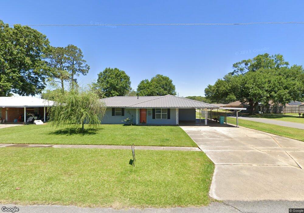
1260 Duck Ave Eunice, LA 70535
Estimated Value: $131,000 - $154,268
3
Beds
2
Baths
1,400
Sq Ft
$102/Sq Ft
Est. Value
About This Home
This home is located at 1260 Duck Ave, Eunice, LA 70535 and is currently estimated at $142,423, approximately $101 per square foot. 1260 Duck Ave is a home located in St. Landry Parish with nearby schools including Highland Elementary School, Central Middle School, and Eunice Junior High School.
Ownership History
Date
Name
Owned For
Owner Type
Purchase Details
Closed on
May 4, 2023
Sold by
Lipps Gene Charles and Christy Mae
Bought by
Clause Clifton John and Garcia Clause Maxine
Current Estimated Value
Purchase Details
Closed on
Jun 9, 2022
Sold by
Sheriff & Ex-Officio Tax Collector
Bought by
Central Properties With Union Bank
Purchase Details
Closed on
May 27, 2020
Sold by
Lipps Gene C and Moody Ginny
Bought by
Eunice City Of
Purchase Details
Closed on
Dec 17, 2015
Bought by
Lipps Ii Gene Charles and Lipps Christy Mae Spence
Create a Home Valuation Report for This Property
The Home Valuation Report is an in-depth analysis detailing your home's value as well as a comparison with similar homes in the area
Purchase History
We collect this data history from publicly available records. To have your information removed, we recommend requesting removal directly through your county’s website.
| Date | Buyer | Sale Price | Title Company |
|---|---|---|---|
| Clause Clifton John | $80,000 | None Listed On Document | |
| Central Properties With Union Bank | $505 | None Listed On Document | |
| Eunice City Of | $521 | None Available | |
| Lipps Ii Gene Charles | $110,000 | -- |
Source: Public Records
Tax History
| Year | Tax Paid | Tax Assessment Tax Assessment Total Assessment is a certain percentage of the fair market value that is determined by local assessors to be the total taxable value of land and additions on the property. | Land | Improvement |
|---|---|---|---|---|
| 2025 | $483 | $11,220 | $1,130 | $10,090 |
| 2024 | $483 | $11,220 | $1,130 | $10,090 |
| 2023 | $452 | $10,390 | $1,130 | $9,260 |
| 2022 | $452 | $10,390 | $1,130 | $9,260 |
| 2021 | $452 | $10,390 | $1,130 | $9,260 |
| 2020 | $447 | $10,390 | $1,130 | $9,260 |
| 2019 | $465 | $10,670 | $1,040 | $9,630 |
| 2018 | $465 | $10,670 | $1,040 | $9,630 |
| 2017 | $465 | $10,670 | $1,040 | $9,630 |
| 2015 | $445 | $10,300 | $1,040 | $9,260 |
| 2013 | $446 | $10,300 | $1,040 | $9,260 |
Source: Public Records
Map
Nearby Homes
- 220 S Vivian Ave
- Tbd E Laurel Ave
- 1422 E Maple Ave
- 0 E Laurel Ave Unit 21010342
- 0 E Laurel Ave Unit 22003406
- 1100 Nile St
- 1501 Nile St
- 611 Halsey St
- 401 Great Slave Ave
- 621 Halsey St
- 450 E Vine Ave
- 0 La Rue de Cour Unit 2500006823
- 565 Kyries Hebert St
- 117 Sam St
- Tbd Brother J Rd
- 0000 Highway 190
- 651 S 2nd St
- 351 N 2nd St
- 530 S 4th St
- 300 Boudreaux St
Your Personal Tour Guide
Ask me questions while you tour the home.