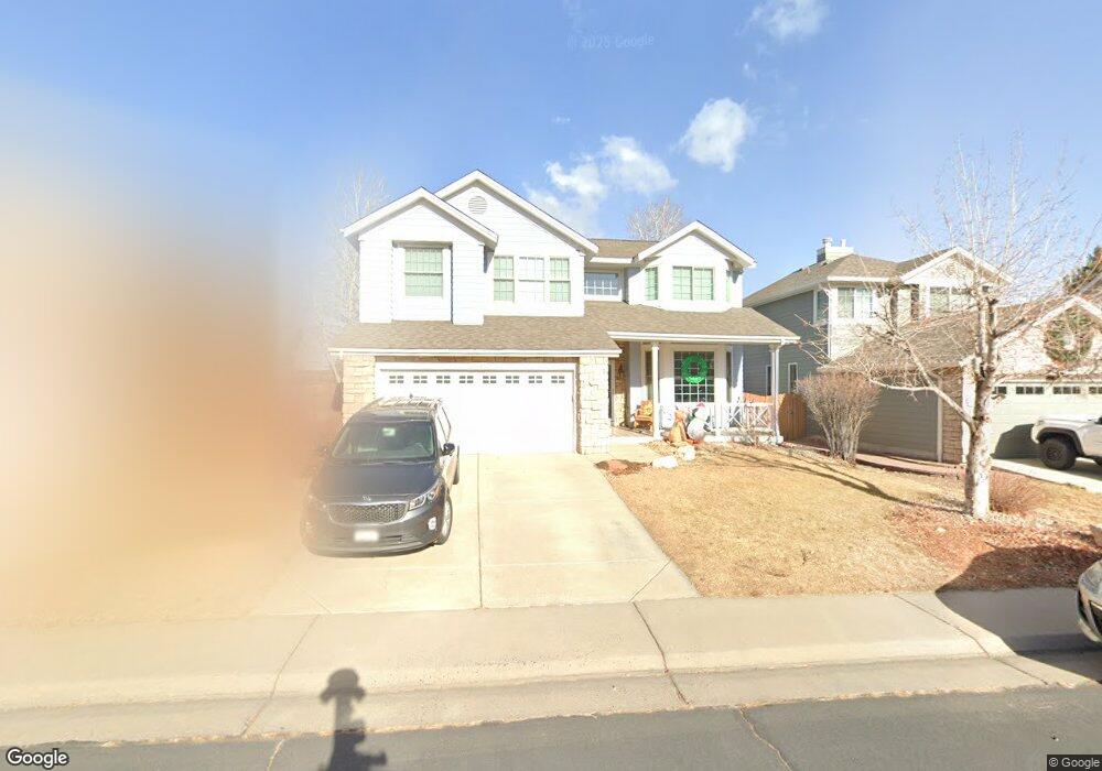
12667 W 85th Cir Arvada, CO 80005
Lakecrest NeighborhoodEstimated Value: $688,733 - $802,000
4
Beds
3
Baths
2,203
Sq Ft
$332/Sq Ft
Est. Value
About This Home
This home is located at 12667 W 85th Cir, Arvada, CO 80005 and is currently estimated at $731,183, approximately $331 per square foot. 12667 W 85th Cir is a home located in Jefferson County with nearby schools including Sierra Elementary School, Oberon Middle School, and Ralston Valley Senior High School.
Ownership History
Date
Name
Owned For
Owner Type
Purchase Details
Closed on
Aug 18, 2022
Sold by
Mckinnis Craig A
Bought by
Manard Blake and Manard Amanda
Current Estimated Value
Home Financials for this Owner
Home Financials are based on the most recent Mortgage that was taken out on this home.
Original Mortgage
$499,649
Outstanding Balance
$471,441
Interest Rate
5%
Mortgage Type
New Conventional
Estimated Equity
$259,742
Purchase Details
Closed on
Sep 4, 2015
Sold by
Harp Edwin Lynn and Harp Lila Ann
Bought by
Mckinnis Craig A and Wiggins Jana M
Home Financials for this Owner
Home Financials are based on the most recent Mortgage that was taken out on this home.
Original Mortgage
$378,000
Interest Rate
4.08%
Mortgage Type
New Conventional
Create a Home Valuation Report for This Property
The Home Valuation Report is an in-depth analysis detailing your home's value as well as a comparison with similar homes in the area
Home Values in the Area
Average Home Value in this Area
Purchase History
We collect this data history from publicly available records. To have your information removed, we recommend requesting removal directly through your county’s website.
| Date | Buyer | Sale Price | Title Company |
|---|---|---|---|
| Manard Blake | $673,125 | New Title Company Name | |
| Mckinnis Craig A | $420,000 | Land Title Guarantee Company |
Source: Public Records
Mortgage History
We collect this data history from publicly available records. To have your information removed, we recommend requesting removal directly through your county’s website.
| Date | Status | Borrower | Loan Amount |
|---|---|---|---|
| Open | Manard Blake | $499,649 | |
| Previous Owner | Mckinnis Craig A | $378,000 |
Source: Public Records
Tax History
| Year | Tax Paid | Tax Assessment Tax Assessment Total Assessment is a certain percentage of the fair market value that is determined by local assessors to be the total taxable value of land and additions on the property. | Land | Improvement |
|---|---|---|---|---|
| 2025 | $3,962 | $38,427 | $9,532 | $28,895 |
| 2024 | $3,648 | $37,614 | $9,468 | $28,146 |
| 2023 | $3,648 | $37,614 | $9,468 | $28,146 |
| 2022 | $3,364 | $34,352 | $8,475 | $25,877 |
| 2021 | $5,050 | $35,341 | $8,719 | $26,622 |
| 2020 | $3,176 | $32,911 | $8,325 | $24,586 |
| 2019 | $3,133 | $32,911 | $8,325 | $24,586 |
| 2018 | $2,947 | $30,099 | $6,303 | $23,796 |
| 2017 | $2,698 | $30,099 | $6,303 | $23,796 |
| 2016 | $2,734 | $28,728 | $7,180 | $21,548 |
| 2015 | $1,527 | $28,728 | $7,180 | $21,548 |
| 2014 | $1,527 | $23,044 | $5,015 | $18,029 |
Source: Public Records
Map
Nearby Homes
- 12526 W 85th Cir
- 12540 W 86th Ave
- 8504 Zang Ct
- 12431 W 84th Cir
- 12072 W 84th Place
- 8506 Union Cir
- 13344 W 86th Dr
- 8310 Arbutus St
- 8565 Braun Loop
- 8475 Braun Loop
- 11629 W 84th Ln
- 8325 Braun St
- 13405 W 82nd Ave
- 7840 W 87th Dr
- 8312 Coors Ct
- 8394 Deframe Ct
- 13805 W 82nd Ave
- 8081 Tabor St
- 8397 Devinney St
- 11350 W 84th Place
- 12647 W 85th Cir
- 12687 W 85th Cir
- 12627 W 85th Cir
- 12707 W 85th Cir
- 12666 W 85th Cir
- 12607 W 85th Cir
- 12711 W 85th Cir
- 12686 W 85th Cir
- 12646 W 85th Cir
- 12706 W 85th Cir
- 12626 W 85th Cir
- 12587 W 85th Cir
- 12717 W 85th Cir
- 12606 W 85th Cir
- 12710 W 85th Cir
- 12659 W 84th Dr
- 12639 W 84th Dr
- 12679 W 84th Dr
- 12586 W 85th Cir
- 12716 W 85th Cir
Your Personal Tour Guide
Ask me questions while you tour the home.