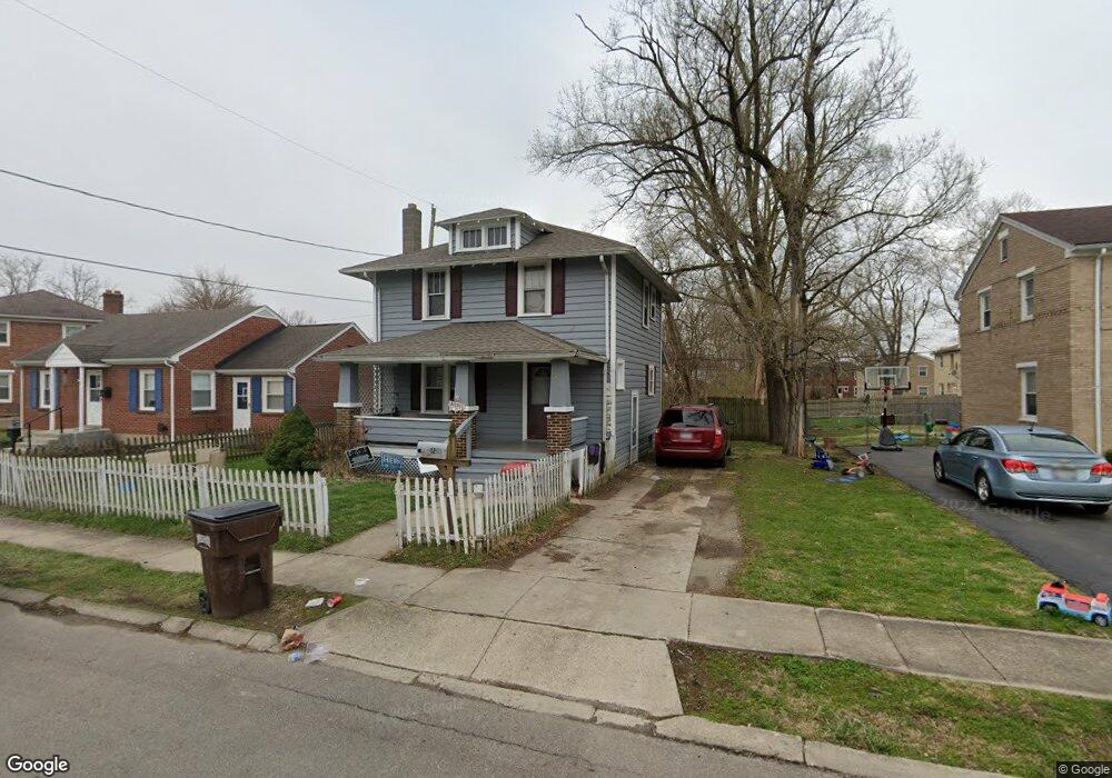
1269 Cedarview Dr E Springfield, OH 45503
Estimated Value: $118,000 - $145,000
3
Beds
1
Bath
1,152
Sq Ft
$113/Sq Ft
Est. Value
About This Home
This home is located at 1269 Cedarview Dr E, Springfield, OH 45503 and is currently estimated at $130,294, approximately $113 per square foot. 1269 Cedarview Dr E is a home located in Clark County with nearby schools including Lagonda Elementary School, Roosevelt Middle School, and Springfield High School.
Ownership History
Date
Name
Owned For
Owner Type
Purchase Details
Closed on
Mar 11, 2016
Sold by
Harrison Kim and Harrison Teresa M
Bought by
Harrison Kim B and Harrison Teresa M
Current Estimated Value
Purchase Details
Closed on
Jun 2, 2008
Sold by
Wells Fargo Bank Na
Bought by
Harrison Kim and Harrison Teresa M
Purchase Details
Closed on
Dec 28, 2007
Sold by
Fairchild Lisa and Fairchild Lisa A
Bought by
Wells Fargo Bank Na and First Franklin Mortgage Loan Trust 2004-
Purchase Details
Closed on
Oct 16, 2002
Sold by
Va
Bought by
Foster Michael A
Home Financials for this Owner
Home Financials are based on the most recent Mortgage that was taken out on this home.
Original Mortgage
$45,000
Interest Rate
6.29%
Mortgage Type
Purchase Money Mortgage
Purchase Details
Closed on
Jul 12, 2002
Sold by
Swenson Murray D
Bought by
Va
Create a Home Valuation Report for This Property
The Home Valuation Report is an in-depth analysis detailing your home's value as well as a comparison with similar homes in the area
Home Values in the Area
Average Home Value in this Area
Purchase History
| Date | Buyer | Sale Price | Title Company |
|---|---|---|---|
| Harrison Kim B | -- | Ohio Real Estate Title | |
| Harrison Kim | $31,500 | None Available | |
| Wells Fargo Bank Na | $59,000 | None Available | |
| Foster Michael A | -- | -- | |
| Va | $32,000 | U S Title Agency Inc |
Source: Public Records
Mortgage History
| Date | Status | Borrower | Loan Amount |
|---|---|---|---|
| Previous Owner | Foster Michael A | $45,000 |
Source: Public Records
Tax History
| Year | Tax Paid | Tax Assessment Tax Assessment Total Assessment is a certain percentage of the fair market value that is determined by local assessors to be the total taxable value of land and additions on the property. | Land | Improvement |
|---|---|---|---|---|
| 2025 | $1,341 | $44,940 | $5,290 | $39,650 |
| 2024 | $1,307 | $26,460 | $4,950 | $21,510 |
| 2023 | $1,307 | $26,460 | $4,950 | $21,510 |
| 2022 | $1,339 | $26,460 | $4,950 | $21,510 |
| 2021 | $1,086 | $19,770 | $3,780 | $15,990 |
| 2020 | $1,089 | $19,770 | $3,780 | $15,990 |
| 2019 | $1,092 | $19,770 | $3,780 | $15,990 |
| 2018 | $935 | $16,250 | $3,780 | $12,470 |
| 2017 | $934 | $14,980 | $3,780 | $11,200 |
| 2016 | $935 | $14,980 | $3,780 | $11,200 |
| 2015 | $1,100 | $16,790 | $3,780 | $13,010 |
| 2014 | $1,095 | $16,790 | $3,780 | $13,010 |
| 2013 | $1,083 | $16,790 | $3,780 | $13,010 |
Source: Public Records
Map
Nearby Homes
- 876 E McCreight Ave Unit 2
- 876 E McCreight Ave Unit 878
- 913 Mitchell Blvd Unit 915
- 0 Mitchell Blvd
- 1015 Rodgers Dr
- 836-838 Rodgers Dr
- 726 E Madison Ave
- 469-471 E Cecil St
- 469 E Cecil St Unit 471
- 464 E Cassilly St
- 364 Ridge Rd
- 1224 Glenmore Dr
- 308 Ridge Rd
- 310 E 3rd St
- 275 Ridge Rd
- 329 Roosevelt Dr
- 1535 Winding Trail
- 1718 Northpoint Rd
- 825-827 Elm St
- 412 E Madison Ave
- 1265 Cedarview Dr E
- 1275 Cedarview Dr E Unit 1277
- 1312 Juniper Dr
- 1233 Cedarview Dr E Unit 1235
- 1227 Cedarview Dr E Unit 1229
- 1310 Juniper Dr
- 1235 E Cedarview Dr
- 1310 Cedarview Dr E Unit 1312
- 1310 E Cedarview Dr
- 1300 Cedarview Dr E Unit 1302
- 1320 Cedarview Dr E Unit 1322
- 1260 Cedarview Dr E Unit 1262
- 1260 E Cedarview Dr
- 1306 Juniper Dr Unit 1308
- 1325 Cedarview Dr E Unit 1327
- 1306-1308 Juniper Dr
- 1254 Cedarview Dr E Unit 1256
- 1226 Cedarview Dr W
- 1309 Juniper Dr Unit 1311
- 1330 Cedarview Dr E Unit 1332
Your Personal Tour Guide
Ask me questions while you tour the home.