Estimated Value: $201,000 - $260,000
3
Beds
2
Baths
1,753
Sq Ft
$127/Sq Ft
Est. Value
About This Home
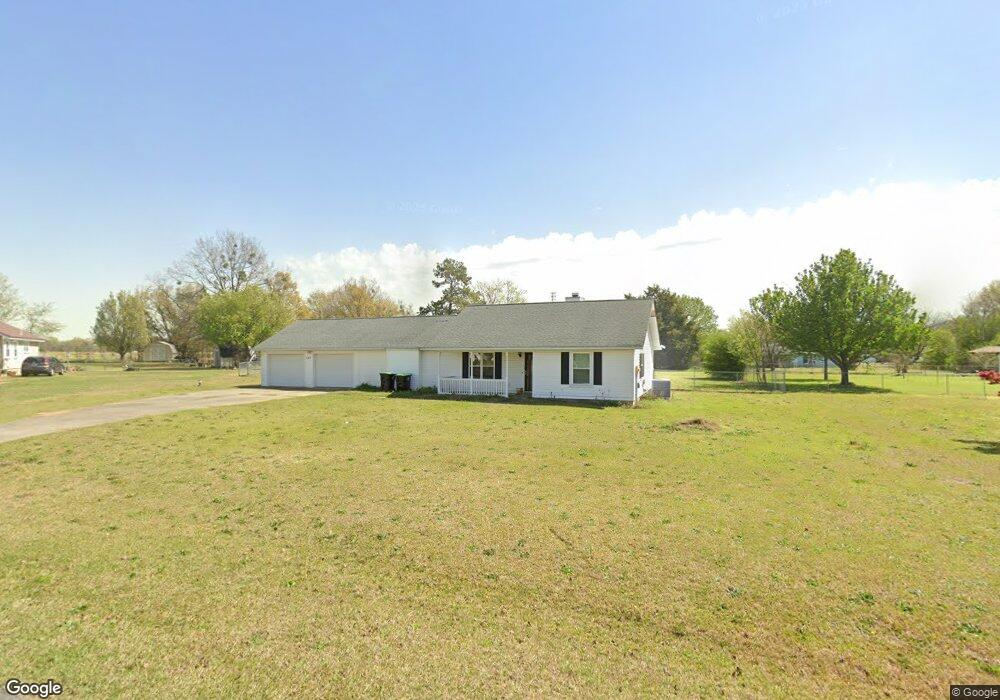
This home is located at 127 Chase Ct, Byron, GA 31008 and is currently estimated at $222,843, approximately $127 per square foot. 127 Chase Ct is a home located in Peach County with nearby schools including Kay Road Elementary School, Fort Valley Middle School, and Peach County High School.
Ownership History
Date
Name
Owned For
Owner Type
Purchase Details
Closed on
Jul 1, 2003
Sold by
Neal Robert J and Neal Krista G
Bought by
Belflower Lance and Belflower Alicia
Current Estimated Value
Purchase Details
Closed on
Jan 10, 2003
Sold by
Neal Robert J
Bought by
Neal Robert J and Neal Krista G
Purchase Details
Closed on
Aug 29, 1996
Sold by
Tresco Judith Ann
Bought by
Neal Robert James and Neal Krista G
Purchase Details
Closed on
Jan 26, 1988
Sold by
Wright Stanley
Bought by
Tresco Judith Ann
Purchase Details
Closed on
Jul 21, 1987
Sold by
Snellgrove Larry G and Grube Jeffrey L
Bought by
Wright Stanley
Purchase Details
Closed on
Mar 20, 1987
Bought by
Wright Stanley Etal
Create a Home Valuation Report for This Property
The Home Valuation Report is an in-depth analysis detailing your home's value as well as a comparison with similar homes in the area
Home Values in the Area
Average Home Value in this Area
Purchase History
We collect this data history from publicly available records. To have your information removed, we recommend requesting removal directly through your county’s website.
| Date | Buyer | Sale Price | Title Company |
|---|---|---|---|
| Belflower Lance | $82,000 | -- | |
| Neal Robert J | -- | -- | |
| Neal Robert James | $69,000 | -- | |
| Tresco Judith Ann | $49,500 | -- | |
| Wright Stanley | $5,300 | -- | |
| Wright Stanley Etal | -- | -- |
Source: Public Records
Tax History
| Year | Tax Paid | Tax Assessment Tax Assessment Total Assessment is a certain percentage of the fair market value that is determined by local assessors to be the total taxable value of land and additions on the property. | Land | Improvement |
|---|---|---|---|---|
| 2025 | $1,655 | $50,240 | $6,280 | $43,960 |
| 2024 | $1,692 | $48,920 | $6,480 | $42,440 |
| 2023 | $789 | $49,560 | $6,480 | $43,080 |
| 2022 | $1,110 | $43,240 | $6,480 | $36,760 |
| 2021 | $1,123 | $37,960 | $6,480 | $31,480 |
| 2020 | $1,374 | $46,000 | $6,480 | $39,520 |
| 2019 | $1,347 | $44,920 | $6,480 | $38,440 |
| 2018 | $1,353 | $44,920 | $6,480 | $38,440 |
| 2017 | $1,360 | $44,920 | $6,480 | $38,440 |
| 2016 | $1,354 | $44,920 | $6,480 | $38,440 |
| 2015 | $1,356 | $44,920 | $6,480 | $38,440 |
| 2014 | $1,359 | $44,920 | $6,480 | $38,440 |
| 2013 | -- | $44,920 | $6,480 | $38,440 |
Source: Public Records
Map
Nearby Homes
- 107 Justin Dr
- 105 Brooke Ct
- 0 Housers Mill Rd Unit 5515996
- 109 Red Tail Cir
- 4682 Housers Mill Rd
- 117 Early Dr
- 146 Hawks Ridge Trace
- 109 Hawks Ridge Trace
- 161 Rowland Cir
- 3563 Housers Mill Rd
- 190 Mystic Cir
- 19C Crown Ct
- 0 Barker Rd Unit 243030
- 0 Barker Rd Unit 14258525
- 0 Barker Rd Unit 175053
- 3397 Housers Mill Rd
- 450 Jones Rd
- 116 Early Dr
- 120 Early Dr
- 124 Early Dr
- 133 Chase Ct
- 123 Chase Ct
- 124 Amanda Dr
- 128 Amanda Dr
- 120 Amanda Dr
- 130 Chase Ct
- 126 Chase Ct
- 119 Chase Ct
- 122 Chase Ct
- 116 Amanda Dr
- 118 Chase Ct
- 115 Chase Ct
- 0 Amanda Dr Unit LOT 3 9026278
- 0 Amanda Dr Unit LOT 2 9026275
- 0 Amanda Dr Unit LOT 1 9026197
- Lot 3 Amanda Dr Unit 3
- Lot 2 Amanda Dr Unit 2
- Lot 1 Amanda Dr Unit 1
- Lot 3 Amanda Dr
- Lot 2 Amanda Dr
Your Personal Tour Guide
Ask me questions while you tour the home.