127 Park Ave Wakefield, RI 02879
Estimated Value: $979,000 - $1,323,000
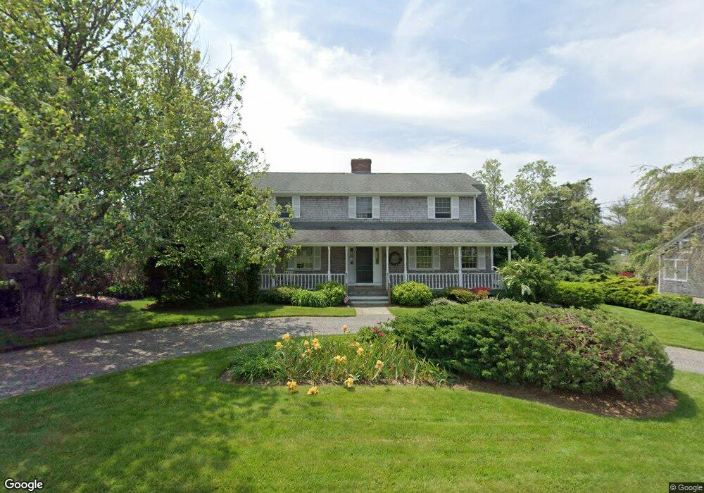
About This Home
This home is located at 127 Park Ave, Wakefield, RI 02879 and is currently estimated at $1,190,440, approximately $416 per square foot. 127 Park Ave is a home located in Washington County with nearby schools including South Kingstown High School.
Ownership History
We collect this data history from publicly available records. To have your information removed, we recommend requesting removal directly through your county’s website.
Purchase Details
Home Values in the Area
Average Home Value in this Area
Purchase History
We collect this data history from publicly available records. To have your information removed, we recommend requesting removal directly through your county’s website.
| Date | Buyer | Sale Price | Title Company |
|---|---|---|---|
| -- | -- |
Mortgage History
We collect this data history from publicly available records. To have your information removed, we recommend requesting removal directly through your county’s website.
| Date | Status | Borrower | Loan Amount |
|---|---|---|---|
| Previous Owner | $101,000 | ||
| Previous Owner | $112,000 |
Tax History
We collect this data history from publicly available records. To have your information removed, we recommend requesting removal directly through your county’s website.
| Year | Tax Paid | Tax Assessment Tax Assessment Total Assessment is a certain percentage of the fair market value that is determined by local assessors to be the total taxable value of land and additions on the property. | Land | Improvement |
|---|---|---|---|---|
| 2025 | $7,862 | $879,400 | $376,800 | $502,600 |
| 2024 | $8,215 | $743,400 | $316,000 | $427,400 |
| 2023 | $8,215 | $743,400 | $316,000 | $427,400 |
| 2022 | $8,140 | $743,400 | $316,000 | $427,400 |
| 2021 | $8,365 | $578,900 | $257,700 | $321,200 |
| 2020 | $8,365 | $578,900 | $257,700 | $321,200 |
| 2019 | $8,365 | $578,900 | $257,700 | $321,200 |
| 2018 | $7,744 | $493,900 | $206,100 | $287,800 |
| 2017 | $7,562 | $493,900 | $206,100 | $287,800 |
| 2016 | $7,453 | $493,900 | $206,100 | $287,800 |
| 2015 | $7,378 | $475,400 | $197,600 | $277,800 |
| 2014 | $7,359 | $475,400 | $197,600 | $277,800 |
Map
- 28 Park Ave
- 836 Matunuck Beach Rd
- 980 Matunuck Beach Rd
- 168 S Weeden Rd
- 240 Cards Pond Rd
- 14 E Pointe Ct Unit 14
- 60 Chappell Rd
- 659 Succotash Rd
- 93 Old Succotash Rd
- 30 Dory Ct
- 0 Westside Rd
- 25 Westside Rd
- 550 Cards Pond Rd
- 6 MacAlder St
- 6 Arbeth Rd
- 2625 Commodore Perry Hwy
- 9 Arbeth Rd
- 251 Succotash Rd
- 1127 Succotash Rd
- 23 E Matunuck Farm Dr
- 135 Park Ave
- 119 Park Ave
- 120 Atlantic Ave
- 142 Atlantic Ave
- 147 Park Ave
- 150 Atlantic Ave
- 121 Atlantic Ave
- 107 Park Ave
- 118 Park Ave
- 131 Atlantic Ave
- 104 Atlantic Ave
- 151 Atlantic Ave
- 154 Park Ave
- 100 Park Ave
- 115 Lake Ave
- 140 Community Dr
- 148 Community Dr
- 103 Atlantic Ave
- 147 Lake Ave
- 11 Cove St Unit SPARTINA
Ask me questions while you tour the home.