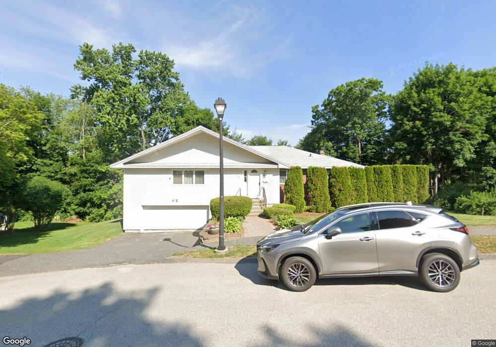
127 Winifred Ave Worcester, MA 01602
Salisbury Street NeighborhoodEstimated Value: $511,000 - $697,000
3
Beds
2
Baths
2,350
Sq Ft
$255/Sq Ft
Est. Value
About This Home
This home is located at 127 Winifred Ave, Worcester, MA 01602 and is currently estimated at $600,245, approximately $255 per square foot. 127 Winifred Ave is a home located in Worcester County with nearby schools including Chandler Magnet, Jacob Hiatt Magnet School, and Flagg Street School.
Ownership History
Date
Name
Owned For
Owner Type
Purchase Details
Closed on
Oct 23, 1992
Sold by
Haddad Patricia A and Mancini Domenic R
Bought by
Fater Alexander and Fater Natalya
Current Estimated Value
Home Financials for this Owner
Home Financials are based on the most recent Mortgage that was taken out on this home.
Original Mortgage
$117,900
Interest Rate
7.79%
Mortgage Type
Purchase Money Mortgage
Create a Home Valuation Report for This Property
The Home Valuation Report is an in-depth analysis detailing your home's value as well as a comparison with similar homes in the area
Home Values in the Area
Average Home Value in this Area
Purchase History
We collect this data history from publicly available records. To have your information removed, we recommend requesting removal directly through your county’s website.
| Date | Buyer | Sale Price | Title Company |
|---|---|---|---|
| Fater Alexander | $131,000 | -- |
Source: Public Records
Mortgage History
We collect this data history from publicly available records. To have your information removed, we recommend requesting removal directly through your county’s website.
| Date | Status | Borrower | Loan Amount |
|---|---|---|---|
| Open | Fater Alexander | $185,000 | |
| Closed | Fater Alexander | $117,900 |
Source: Public Records
Tax History
| Year | Tax Paid | Tax Assessment Tax Assessment Total Assessment is a certain percentage of the fair market value that is determined by local assessors to be the total taxable value of land and additions on the property. | Land | Improvement |
|---|---|---|---|---|
| 2025 | $7,111 | $539,100 | $118,900 | $420,200 |
| 2024 | $6,903 | $502,000 | $118,900 | $383,100 |
| 2023 | $6,738 | $469,900 | $103,300 | $366,600 |
| 2022 | $6,019 | $395,700 | $82,700 | $313,000 |
| 2021 | $6,312 | $387,700 | $66,200 | $321,500 |
| 2020 | $6,118 | $359,900 | $66,100 | $293,800 |
| 2019 | $5,747 | $319,300 | $59,600 | $259,700 |
| 2018 | $5,503 | $291,000 | $59,600 | $231,400 |
| 2017 | $5,683 | $295,700 | $59,600 | $236,100 |
| 2016 | $5,742 | $278,600 | $44,100 | $234,500 |
| 2015 | $5,592 | $278,600 | $44,100 | $234,500 |
| 2014 | $5,393 | $276,000 | $44,100 | $231,900 |
Source: Public Records
Map
Nearby Homes
- 36 Chippewa Rd
- 123 Winifred Ave
- 131 Winifred Ave
- 34 Chippewa Rd
- 38 Chippewa Rd
- 32 Chippewa Rd
- 115 Winifred Ave
- 135 Winifred Ave
- 40 Chippewa Rd
- 30 Chippewa Rd
- 116 Winifred Ave
- 113 Winifred Ave
- 41 Ellis Dr
- 35 Chippewa Rd
- 33 Chippewa Rd
- 136 Winifred Ave
- 43 Ellis Dr
- 37 Chippewa Rd
- 28 Chippewa Rd
- 141 Winifred Ave
Your Personal Tour Guide
Ask me questions while you tour the home.