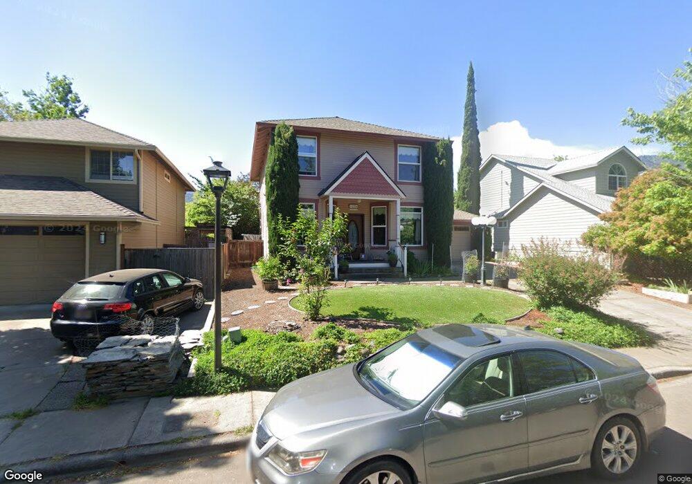
1270 Kirk Ln Ashland, OR 97520
Mill Pond NeighborhoodEstimated Value: $559,000 - $598,000
3
Beds
2
Baths
1,808
Sq Ft
$318/Sq Ft
Est. Value
About This Home
This home is located at 1270 Kirk Ln, Ashland, OR 97520 and is currently estimated at $574,387, approximately $317 per square foot. 1270 Kirk Ln is a home located in Jackson County with nearby schools including Walker Elementary School, Ashland Middle School, and Ashland High School.
Ownership History
Date
Name
Owned For
Owner Type
Purchase Details
Closed on
Jul 8, 2025
Sold by
Mehaffey Larry and Mehaffey Leslie R
Bought by
Mehaffey Family Trust and Mehaffey
Current Estimated Value
Purchase Details
Closed on
Dec 14, 1999
Sold by
Chick Blanche E
Bought by
Mehaffey Larry and Mehaffey Leslie R
Home Financials for this Owner
Home Financials are based on the most recent Mortgage that was taken out on this home.
Original Mortgage
$153,200
Interest Rate
7.82%
Create a Home Valuation Report for This Property
The Home Valuation Report is an in-depth analysis detailing your home's value as well as a comparison with similar homes in the area
Home Values in the Area
Average Home Value in this Area
Purchase History
| Date | Buyer | Sale Price | Title Company |
|---|---|---|---|
| Mehaffey Family Trust | -- | None Listed On Document | |
| Mehaffey Larry | $191,500 | Amerititle |
Source: Public Records
Mortgage History
| Date | Status | Borrower | Loan Amount |
|---|---|---|---|
| Previous Owner | Mehaffey Larry | $153,200 |
Source: Public Records
Tax History
| Year | Tax Paid | Tax Assessment Tax Assessment Total Assessment is a certain percentage of the fair market value that is determined by local assessors to be the total taxable value of land and additions on the property. | Land | Improvement |
|---|---|---|---|---|
| 2026 | $4,696 | $305,420 | -- | -- |
| 2025 | $4,597 | $296,530 | $116,940 | $179,590 |
| 2024 | $4,597 | $287,900 | $113,530 | $174,370 |
| 2023 | $4,448 | $279,520 | $110,230 | $169,290 |
| 2022 | $4,305 | $279,520 | $110,230 | $169,290 |
| 2021 | $4,159 | $271,380 | $107,020 | $164,360 |
| 2020 | $4,042 | $263,480 | $103,910 | $159,570 |
| 2019 | $3,978 | $248,360 | $97,950 | $150,410 |
| 2018 | $3,758 | $241,130 | $95,100 | $146,030 |
| 2017 | $3,731 | $241,130 | $95,100 | $146,030 |
| 2016 | $3,633 | $227,300 | $89,640 | $137,660 |
| 2015 | $3,493 | $227,300 | $89,640 | $137,660 |
| 2014 | $3,380 | $214,260 | $84,500 | $129,760 |
Source: Public Records
Map
Nearby Homes
- 1259 Hagen Way
- 139 N Wightman St
- 159 N Wightman St
- 112 N Wightman St
- 58 N Mountain Ave Unit 58
- 2082 E Main St
- 65 S Mountain Ave
- 55 S Mountain Ave
- 1040 E Main St
- 156 8th St
- 128 S Mountain Ave
- 485 Larkspur Ln
- 479 Russell St Unit 202
- 500 Starflower Ln
- 36 Dewey St
- 24 Dewey St
- 463 E Hersey St
- 753 Siskiyou Blvd
- 124 Morton St
- 285 Beach St
Your Personal Tour Guide
Ask me questions while you tour the home.