Estimated Value: $274,000 - $360,000
2
Beds
2
Baths
969
Sq Ft
$326/Sq Ft
Est. Value
About This Home
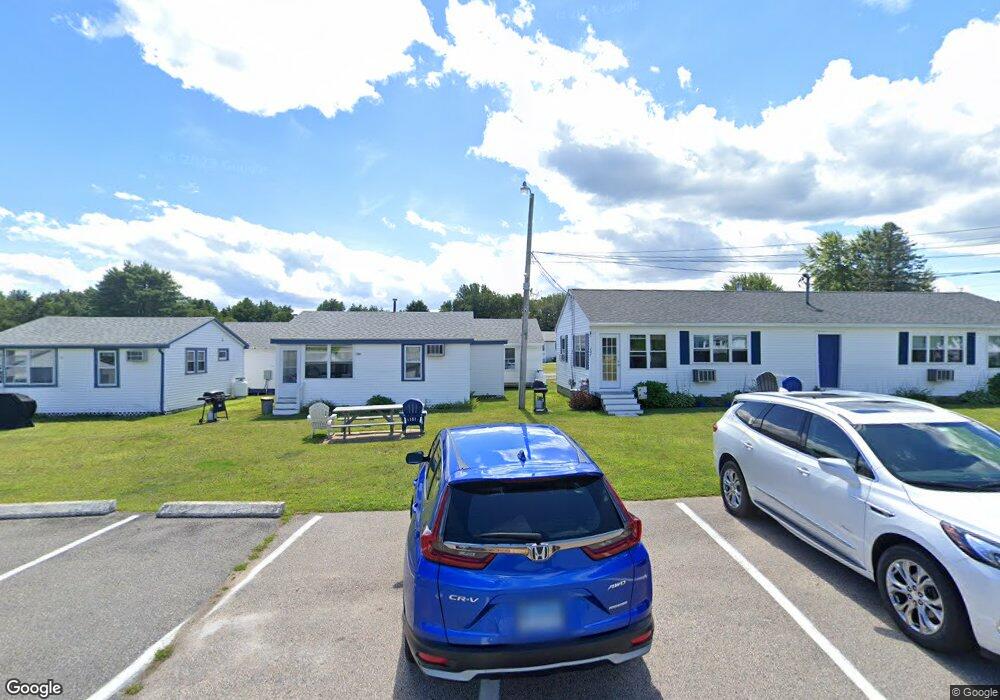
This home is located at 1277 Post Rd Unit 161, Wells, ME 04090 and is currently estimated at $316,048, approximately $326 per square foot. 1277 Post Rd Unit 161 is a home located in York County with nearby schools including Wells Junior High School, Wells Elementary School, and Wells High School.
Ownership History
Date
Name
Owned For
Owner Type
Purchase Details
Closed on
Mar 23, 2010
Sold by
Cassidy Dennis C and Cassidy Linda A
Bought by
Walsh Frances L
Current Estimated Value
Purchase Details
Closed on
Jun 29, 2005
Sold by
Mcintyre Merit E
Bought by
Cassidy Linda A and Cassidy Dennis C
Home Financials for this Owner
Home Financials are based on the most recent Mortgage that was taken out on this home.
Original Mortgage
$0
Interest Rate
5.16%
Mortgage Type
Unknown
Create a Home Valuation Report for This Property
The Home Valuation Report is an in-depth analysis detailing your home's value as well as a comparison with similar homes in the area
Home Values in the Area
Average Home Value in this Area
Purchase History
We collect this data history from publicly available records. To have your information removed, we recommend requesting removal directly through your county’s website.
| Date | Buyer | Sale Price | Title Company |
|---|---|---|---|
| Walsh Frances L | -- | -- | |
| Walsh Frances L | -- | -- | |
| Cassidy Linda A | -- | -- | |
| Cassidy Linda A | -- | -- |
Source: Public Records
Mortgage History
We collect this data history from publicly available records. To have your information removed, we recommend requesting removal directly through your county’s website.
| Date | Status | Borrower | Loan Amount |
|---|---|---|---|
| Previous Owner | Cassidy Linda A | $0 |
Source: Public Records
Tax History
| Year | Tax Paid | Tax Assessment Tax Assessment Total Assessment is a certain percentage of the fair market value that is determined by local assessors to be the total taxable value of land and additions on the property. | Land | Improvement |
|---|---|---|---|---|
| 2025 | $1,645 | $254,580 | $124,210 | $130,370 |
| 2024 | $1,545 | $254,040 | $124,210 | $129,830 |
| 2023 | $1,514 | $254,040 | $124,210 | $129,830 |
| 2022 | $1,673 | $159,990 | $56,480 | $103,510 |
| 2021 | $1,683 | $159,990 | $56,480 | $103,510 |
| 2020 | $1,604 | $153,090 | $56,480 | $96,610 |
| 2019 | $1,595 | $153,090 | $56,480 | $96,610 |
| 2018 | $1,552 | $153,090 | $56,480 | $96,610 |
| 2017 | $1,555 | $153,090 | $56,480 | $96,610 |
| 2016 | $1,540 | $153,090 | $56,480 | $96,610 |
| 2015 | $1,523 | $153,090 | $56,480 | $96,610 |
| 2013 | $1,396 | $153,090 | $56,480 | $96,610 |
Source: Public Records
Map
Nearby Homes
- 1277 Post Rd Unit 118
- 68 Poplar Park Dr
- 1351 Post Rd Unit 39
- 1351 Post Rd Unit 49
- 4 Tidal Ct
- 1373 Post Rd Unit 8B
- 1373 Post Rd Unit 10A
- 1373 Post Rd Unit 2C
- 1373 Post Rd Unit 12B
- 1373 Post Rd Unit 8D
- 1139 Post Rd Unit 27
- 1413 Post Rd Unit 63
- 1413 Post Rd Unit 7
- 150 Chapel Rd Unit 118
- 150 Chapel Rd Unit 817
- 150 Chapel Rd Unit 906
- 150 Chapel Rd Unit 208
- 165 Flintlock Village Rd Unit 1
- 60 Mile Rd Unit 41
- 74 Morison Ave
- 1277 Post Rd Unit 160
- 1277 Post Rd Unit 159
- 1277 Post Rd Unit 158
- 1277 Post Rd Unit 157
- 1277 Post Rd Unit 156
- 1277 Post Rd Unit 155
- 1277 Post Rd Unit 154
- 1277 Post Rd Unit 153
- 1277 Post Rd Unit 152
- 1277 Post Rd Unit 151
- 1277 Post Rd Unit 150
- 1277 Post Rd Unit 149
- 1277 Post Rd Unit 148
- 1277 Post Rd Unit 147
- 1277 Post Rd Unit 146
- 1277 Post Rd Unit 145
- 1277 Post Rd Unit 144
- 1277 Post Rd Unit 143
- 1277 Post Rd Unit 141
- 1277 Post Rd Unit 140
Your Personal Tour Guide
Ask me questions while you tour the home.