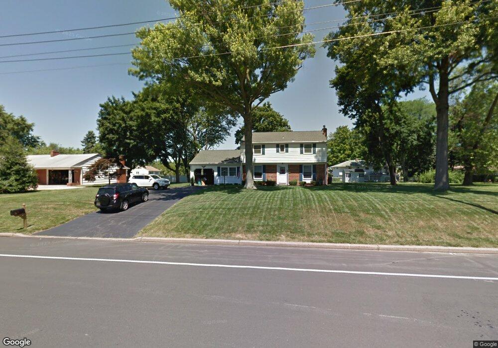
128 Upper Ferry Rd Ewing, NJ 08628
Ewingville NeighborhoodEstimated Value: $441,412 - $500,000
Studio
--
Bath
2,031
Sq Ft
$238/Sq Ft
Est. Value
About This Home
This home is located at 128 Upper Ferry Rd, Ewing, NJ 08628 and is currently estimated at $482,603, approximately $237 per square foot. 128 Upper Ferry Rd is a home located in Mercer County with nearby schools including Ewing High School and Trenton Stem-To-Civics Charter School.
Ownership History
Date
Name
Owned For
Owner Type
Purchase Details
Closed on
Nov 24, 2016
Sold by
Torrella Matthew Danielle
Bought by
Torrette Matthew
Current Estimated Value
Home Financials for this Owner
Home Financials are based on the most recent Mortgage that was taken out on this home.
Original Mortgage
$153,000
Outstanding Balance
$121,520
Interest Rate
3%
Mortgage Type
Adjustable Rate Mortgage/ARM
Estimated Equity
$361,083
Purchase Details
Closed on
Aug 22, 2016
Sold by
Agocs Stephen E and Ranson Alice E
Bought by
Coe Jessica M and Coe Matthew J
Purchase Details
Closed on
Jun 28, 2016
Sold by
Ranson Alice
Bought by
Agocs Stephen F and Ranson Alcie E
Purchase Details
Closed on
Oct 30, 1990
Sold by
Agocs Stephen F and Agocs Marie C
Bought by
County Of Mercer
Create a Home Valuation Report for This Property
The Home Valuation Report is an in-depth analysis detailing your home's value as well as a comparison with similar homes in the area
Home Values in the Area
Average Home Value in this Area
Purchase History
| Date | Buyer | Sale Price | Title Company |
|---|---|---|---|
| Torrette Matthew | -- | None Available | |
| Coe Jessica M | -- | None Available | |
| Agocs Stephen F | -- | None Available | |
| County Of Mercer | $4,500 | -- |
Source: Public Records
Mortgage History
| Date | Status | Borrower | Loan Amount |
|---|---|---|---|
| Open | Torrette Matthew | $153,000 |
Source: Public Records
Tax History
| Year | Tax Paid | Tax Assessment Tax Assessment Total Assessment is a certain percentage of the fair market value that is determined by local assessors to be the total taxable value of land and additions on the property. | Land | Improvement |
|---|---|---|---|---|
| 2025 | $11,221 | $285,300 | $86,200 | $199,100 |
| 2024 | $10,548 | $285,300 | $86,200 | $199,100 |
| 2023 | $10,548 | $285,300 | $86,200 | $199,100 |
| 2022 | $10,262 | $285,300 | $86,200 | $199,100 |
| 2021 | $10,011 | $285,300 | $86,200 | $199,100 |
| 2020 | $9,869 | $285,300 | $86,200 | $199,100 |
| 2019 | $9,612 | $285,300 | $86,200 | $199,100 |
| 2018 | $9,032 | $171,000 | $60,800 | $110,200 |
| 2017 | $8,659 | $160,200 | $60,800 | $99,400 |
| 2016 | $8,542 | $160,200 | $60,800 | $99,400 |
| 2015 | $8,428 | $160,200 | $60,800 | $99,400 |
| 2014 | $8,406 | $160,200 | $60,800 | $99,400 |
Source: Public Records
Map
Nearby Homes
- 2 Rockleigh Dr
- 13 Hickory Hill Dr
- 20 Corey Dr
- 146 Masterson Ct
- 235 Masterson Ct
- 222 Masterson Ct
- 231 Masterson Ct
- 27 Bayberry Rd
- 30 Upper Ferry Rd
- 19 van Saun Dr
- 53 Carlton Ave
- 1247 Lower Ferry Rd
- 632 Timberlake Dr
- 311 Timberlake Dr
- 2148 Pennington Rd
- 532 Timberlake Dr
- 18 Kyle Way
- 59 Kyle Way
- 41 Harding St
- 1183 Lower Ferry Rd
- 120 Upper Ferry Rd
- 132 Upper Ferry Rd
- 5 Rockleigh Dr
- 7 Rockleigh Dr
- 125 Upper Ferry Rd
- 119 Upper Ferry Rd
- 7 Rayburn Dr
- 3 Rockleigh Dr
- 9 Rockleigh Dr
- 131 Upper Ferry Rd
- 136 Upper Ferry Rd
- 113 Upper Ferry Rd
- 137 Upper Ferry Rd
- 1 Rockleigh Dr
- 6 Rockleigh Dr
- 8 Hickory Hill Dr
- 10 Hickory Hill Dr
- 144 Upper Ferry Rd
- 4 Rockleigh Dr
- 12 Hickory Hill Dr
Your Personal Tour Guide
Ask me questions while you tour the home.