J
Seller's Agent in 2026
Josh Jennings
eXp Realty LLC
(715) 316-2603
1 in this area
19 Total Sales
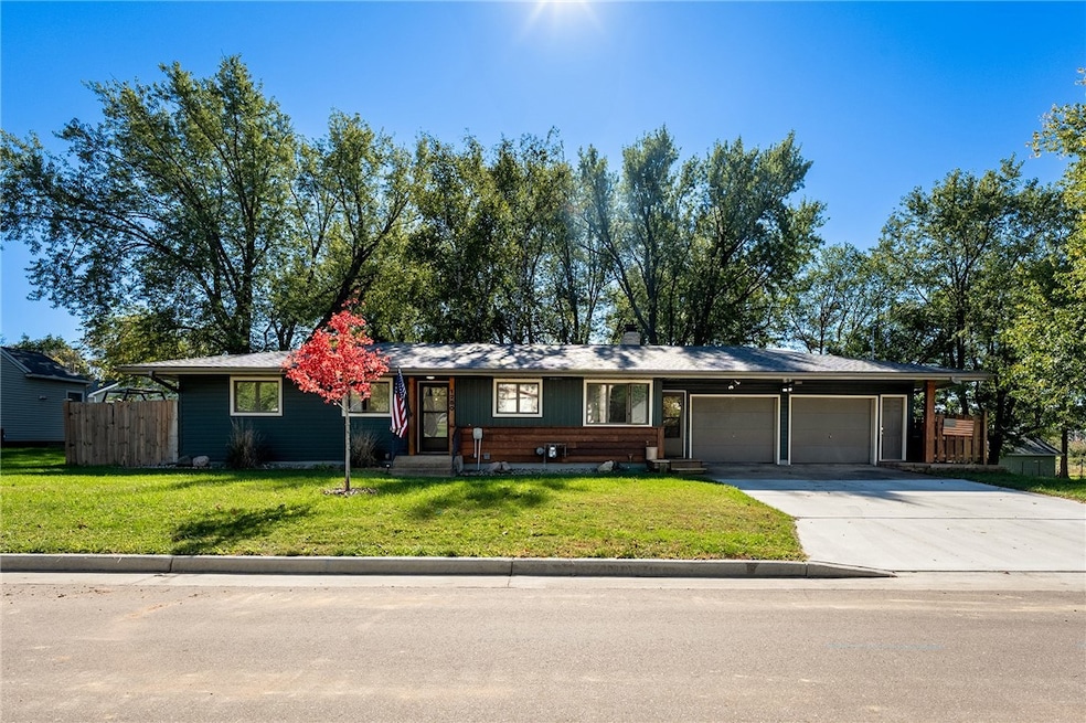
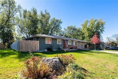
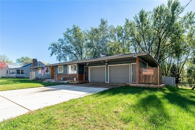
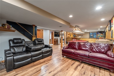
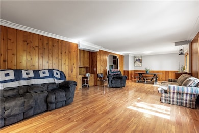
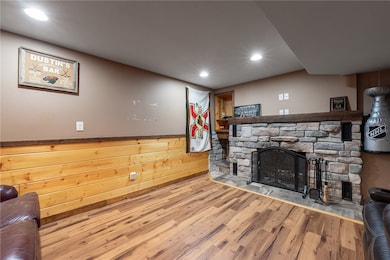
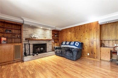
Step in and imagine yourself in this beautiful 3 bed 2 bath home with heated bathroom floors. all within less than 45 miles of the twin cities! New updates throughout including a new roof with 2" impact shingles, heated garage with 220v hook up. Enjoy warm days and cool evenings out on your new deck. 3 seasons room and a "she" shed or Garden shed to store some of your tools! New carpet in the bedrooms and stairs, making this a truly move in ready home. Schedule your showing today!
Last Agent to Sell the Property
eXp Realty LLC Brokerage Phone: 866-848-6990 License #111257-94 Listed on: 10/11/2025

Last Buyer's Agent
Other Companies Non-MLS
Other Companies/Non-MLS License #0
| Date | Type | Sale Price | Title Company |
|---|---|---|---|
| Warranty Deed | $252,000 | Land Title | |
| Warranty Deed | $250,000 | None Available |
| Date | Status | Loan Amount | Loan Type |
|---|---|---|---|
| Open | $247,435 | FHA | |
| Previous Owner | $245,471 | FHA |
| Date | Event | Price | List to Sale | Price per Sq Ft |
|---|---|---|---|---|
| 02/13/2026 02/13/26 | Sold | $340,000 | 0.0% | $140 / Sq Ft |
| 10/11/2025 10/11/25 | For Sale | $340,000 | -- | $140 / Sq Ft |
| Year | Tax Paid | Tax Assessment Tax Assessment Total Assessment is a certain percentage of the fair market value that is determined by local assessors to be the total taxable value of land and additions on the property. | Land | Improvement |
|---|---|---|---|---|
| 2025 | $4,799 | $245,400 | $33,800 | $211,600 |
| 2024 | $62 | $245,400 | $33,800 | $211,600 |
| 2023 | $3,832 | $245,400 | $33,800 | $211,600 |
| 2022 | $3,769 | $245,400 | $33,800 | $211,600 |
| 2021 | $3,664 | $245,400 | $33,800 | $211,600 |
| 2020 | $3,539 | $166,400 | $25,400 | $141,000 |
| 2019 | $3,464 | $166,400 | $25,400 | $141,000 |
| 2018 | $3,192 | $166,400 | $25,400 | $141,000 |
| 2017 | $3,351 | $166,400 | $25,400 | $141,000 |
| 2016 | $3,351 | $166,400 | $25,400 | $141,000 |
| 2015 | $2,911 | $124,100 | $22,500 | $101,600 |
| 2014 | $2,625 | $124,100 | $22,500 | $101,600 |
| 2013 | $2,676 | $124,100 | $22,500 | $101,600 |
J
Seller's Agent in 2026
Josh Jennings
eXp Realty LLC
(715) 316-2603
1 in this area
19 Total Sales
O
Buyer's Agent in 2026
Other Companies Non-MLS
Other Companies/Non-MLS
Source: Northwestern Wisconsin Multiple Listing Service
MLS Number: 1596434
APN: 106-1031-60-000
Disclaimer: Certain information contained herein is derived from information provided by parties other than Homes.com. All information provided is deemed reliable, but is not guaranteed to be accurate and should be independently verified.
![]() IDX information is provided exclusively for personal, non-commercial use, and may not be used for any purpose other than to identify prospective properties consumers may be interested in purchasing. Information is deemed reliable but not guaranteed.
IDX information is provided exclusively for personal, non-commercial use, and may not be used for any purpose other than to identify prospective properties consumers may be interested in purchasing. Information is deemed reliable but not guaranteed.
Ask me questions while you tour the home.