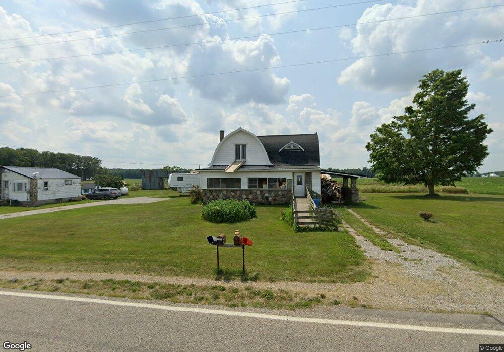
12891 Broom Rd Waldron, MI 49288
Estimated Value: $189,000 - $229,000
6
Beds
3
Baths
844
Sq Ft
$249/Sq Ft
Est. Value
About This Home
This home is located at 12891 Broom Rd, Waldron, MI 49288 and is currently estimated at $210,253, approximately $249 per square foot. 12891 Broom Rd is a home located in Hillsdale County with nearby schools including Waldron High School and Waldron Elementary School.
Ownership History
Date
Name
Owned For
Owner Type
Purchase Details
Closed on
Feb 28, 2022
Sold by
Davis Kandis
Bought by
Saxton Candi
Current Estimated Value
Purchase Details
Closed on
Feb 2, 2021
Sold by
Wallen Nancy Carol
Bought by
Davis Kandis
Purchase Details
Closed on
Jan 7, 2015
Sold by
Smith Harlyn and Smith Peggy A
Bought by
Wallen Nancy Carol
Home Financials for this Owner
Home Financials are based on the most recent Mortgage that was taken out on this home.
Original Mortgage
$10,000
Interest Rate
3.94%
Mortgage Type
Credit Line Revolving
Purchase Details
Closed on
Apr 30, 2001
Sold by
Smith Harlyn
Bought by
Smith Harlyn and Smith Peggy A
Create a Home Valuation Report for This Property
The Home Valuation Report is an in-depth analysis detailing your home's value as well as a comparison with similar homes in the area
Purchase History
| Date | Buyer | Sale Price | Title Company |
|---|---|---|---|
| Saxton Candi | -- | -- | |
| Davis Kandis | -- | None Available | |
| Wallen Nancy Carol | -- | None Available | |
| Smith Harlyn | $100 | -- |
Source: Public Records
Mortgage History
| Date | Status | Borrower | Loan Amount |
|---|---|---|---|
| Previous Owner | Wallen Nancy Carol | $10,000 |
Source: Public Records
Tax History
| Year | Tax Paid | Tax Assessment Tax Assessment Total Assessment is a certain percentage of the fair market value that is determined by local assessors to be the total taxable value of land and additions on the property. | Land | Improvement |
|---|---|---|---|---|
| 2025 | $367 | $81,400 | $0 | $0 |
| 2024 | $4 | $73,400 | $0 | $0 |
| 2023 | $341 | $60,200 | $0 | $0 |
| 2022 | $892 | $49,900 | $0 | $0 |
| 2021 | $878 | $47,000 | $0 | $0 |
| 2020 | $799 | $36,900 | $0 | $0 |
| 2019 | $769 | $31,400 | $0 | $0 |
| 2018 | $734 | $36,700 | $0 | $0 |
| 2017 | $712 | $38,000 | $0 | $0 |
| 2016 | $706 | $26,200 | $0 | $0 |
| 2015 | $287 | $26,200 | $0 | $0 |
| 2013 | $308 | $28,110 | $0 | $0 |
| 2012 | $313 | $28,600 | $0 | $0 |
Source: Public Records
Map
Nearby Homes
- 400 S Main St
- 126 S Main St
- 413 W Center St
- 10800 South Rd
- 14191 Lickley Rd
- 0 Willow Trace Dr Unit 26008895
- 13854 Emens Dr
- 13764 Emens Dr
- 17916 County Road R
- 203 College St
- 301 E Spring St
- 310 Irene Ct
- 404 S Fayette St
- 35 Rehn Dr
- Lot 35 of Rehn Dr
- 7100 S Waldron Rd
- 14940 Medina Rd
- 645 S Meridian Rd
- 14857 U S 20
- 909 High Point Dr
Your Personal Tour Guide
Ask me questions while you tour the home.