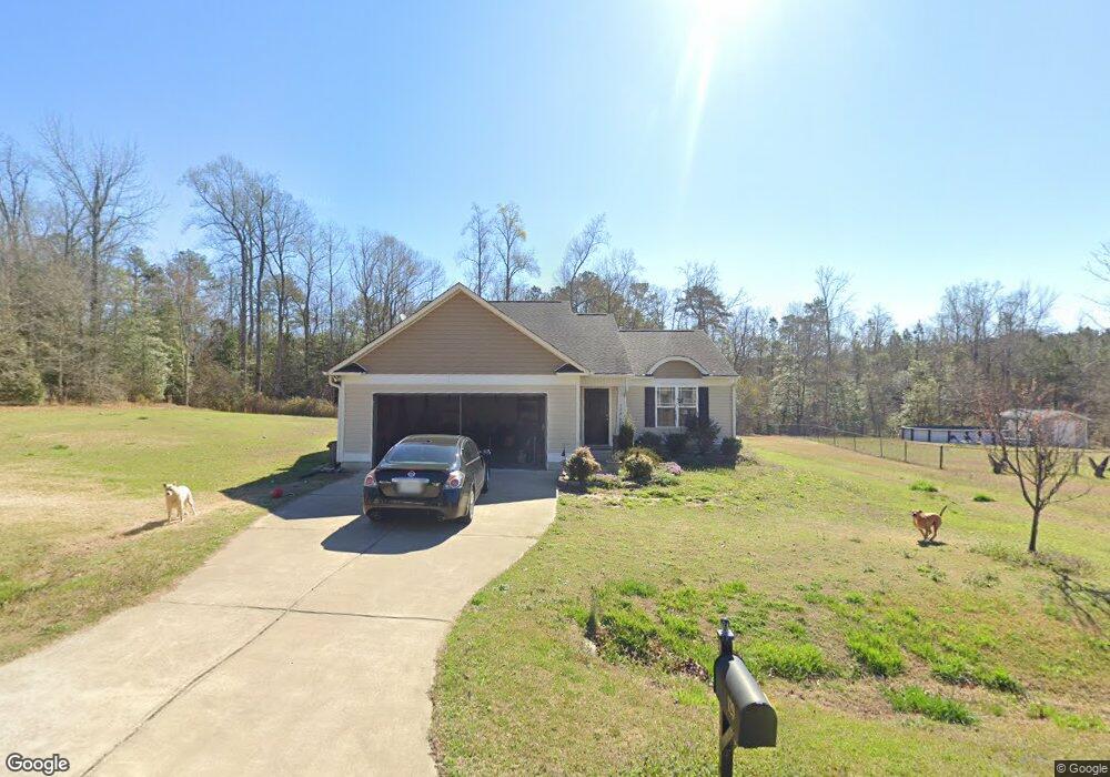
129 Crownside Dr Four Oaks, NC 27524
Elevation NeighborhoodEstimated Value: $282,000 - $313,000
About This Home
This home is located at 129 Crownside Dr, Four Oaks, NC 27524 and is currently estimated at $302,064, approximately $215 per square foot. 129 Crownside Dr is a home located in Johnston County with nearby schools including Four Oaks Elementary School, Four Oaks Middle School, and South Johnston High School.
Ownership History
We collect this data history from publicly available records. To have your information removed, we recommend requesting removal directly through your county’s website.
Purchase Details
Home Financials for this Owner
Home Financials are based on the most recent Mortgage that was taken out on this home.Purchase Details
Home Values in the Area
Average Home Value in this Area
Purchase History
We collect this data history from publicly available records. To have your information removed, we recommend requesting removal directly through your county’s website.
| Date | Buyer | Sale Price | Title Company |
|---|---|---|---|
| $156,000 | None Available | ||
| $108,000 | None Available |
Mortgage History
We collect this data history from publicly available records. To have your information removed, we recommend requesting removal directly through your county’s website.
| Date | Status | Borrower | Loan Amount |
|---|---|---|---|
| Open | $156,000 |
Tax History
We collect this data history from publicly available records. To have your information removed, we recommend requesting removal directly through your county’s website.
| Year | Tax Paid | Tax Assessment Tax Assessment Total Assessment is a certain percentage of the fair market value that is determined by local assessors to be the total taxable value of land and additions on the property. | Land | Improvement |
|---|---|---|---|---|
| 2025 | $1,907 | $300,290 | $60,000 | $240,290 |
| 2024 | $1,422 | $175,550 | $26,500 | $149,050 |
| 2023 | $1,387 | $175,550 | $26,500 | $149,050 |
| 2022 | $1,457 | $175,550 | $26,500 | $149,050 |
| 2021 | $1,457 | $175,550 | $26,500 | $149,050 |
| 2020 | $1,510 | $175,550 | $26,500 | $149,050 |
| 2019 | $1,510 | $175,550 | $26,500 | $149,050 |
| 2018 | $1,346 | $152,960 | $23,000 | $129,960 |
| 2017 | $1,346 | $152,960 | $23,000 | $129,960 |
| 2016 | $1,346 | $152,960 | $23,000 | $129,960 |
| 2015 | -- | $104,720 | $23,000 | $81,720 |
Map
- 110 Brookside Ln
- 328 Barewood Dr
- 2222 Elevation Rd
- 15 Bristow Ct
- 109 Tee Time Terrace
- 93 Tee Time Terrace
- 308 Juniper Branch Trail
- 2568 Lassiter Rd
- 160 Golfview Ave
- 144 Golfview Ave
- 2590 Lassiter Rd
- 256 Juniper Branch Trail
- 0 Lassiter Rd Unit 100555881
- 2880 Elevation Rd
- 112 Napa Dr
- 19 Via Capri Way
- 23 Nonabell Ln
- 367 Fenella Dr
- 320 Lakewood Rd
- 326 Lakewood Rd
- 175 Crownside Dr
- 175 Crown Side Dr
- 155 Crownside Dr
- 195 Crown Unit Dr
- 209 Crown Unit Dr
- 195 Crown Side Dr
- 195 Crownside Dr
- 168 Crownside Dr
- 208 Crownside Dr
- 196 Crownside Dr
- 144 Crown Unit Dr
- 144 Crown Side Dr
- 144 Crownside Dr
- 209 Crownside Dr
- 124 Crown Side Dr
- 213 Crownside Dr
- 117 Crownside Dr
- 112 Crownside Dr
- 183 Cherryhill Dr
- 183 Cherry Hill Dr
Ask me questions while you tour the home.