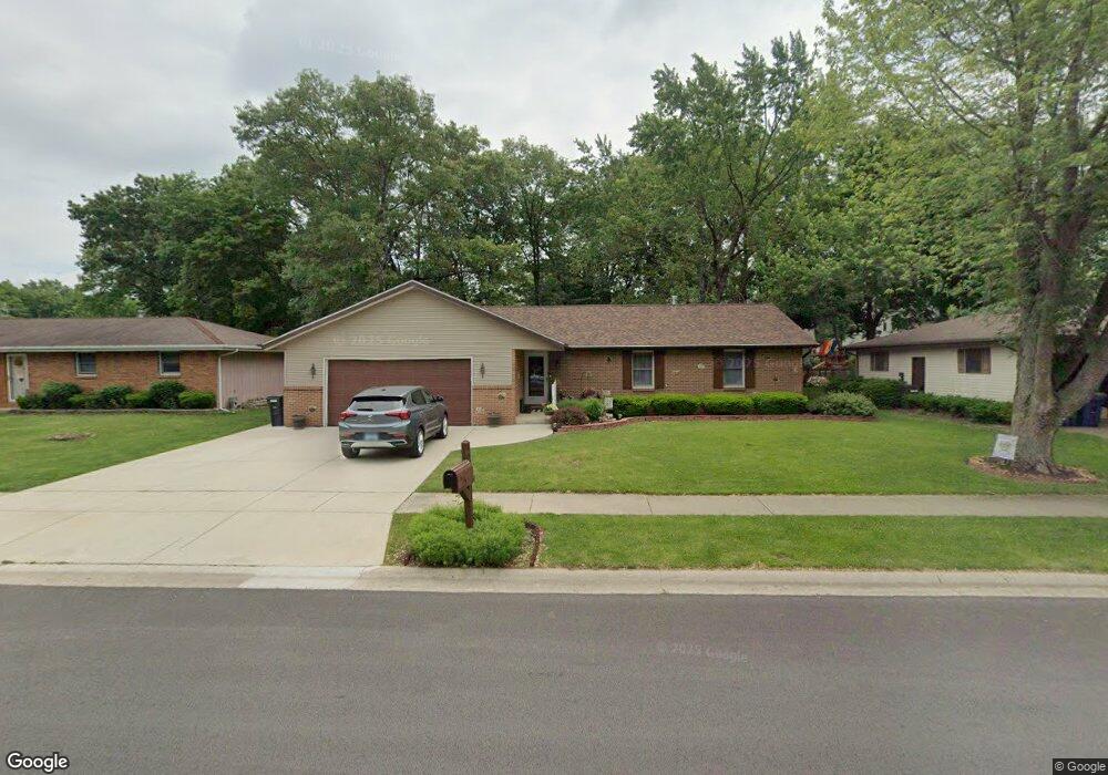
129 Deerpath Dr Morris, IL 60450
Estimated Value: $278,000 - $312,000
About This Home
This home is located at 129 Deerpath Dr, Morris, IL 60450 and is currently estimated at $294,545, approximately $202 per square foot. 129 Deerpath Dr is a home located in Grundy County with nearby schools including White Oak Elementary School, Shabbona Middle School, and Morris Community High School.
Ownership History
We collect this data history from publicly available records. To have your information removed, we recommend requesting removal directly through your county’s website.
Purchase Details
Purchase Details
Home Financials for this Owner
Home Financials are based on the most recent Mortgage that was taken out on this home.Purchase History
We collect this data history from publicly available records. To have your information removed, we recommend requesting removal directly through your county’s website.
| Date | Buyer | Sale Price | Title Company |
|---|---|---|---|
| -- | None Available | ||
| -- | -- |
Mortgage History
We collect this data history from publicly available records. To have your information removed, we recommend requesting removal directly through your county’s website.
| Date | Status | Borrower | Loan Amount |
|---|---|---|---|
| Open | $158,119 |
Tax History
We collect this data history from publicly available records. To have your information removed, we recommend requesting removal directly through your county’s website.
| Year | Tax Paid | Tax Assessment Tax Assessment Total Assessment is a certain percentage of the fair market value that is determined by local assessors to be the total taxable value of land and additions on the property. | Land | Improvement |
|---|---|---|---|---|
| 2024 | $6,013 | $76,832 | $17,606 | $59,226 |
| 2023 | $5,663 | $72,360 | $16,581 | $55,779 |
| 2022 | $4,362 | $66,740 | $15,293 | $51,447 |
| 2021 | $4,136 | $63,117 | $14,463 | $48,654 |
| 2020 | $4,470 | $61,506 | $14,094 | $47,412 |
| 2019 | $4,188 | $58,299 | $13,359 | $44,940 |
| 2018 | $3,581 | $50,538 | $13,100 | $37,438 |
| 2017 | $3,345 | $47,880 | $12,411 | $35,469 |
| 2016 | $3,309 | $47,505 | $12,314 | $35,191 |
| 2015 | $3,079 | $45,603 | $11,821 | $33,782 |
| 2014 | $2,991 | $44,412 | $11,512 | $32,900 |
| 2013 | $3,059 | $46,180 | $11,970 | $34,210 |
Map
- 1455 Lake Dr
- 1259 Brendan Dr
- 0000 Lakewood Dr
- 1180 Lakewood Dr
- 407 Ottawa St
- 1716 Kingtree Dr
- 374 Edgewater Dr
- Lot 3,4,5,7,8 Edgewater Dr
- 1198 Lisbon St
- 409 W Jefferson St
- 1233 Oak Grove Ct
- 1041 Lakeview Dr
- 413 W Washington St
- 523 Bedford Rd
- 116 Crabapple Ln
- Lot 58 Timber Edge Dr
- 2099 Kingtree Dr
- 1082 Timber Edge Dr
- 1595 W Us Rte 6
- 1.88 Acres Rd
- 924 Shabbona St
- 928 Shabbona St
- 922 Shabbona St
- 131 Deerpath Dr
- 133 Deerpath Dr
- 127 Deerpath Dr
- 932 Shabbona St
- 920 Shabbona St
- 917 Shabbona St
- 135 Deerpath Dr
- 927 Shabbona St
- 1029 Oriole Dr
- 1029 Oriole Dr Unit 3
- 1031 Oriole Dr
- 936 Shabbona St
- 918 Shabbona St
- 1027 Oriole Dr
- 125 Deerpath Dr
- 931 Shabbona St
- 913 Shabbona St
Ask me questions while you tour the home.