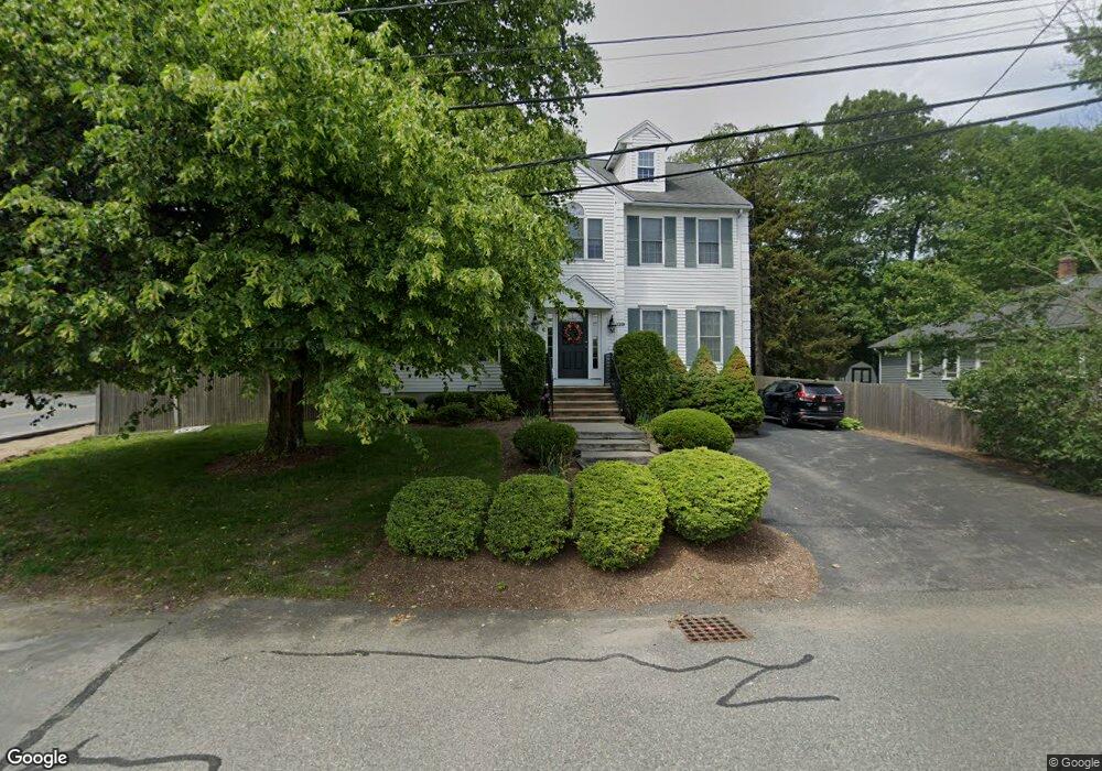
129 Etna Rd Dedham, MA 02026
The Manor NeighborhoodEstimated Value: $889,000 - $1,089,000
4
Beds
3
Baths
2,144
Sq Ft
$446/Sq Ft
Est. Value
About This Home
This home is located at 129 Etna Rd, Dedham, MA 02026 and is currently estimated at $956,643, approximately $446 per square foot. 129 Etna Rd is a home located in Norfolk County with nearby schools including Greenlodge Elementary School, Dedham Middle School, and Dedham High School.
Create a Home Valuation Report for This Property
The Home Valuation Report is an in-depth analysis detailing your home's value as well as a comparison with similar homes in the area
Home Values in the Area
Average Home Value in this Area
Tax History
| Year | Tax Paid | Tax Assessment Tax Assessment Total Assessment is a certain percentage of the fair market value that is determined by local assessors to be the total taxable value of land and additions on the property. | Land | Improvement |
|---|---|---|---|---|
| 2025 | $10,966 | $868,900 | $335,000 | $533,900 |
| 2024 | $10,668 | $853,400 | $303,900 | $549,500 |
| 2023 | $9,603 | $747,900 | $275,300 | $472,600 |
| 2022 | $8,943 | $669,900 | $258,500 | $411,400 |
| 2021 | $8,254 | $603,800 | $239,300 | $364,500 |
| 2020 | $8,453 | $616,100 | $239,200 | $376,900 |
| 2019 | $7,920 | $559,700 | $208,000 | $351,700 |
| 2018 | $7,774 | $534,300 | $182,600 | $351,700 |
| 2017 | $7,417 | $502,500 | $171,000 | $331,500 |
| 2016 | $7,706 | $497,500 | $158,300 | $339,200 |
| 2015 | $7,505 | $472,900 | $156,000 | $316,900 |
| 2014 | $7,739 | $481,300 | $153,100 | $328,200 |
Source: Public Records
Map
Nearby Homes
Your Personal Tour Guide
Ask me questions while you tour the home.