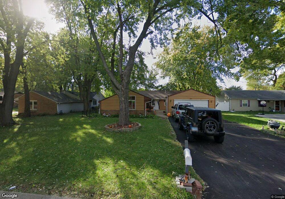
129 Mellbrook Rd Bolingbrook, IL 60440
East Bolingbrook NeighborhoodEstimated Value: $270,000 - $355,000
5
Beds
2
Baths
1,772
Sq Ft
$174/Sq Ft
Est. Value
About This Home
This home is located at 129 Mellbrook Rd, Bolingbrook, IL 60440 and is currently estimated at $308,881, approximately $174 per square foot. 129 Mellbrook Rd is a home located in Will County with nearby schools including Bernard J Ward Elementary School, Hubert H Humphrey Middle School, and Bolingbrook High School.
Ownership History
Date
Name
Owned For
Owner Type
Purchase Details
Closed on
Aug 20, 1999
Sold by
Hawkes Mark L and Hawkes Joy A
Bought by
Camacho Osvaldo and Camacho Elena
Current Estimated Value
Home Financials for this Owner
Home Financials are based on the most recent Mortgage that was taken out on this home.
Original Mortgage
$121,200
Outstanding Balance
$35,591
Interest Rate
7.93%
Mortgage Type
FHA
Estimated Equity
$273,290
Purchase Details
Closed on
Nov 22, 1994
Sold by
Chemical Bank
Bought by
Hawkes Mark L and Hawkes Joy A
Home Financials for this Owner
Home Financials are based on the most recent Mortgage that was taken out on this home.
Original Mortgage
$76,950
Interest Rate
8.25%
Create a Home Valuation Report for This Property
The Home Valuation Report is an in-depth analysis detailing your home's value as well as a comparison with similar homes in the area
Home Values in the Area
Average Home Value in this Area
Purchase History
| Date | Buyer | Sale Price | Title Company |
|---|---|---|---|
| Camacho Osvaldo | $122,500 | -- | |
| Hawkes Mark L | $81,000 | 1St American Title |
Source: Public Records
Mortgage History
| Date | Status | Borrower | Loan Amount |
|---|---|---|---|
| Open | Camacho Osvaldo | $121,200 | |
| Previous Owner | Hawkes Mark L | $76,950 |
Source: Public Records
Tax History
| Year | Tax Paid | Tax Assessment Tax Assessment Total Assessment is a certain percentage of the fair market value that is determined by local assessors to be the total taxable value of land and additions on the property. | Land | Improvement |
|---|---|---|---|---|
| 2024 | $8,520 | $100,248 | $19,575 | $80,673 |
| 2023 | $8,520 | $90,200 | $17,613 | $72,587 |
| 2022 | $7,445 | $81,320 | $15,879 | $65,441 |
| 2021 | $7,051 | $76,035 | $14,847 | $61,188 |
| 2020 | $6,831 | $73,535 | $14,359 | $59,176 |
| 2019 | $6,465 | $68,660 | $13,407 | $55,253 |
| 2018 | $5,937 | $63,163 | $12,333 | $50,830 |
| 2017 | $5,646 | $59,870 | $11,690 | $48,180 |
| 2016 | $5,241 | $54,800 | $10,700 | $44,100 |
| 2015 | $4,894 | $52,600 | $10,300 | $42,300 |
| 2014 | $4,894 | $50,100 | $9,800 | $40,300 |
| 2013 | $4,894 | $52,700 | $10,300 | $42,400 |
Source: Public Records
Map
Nearby Homes
- 108 Allison Ct
- 132 N Pinecrest Rd
- 104 Stoneham Ct
- 149 Vernon Dr
- 252 S Ashbury Ave
- 533 Redwood Rd
- 547 Redwood Rd
- 220 N Ashbury Ave
- 564 White Oak Rd
- 125 Monterey Dr
- 404 Galahad Rd
- 140 Enclave Cir Unit C
- 401 Salem Square
- 196 Hadleigh Rd
- 408 Colony Ct Unit 4
- 405 Colony Ct
- 145 Enclave Cir Unit D
- 316 Bedford Rd
- 234 Malibu Dr
- 103 Enclave Cir Unit C
- 125 Mellbrook Rd
- 133 Mellbrook Rd
- 128 Lawton Ln
- 124 Lawton Ln
- 132 Lawton Ln Unit 5
- 137 Mellbrook Rd
- 121 Mellbrook Rd
- 120 Lawton Ln
- 136 Lawton Ln
- 128 Mellbrook Rd
- 124 Mellbrook Rd
- 141 Mellbrook Rd
- 117 Mellbrook Rd
- 140 Lawton Ln
- 116 Lawton Ln
- 116 Mellbrook Rd
- 159 Nutwood Ct
- 113 Mellbrook Rd
- 182 Nutwood Ct Unit 5
- 145 Mellbrook Rd
Your Personal Tour Guide
Ask me questions while you tour the home.