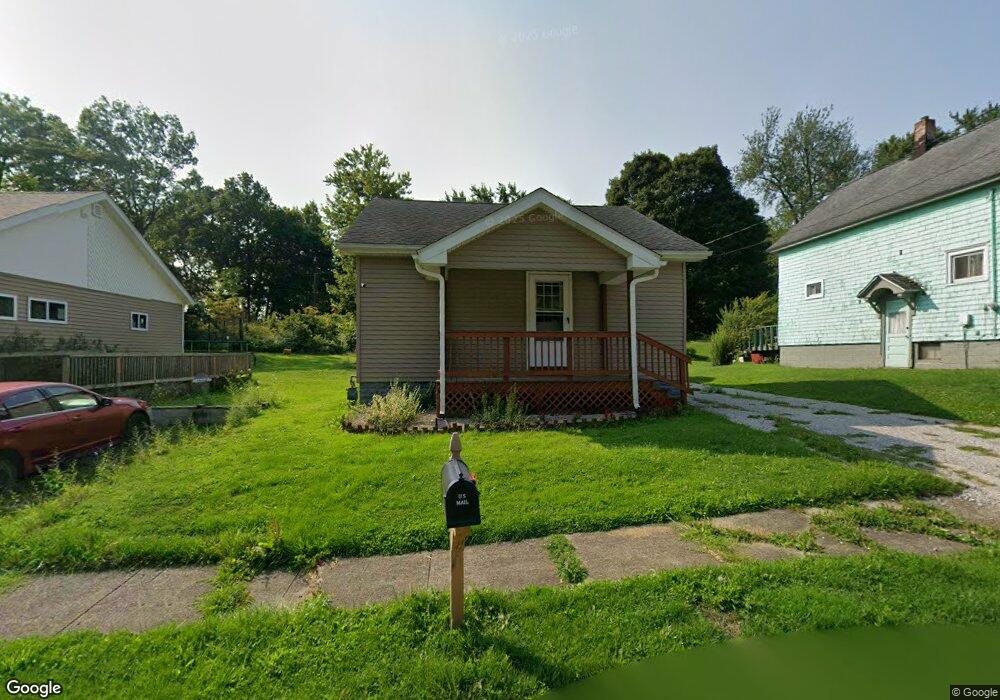
129 Poplar St Conneaut, OH 44030
Estimated Value: $80,532 - $100,000
2
Beds
1
Bath
720
Sq Ft
$129/Sq Ft
Est. Value
About This Home
This home is located at 129 Poplar St, Conneaut, OH 44030 and is currently estimated at $92,883, approximately $129 per square foot. 129 Poplar St is a home located in Ashtabula County with nearby schools including Lakeshore Primary Elementary School, Gateway Elementary School, and Conneaut Middle School.
Ownership History
Date
Name
Owned For
Owner Type
Purchase Details
Closed on
Jun 3, 2013
Sold by
Hazeltine Charles L
Bought by
Rea James G
Current Estimated Value
Purchase Details
Closed on
Sep 7, 2005
Sold by
Hawn David L and Hawn Kathryn A
Bought by
Hazeltine Charles L
Home Financials for this Owner
Home Financials are based on the most recent Mortgage that was taken out on this home.
Original Mortgage
$47,500
Interest Rate
5.89%
Mortgage Type
Credit Line Revolving
Create a Home Valuation Report for This Property
The Home Valuation Report is an in-depth analysis detailing your home's value as well as a comparison with similar homes in the area
Home Values in the Area
Average Home Value in this Area
Purchase History
| Date | Buyer | Sale Price | Title Company |
|---|---|---|---|
| Rea James G | $10,000 | None Available | |
| Hazeltine Charles L | $47,500 | Franklin Blair Title Agency |
Source: Public Records
Mortgage History
| Date | Status | Borrower | Loan Amount |
|---|---|---|---|
| Previous Owner | Hazeltine Charles L | $47,500 |
Source: Public Records
Tax History
| Year | Tax Paid | Tax Assessment Tax Assessment Total Assessment is a certain percentage of the fair market value that is determined by local assessors to be the total taxable value of land and additions on the property. | Land | Improvement |
|---|---|---|---|---|
| 2024 | $925 | $12,640 | $2,070 | $10,570 |
| 2023 | $604 | $12,640 | $2,070 | $10,570 |
| 2022 | $563 | $10,370 | $1,580 | $8,790 |
| 2021 | $573 | $10,370 | $1,580 | $8,790 |
| 2020 | $572 | $10,370 | $1,580 | $8,790 |
| 2019 | $341 | $5,990 | $950 | $5,040 |
| 2018 | $325 | $5,990 | $950 | $5,040 |
| 2017 | $325 | $5,990 | $950 | $5,040 |
| 2016 | $439 | $8,930 | $1,440 | $7,490 |
| 2015 | $443 | $8,930 | $1,440 | $7,490 |
| 2014 | $716 | $16,390 | $1,440 | $14,950 |
| 2013 | $698 | $10,890 | $1,330 | $9,560 |
Source: Public Records
Map
Nearby Homes
Your Personal Tour Guide
Ask me questions while you tour the home.