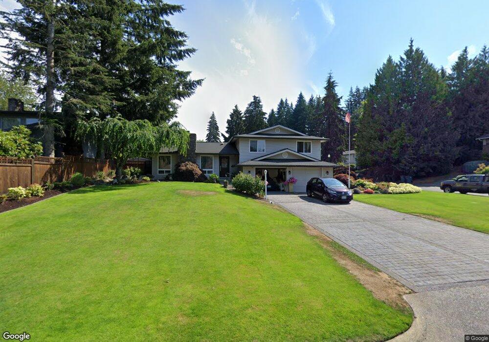
1290 Alpine Ln Fircrest, WA 98466
Estimated Value: $641,407 - $758,000
3
Beds
3
Baths
1,718
Sq Ft
$403/Sq Ft
Est. Value
About This Home
This home is located at 1290 Alpine Ln, Fircrest, WA 98466 and is currently estimated at $692,602, approximately $403 per square foot. 1290 Alpine Ln is a home located in Pierce County with nearby schools including Whittier Elementary School, Wainwright Intermediate School, and Foss High School.
Ownership History
Date
Name
Owned For
Owner Type
Purchase Details
Closed on
Mar 5, 2019
Sold by
Loth Renald D
Bought by
Loth Renald D and Loth Annie L
Current Estimated Value
Purchase Details
Closed on
Aug 23, 2000
Sold by
Swenson Leroy W
Bought by
Loth Renald D
Home Financials for this Owner
Home Financials are based on the most recent Mortgage that was taken out on this home.
Original Mortgage
$168,000
Outstanding Balance
$60,614
Interest Rate
8.15%
Estimated Equity
$631,988
Create a Home Valuation Report for This Property
The Home Valuation Report is an in-depth analysis detailing your home's value as well as a comparison with similar homes in the area
Home Values in the Area
Average Home Value in this Area
Purchase History
| Date | Buyer | Sale Price | Title Company |
|---|---|---|---|
| Loth Renald D | -- | None Available | |
| Loth Renald D | $244,313 | Rainier Title Company |
Source: Public Records
Mortgage History
| Date | Status | Borrower | Loan Amount |
|---|---|---|---|
| Open | Loth Renald D | $168,000 |
Source: Public Records
Tax History
| Year | Tax Paid | Tax Assessment Tax Assessment Total Assessment is a certain percentage of the fair market value that is determined by local assessors to be the total taxable value of land and additions on the property. | Land | Improvement |
|---|---|---|---|---|
| 2025 | $5,466 | $586,500 | $322,800 | $263,700 |
| 2024 | $5,466 | $571,700 | $303,800 | $267,900 |
| 2023 | $5,466 | $573,100 | $297,800 | $275,300 |
| 2022 | $5,350 | $574,000 | $306,200 | $267,800 |
| 2021 | $5,081 | $437,500 | $215,300 | $222,200 |
| 2019 | $4,297 | $402,700 | $184,400 | $218,300 |
| 2018 | $4,734 | $399,100 | $156,600 | $242,500 |
| 2017 | $4,340 | $356,300 | $127,100 | $229,200 |
| 2016 | $4,036 | $286,100 | $92,300 | $193,800 |
| 2014 | $3,652 | $273,100 | $88,700 | $184,400 |
| 2013 | $3,652 | $244,400 | $79,800 | $164,600 |
Source: Public Records
Map
Nearby Homes
- 1340 Coral Dr
- 1584 Woodside Dr
- 1436 Evergreen Place
- 1339 Coral Dr
- 4003 Flora Dr
- 4063 Flora Dr Unit F
- 1151 Fordham Ct
- 3826 67th Avenue Ct W Unit 3826
- 3831 68th Ave W Unit 3831
- 4323 67th Avenue Ct W
- 4504 67th Ave W
- 1559 Bay Hill Ave
- 6812 37th Street Ct W
- 3814 69th Ave W
- 6910 38th Street Ct W Unit 6910
- 1220 Alameda Ave Unit F
- 3645 67th Ave W
- 6809 Boulders Way W
- 4719 61st Ave W
- 4419 Shoshone St W
- 1286 Alpine Ln
- 1433 Woodside Dr
- 1280 Alpine Ln
- 1422 Woodside Dr
- 1426 Woodside Dr
- 1283 Alpine Ln
- 1418 Woodside Dr
- 1439 Woodside Dr
- 1281 Alpine Ln
- 1430 Woodside Dr
- 1414 Woodside Dr
- 1533 Weathervane Ct
- 1508 Woodside Dr
- 1515 Woodside Dr
- 1503 Woodside Dr
- 1529 Weathervane Ct
- 1537 Weathervane Ct
- 1509 Woodside Dr
- 1410 Woodside Dr
Your Personal Tour Guide
Ask me questions while you tour the home.