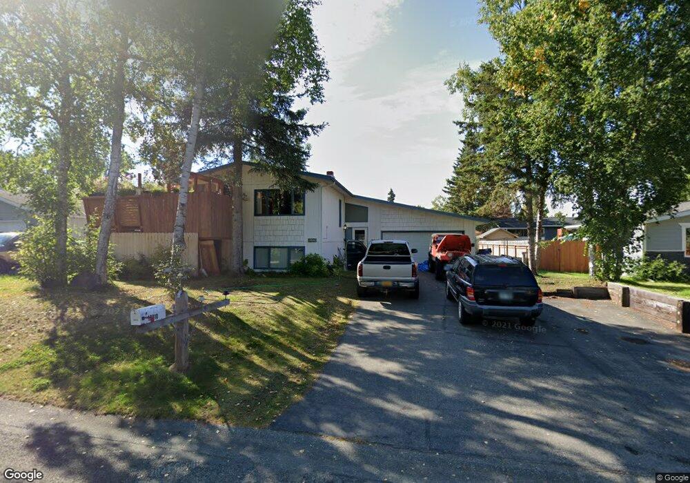
12910 Troy St Anchorage, AK 99515
Old Seward-Oceanview NeighborhoodEstimated Value: $368,000 - $495,726
5
Beds
3
Baths
2,236
Sq Ft
$193/Sq Ft
Est. Value
About This Home
This home is located at 12910 Troy St, Anchorage, AK 99515 and is currently estimated at $431,432, approximately $192 per square foot. 12910 Troy St is a home located in Anchorage Municipality with nearby schools including Ocean View Elementary School, Goldenview Middle School, and South Anchorage High School.
Ownership History
Date
Name
Owned For
Owner Type
Purchase Details
Closed on
Jan 27, 2011
Sold by
Lamb David C and Lamb Toni K
Bought by
Jones Douglas B
Current Estimated Value
Home Financials for this Owner
Home Financials are based on the most recent Mortgage that was taken out on this home.
Original Mortgage
$271,439
Outstanding Balance
$186,092
Interest Rate
4.82%
Mortgage Type
FHA
Estimated Equity
$245,340
Create a Home Valuation Report for This Property
The Home Valuation Report is an in-depth analysis detailing your home's value as well as a comparison with similar homes in the area
Home Values in the Area
Average Home Value in this Area
Purchase History
We collect this data history from publicly available records. To have your information removed, we recommend requesting removal directly through your county’s website.
| Date | Buyer | Sale Price | Title Company |
|---|---|---|---|
| Jones Douglas B | -- | Atga |
Source: Public Records
Mortgage History
We collect this data history from publicly available records. To have your information removed, we recommend requesting removal directly through your county’s website.
| Date | Status | Borrower | Loan Amount |
|---|---|---|---|
| Open | Jones Douglas B | $271,439 |
Source: Public Records
Tax History
| Year | Tax Paid | Tax Assessment Tax Assessment Total Assessment is a certain percentage of the fair market value that is determined by local assessors to be the total taxable value of land and additions on the property. | Land | Improvement |
|---|---|---|---|---|
| 2025 | $7,039 | $466,600 | $100,400 | $366,200 |
| 2024 | $7,039 | $436,000 | $100,400 | $335,600 |
| 2023 | $3,343 | $388,700 | $100,400 | $288,300 |
| 2022 | $6,386 | $379,200 | $100,400 | $278,800 |
| 2021 | $6,408 | $355,600 | $100,400 | $255,200 |
| 2020 | $5,931 | $348,900 | $100,400 | $248,500 |
| 2019 | $5,805 | $354,800 | $100,400 | $254,400 |
| 2018 | $5,799 | $353,600 | $100,400 | $253,200 |
| 2017 | $5,569 | $355,600 | $95,700 | $259,900 |
| 2016 | $4,617 | $351,800 | $95,700 | $256,100 |
| 2015 | $4,617 | $334,900 | $95,700 | $239,200 |
| 2014 | $4,617 | $322,800 | $81,300 | $241,500 |
Source: Public Records
Map
Nearby Homes
- 12901 Troy St
- 12636 Silver Fox Ln
- 1296 Snow Fox Ln Unit 4
- 1270 Snow Fox Ln Unit 1
- 12521 Tanada Loop
- 12468 Silver Fox Ln Unit 15
- 13051 Sues Way
- 2311 Sues Way
- 13751 Venus Way
- 2430 Legacy Dr
- 13761 Venus Way
- 2500 Tradewind Dr
- 11720 Birch Knoll Loop Unit 11720
- 500 Dailey Ave
- 11750 Birch Trail Cir
- 12106 Lucille Ln Unit 1
- 2741 Kempton Hills Dr
- 2649 Timberview Dr
- 1301 E Klatt Rd
- 11501 Tanglewood Lakes Cir Unit C-1
Your Personal Tour Guide
Ask me questions while you tour the home.