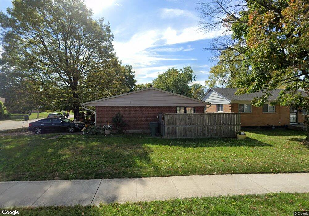
1297 Smith Rd Columbus, OH 43207
Innis Gardens Village NeighborhoodEstimated Value: $182,408 - $197,000
About This Home
This home is located at 1297 Smith Rd, Columbus, OH 43207 and is currently estimated at $190,602, approximately $153 per square foot. 1297 Smith Rd is a home located in Franklin County with nearby schools including Moler Elementary School, South High School, and Summit Academy Community School-Columbus.
Ownership History
We collect this data history from publicly available records. To have your information removed, we recommend requesting removal directly through your county’s website.
Purchase Details
Home Financials for this Owner
Home Financials are based on the most recent Mortgage that was taken out on this home.Purchase Details
Purchase Details
Home Values in the Area
Average Home Value in this Area
Purchase History
We collect this data history from publicly available records. To have your information removed, we recommend requesting removal directly through your county’s website.
| Date | Buyer | Sale Price | Title Company |
|---|---|---|---|
| $85,000 | Title First | ||
| -- | -- | ||
| -- | -- |
Mortgage History
We collect this data history from publicly available records. To have your information removed, we recommend requesting removal directly through your county’s website.
| Date | Status | Borrower | Loan Amount |
|---|---|---|---|
| Open | $84,200 |
Tax History
We collect this data history from publicly available records. To have your information removed, we recommend requesting removal directly through your county’s website.
| Year | Tax Paid | Tax Assessment Tax Assessment Total Assessment is a certain percentage of the fair market value that is determined by local assessors to be the total taxable value of land and additions on the property. | Land | Improvement |
|---|---|---|---|---|
| 2025 | $2,317 | $51,630 | $13,480 | $38,150 |
| 2024 | $2,317 | $51,630 | $13,480 | $38,150 |
| 2023 | $2,288 | $51,625 | $13,475 | $38,150 |
| 2022 | $1,124 | $21,670 | $6,200 | $15,470 |
| 2021 | $1,126 | $21,670 | $6,200 | $15,470 |
| 2020 | $1,127 | $21,670 | $6,200 | $15,470 |
| 2019 | $1,119 | $18,450 | $5,390 | $13,060 |
| 2018 | $1,196 | $18,450 | $5,390 | $13,060 |
| 2017 | $1,119 | $18,450 | $5,390 | $13,060 |
| 2016 | $1,406 | $21,220 | $5,010 | $16,210 |
| 2015 | $1,276 | $21,220 | $5,010 | $16,210 |
| 2014 | $1,279 | $21,220 | $5,010 | $16,210 |
| 2013 | $663 | $22,295 | $5,250 | $17,045 |
Map
- 1280 Smith Rd
- 1217 Smith Rd
- 1804 Kelton Ave
- 1910 Fairwood Ave
- 1110 E Innis Ave
- 1316 Moler Rd
- 1384 Moler Rd
- 1099 Lawrence Dr
- 1645 Liscomb Rd
- 1598 Anchor Dr E
- 1019 Lawrence Dr
- 1680 Linwood Ave
- 0 Moler Rd
- 1545 Fairwood Ave
- 1436 Ellsworth Ave Unit 438
- 1435 E Mithoff St
- 1571 Wilson Ave
- 1418-1422 Miller Ave
- 1514-1518 Wilson Ave
- 1633 E Gates St
- 1289 Smith Rd
- 1919 Berkeley Rd
- 1313 Smith Rd
- 1279 Smith Rd
- 1925 Berkeley Rd
- 1920 Berkeley Rd
- 1319 Smith Rd
- 1886 Berkeley Rd
- 1889 Berkeley Rd
- 1320 Smith Rd
- 1933 Berkeley Rd
- 1926 Berkeley Rd
- 1269 Smith Rd
- 1330 Smith Rd
- 1934 Berkeley Rd
- 1939 Berkeley Rd
- 1333 Smith Rd
- 1869 Berkeley Rd
- 1332 Smith Rd
- 1866 Berkeley Rd
Ask me questions while you tour the home.