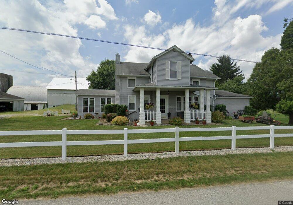
12970 Oller Rd Creston, OH 44217
Estimated Value: $229,000 - $871,181
3
Beds
1
Bath
1,692
Sq Ft
$344/Sq Ft
Est. Value
About This Home
This home is located at 12970 Oller Rd, Creston, OH 44217 and is currently estimated at $582,060, approximately $344 per square foot. 12970 Oller Rd is a home located in Wayne County with nearby schools including Norwayne Elementary School, Norwayne Middle School, and Norwayne High School.
Ownership History
Date
Name
Owned For
Owner Type
Purchase Details
Closed on
Aug 19, 2025
Sold by
Gessel Gale H
Bought by
Larrison Lance J
Current Estimated Value
Purchase Details
Closed on
Aug 30, 2001
Sold by
Griffitts Mitchell C
Bought by
Flynn Douglas P and Flynn Sharon D
Home Financials for this Owner
Home Financials are based on the most recent Mortgage that was taken out on this home.
Original Mortgage
$124,100
Interest Rate
7.11%
Mortgage Type
New Conventional
Purchase Details
Closed on
Jun 19, 1992
Sold by
Gessel Gale H
Bought by
Gessel Gale H Trustee
Purchase Details
Closed on
Apr 10, 1989
Sold by
Gessel Gale H and Gessel Joyce E
Bought by
Gessel Gale H
Purchase Details
Closed on
Dec 29, 1986
Bought by
Gessel Gale H and Gessel Joyce E
Create a Home Valuation Report for This Property
The Home Valuation Report is an in-depth analysis detailing your home's value as well as a comparison with similar homes in the area
Purchase History
We collect this data history from publicly available records. To have your information removed, we recommend requesting removal directly through your county’s website.
| Date | Buyer | Sale Price | Title Company |
|---|---|---|---|
| Larrison Lance J | $77,900 | None Listed On Document | |
| Flynn Douglas P | $22,000 | -- | |
| Gessel Gale H Trustee | -- | -- | |
| Gessel Gale H | -- | -- | |
| Gessel Gale H | $102,700 | -- |
Source: Public Records
Mortgage History
We collect this data history from publicly available records. To have your information removed, we recommend requesting removal directly through your county’s website.
| Date | Status | Borrower | Loan Amount |
|---|---|---|---|
| Previous Owner | Flynn Douglas P | $124,100 |
Source: Public Records
Tax History
| Year | Tax Paid | Tax Assessment Tax Assessment Total Assessment is a certain percentage of the fair market value that is determined by local assessors to be the total taxable value of land and additions on the property. | Land | Improvement |
|---|---|---|---|---|
| 2025 | $1,999 | $227,620 | $193,450 | $34,170 |
| 2024 | $1,999 | $236,880 | $202,710 | $34,170 |
| 2023 | $2,062 | $236,880 | $202,710 | $34,170 |
| 2022 | $1,775 | $237,050 | $202,710 | $34,340 |
| 2021 | $1,808 | $237,050 | $202,710 | $34,340 |
| 2020 | $1,820 | $237,050 | $202,710 | $34,340 |
| 2019 | $1,640 | $202,220 | $174,400 | $27,820 |
| 2018 | $1,648 | $202,220 | $174,400 | $27,820 |
| 2017 | $1,875 | $202,220 | $174,400 | $27,820 |
| 2016 | $2,141 | $142,640 | $114,820 | $27,820 |
| 2015 | $2,114 | $142,640 | $114,820 | $27,820 |
| 2014 | $2,134 | $142,640 | $114,820 | $27,820 |
| 2013 | $1,507 | $106,720 | $78,820 | $27,900 |
Source: Public Records
Map
Nearby Homes
- 0 Easton Rd
- 2483 Steiner Rd
- 0 Steiner Rd
- 100 W Erie St
- 0 Burbank & Erie St
- 9535 Daniels Rd
- 9376 Daniels Rd
- 0 White Rd
- 39 Prospect St
- 8212 White Rd
- V/L White Rd
- 31 Ironwood Dr
- 7389 Doylestown Rd
- 8995 Ridge Rd
- 5058 Catawba Place Ln
- 5222 Greenwich Rd Unit 30
- 5222 Greenwich Rd Unit 28
- 5222 Greenwich Rd Unit 12
- 9389 Towpath Trail
- 9338 Towpath Trail
- 13033 Oller Rd
- 13111 Oller Rd
- 1949 Sterling Rd
- 1949 Sterling Rd
- 1985 Sterling Rd
- 2201 Sterling Rd
- 2245 Sterling Rd
- 2245 Sterling Rd
- 2128 Sterling Rd
- 2277 Sterling Rd
- 2277 Sterling Rd
- 2315 Sterling Rd
- 1894 Sterling Rd
- 2353 Sterling Rd
- 2353 Sterling Rd
- 2393 Sterling Rd
- 2399 Sterling Rd
- 2292 Sterling Rd
- 1794 Sterling Rd
- 2150 Sterling Rd
Your Personal Tour Guide
Ask me questions while you tour the home.