Estimated Value: $443,827 - $497,000
Studio
--
Bath
--
Sq Ft
0.29
Acres Lot
About This Home
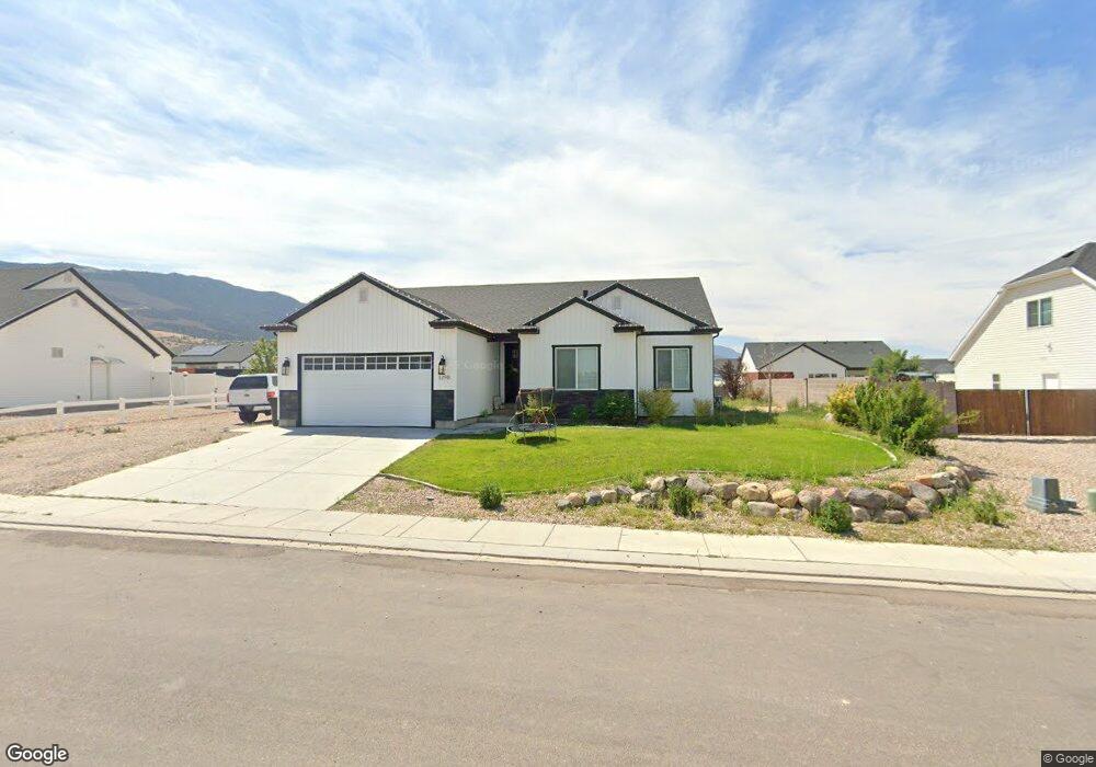
This home is located at 1298 E 4375 N Unit Phase 1, Enoch, UT 84721 and is currently estimated at $473,707. 1298 E 4375 N Unit Phase 1 is a home located in Iron County with nearby schools including Enoch School, Cedar Middle School, and Cedar City High School.
Ownership History
Date
Name
Owned For
Owner Type
Purchase Details
Closed on
Feb 13, 2024
Sold by
White Abbie Gwen
Bought by
White Kache Howard
Current Estimated Value
Purchase Details
Closed on
Mar 19, 2021
Sold by
Alex Meisner Construction Llc
Bought by
White Kache Howard
Home Financials for this Owner
Home Financials are based on the most recent Mortgage that was taken out on this home.
Original Mortgage
$312,727
Interest Rate
2.7%
Mortgage Type
New Conventional
Purchase Details
Closed on
Mar 18, 2021
Sold by
White Kache Howard
Bought by
White Kache Howard and White Abbie Gwen
Home Financials for this Owner
Home Financials are based on the most recent Mortgage that was taken out on this home.
Original Mortgage
$312,727
Interest Rate
2.7%
Mortgage Type
New Conventional
Purchase Details
Closed on
Mar 9, 2021
Sold by
White Kache Howard
Bought by
White Kache Howard and White Abbie Gwen
Home Financials for this Owner
Home Financials are based on the most recent Mortgage that was taken out on this home.
Original Mortgage
$312,727
Interest Rate
2.7%
Mortgage Type
New Conventional
Purchase Details
Closed on
Nov 18, 2020
Sold by
Amc Development Llc
Bought by
Alex Meisner Construction Llc
Create a Home Valuation Report for This Property
The Home Valuation Report is an in-depth analysis detailing your home's value as well as a comparison with similar homes in the area
Home Values in the Area
Average Home Value in this Area
Purchase History
| Date | Buyer | Sale Price | Title Company |
|---|---|---|---|
| White Kache Howard | -- | -- | |
| White Kache Howard | -- | Southern Ut Ttl Co Of Cedar | |
| White Kache Howard | -- | -- | |
| White Kache Howard | -- | Southern Ut Ttl Co Of Cedar | |
| Alex Meisner Construction Llc | -- | Southern Ut Ttl Co Of Cedar |
Source: Public Records
Mortgage History
| Date | Status | Borrower | Loan Amount |
|---|---|---|---|
| Previous Owner | White Kache Howard | $312,727 |
Source: Public Records
Tax History
| Year | Tax Paid | Tax Assessment Tax Assessment Total Assessment is a certain percentage of the fair market value that is determined by local assessors to be the total taxable value of land and additions on the property. | Land | Improvement |
|---|---|---|---|---|
| 2025 | $1,890 | $258,902 | $45,650 | $213,252 |
| 2023 | $1,856 | $232,740 | $36,970 | $195,770 |
| 2022 | $1,824 | $213,185 | $35,210 | $177,975 |
| 2021 | $569 | $66,505 | $20,710 | $45,795 |
| 2020 | $367 | $37,655 | $37,655 | $0 |
Source: Public Records
Map
Nearby Homes
- 1271 E Southern Homestead Blvd
- 1116 E Southern Homestead Blvd
- 4199 N Tomahawk Dr Unit Lot 10 Sunview Estat
- 4228 N Tomahawk Dr Unit Lot 7 Sunview Estate
- 5222 N Tomahawk Dr
- 4636 N Marshal Trail
- 4349 N Half Mile Rd
- 4355 Sagebrush Dr
- 4580 N Half Mile Rd
- 4785 Old Scout Trail
- 4637 N Pioneer Dr
- 5 Acre Ft 1963 Priority Date
- 60 acre ft Priority Date 1951
- 3 acre ft
- 26.25 Acre E Midvalley Rd
- 3.32 Acres E Midvalley Rd
- 1050 E Midvalley Rd Unit Approx.
- 3.32 E Midvalley Rd
- 4696 Santa fe Trail
- 4766 N Mule Train Dr
- 1298 E 4375 N Unit Lot 17, Settler's Sq
- 1298 E 4375 N
- 1314 E 4375 N Unit Lot 18, Settler's Sq
- 1314 E 4375 N
- 1314 E 4375 N Unit Phase 1
- 1268 E 4375 N Unit Lot 16, Settler's Sq
- 1268 E 4375 N
- 1299 E Southern Homestead Blvd Unit Lot 28, Settler's Sq
- 1299 E Southern Homestead Blvd
- 1315 E Southern Homestead Blvd Unit Lot 27, Settler's Sq
- 1315 E Southern Homestead Blvd
- 1271 E Southern Homestead Blvd Unit Lot 29, Settler's Sq
- 1322 E 4375 N Unit Lot 19, Settler's Sq
- 1322 E 4375 N
- 1322 E 4375 N Unit Phase 1
- 1259 E 4375 N Unit Lot 15, Settler's Sq
- 1259 E 4375 N
- 1279 E 4375 N Unit Lot 8, Settler's Squ
- 1279 E 4375 N
- 1311 E 4375 N Unit Lot 7
Your Personal Tour Guide
Ask me questions while you tour the home.