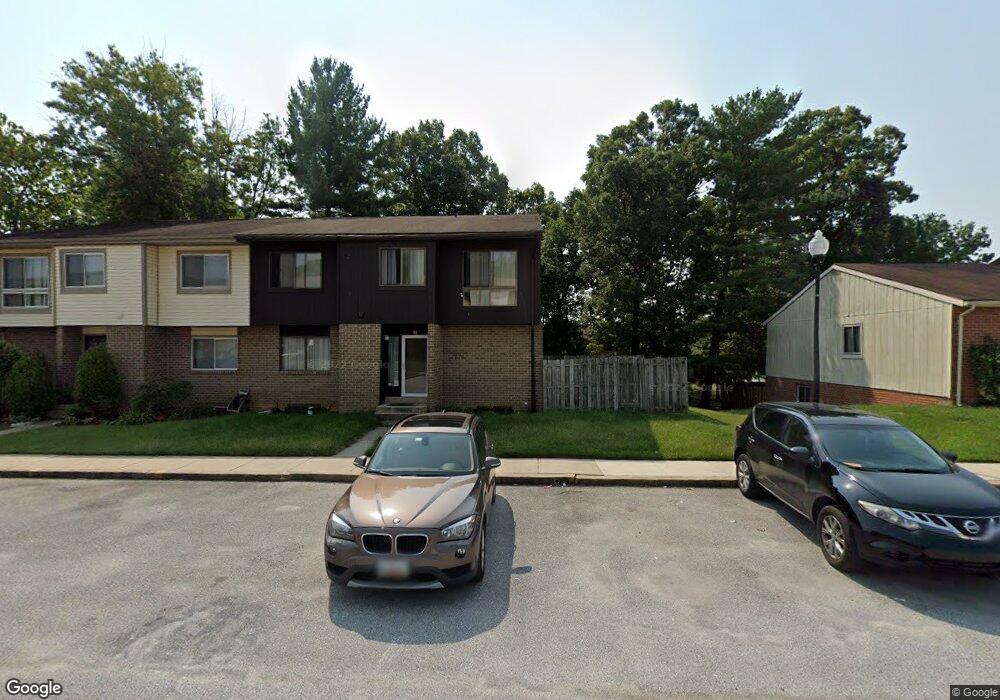
13 Bannock Ct Randallstown, MD 21133
Estimated Value: $271,000 - $292,000
Studio
3
Baths
1,344
Sq Ft
$209/Sq Ft
Est. Value
About This Home
This home is located at 13 Bannock Ct, Randallstown, MD 21133 and is currently estimated at $280,313, approximately $208 per square foot. 13 Bannock Ct is a home located in Baltimore County with nearby schools including Deer Park Elementary School, Deer Park Middle Magnet School, and New Town High.
Ownership History
Date
Name
Owned For
Owner Type
Purchase Details
Closed on
Nov 9, 2018
Sold by
Carter Trinee T
Bought by
Dominion Rental Holdings Llc
Current Estimated Value
Purchase Details
Closed on
Jan 9, 2003
Sold by
Brooks Eric S
Bought by
Carter Trinee T
Purchase Details
Closed on
Apr 28, 1992
Sold by
Davis Harvey A
Bought by
Brooks Eric S
Create a Home Valuation Report for This Property
The Home Valuation Report is an in-depth analysis detailing your home's value as well as a comparison with similar homes in the area
Home Values in the Area
Average Home Value in this Area
Purchase History
| Date | Buyer | Sale Price | Title Company |
|---|---|---|---|
| Dominion Rental Holdings Llc | $117,000 | Eagle Premier Title Group Ll | |
| Carter Trinee T | $104,400 | -- | |
| Brooks Eric S | $83,900 | -- |
Source: Public Records
Tax History
| Year | Tax Paid | Tax Assessment Tax Assessment Total Assessment is a certain percentage of the fair market value that is determined by local assessors to be the total taxable value of land and additions on the property. | Land | Improvement |
|---|---|---|---|---|
| 2025 | $3,472 | $176,200 | -- | -- |
| 2024 | $3,472 | $159,200 | $47,000 | $112,200 |
| 2023 | $3,313 | $150,433 | $0 | $0 |
| 2022 | $3,124 | $141,667 | $0 | $0 |
| 2020 | $3,001 | $132,900 | $47,000 | $85,900 |
| 2019 | $1,611 | $132,900 | $47,000 | $85,900 |
| 2018 | $3,044 | $138,000 | $46,400 | $91,600 |
| 2017 | $2,719 | $134,433 | $0 | $0 |
| 2016 | -- | $130,867 | $0 | $0 |
| 2015 | $2,241 | $127,300 | $0 | $0 |
| 2014 | $2,241 | $127,300 | $0 | $0 |
Source: Public Records
Map
Nearby Homes
- 4264 Cayuga Rd
- 9839 Branchleigh Rd
- 4205 Paran Rd
- 3901 Tiverton Rd
- 9713 Tulsemere Rd
- 4105 Hanwell Rd
- 9540 Branchleigh Rd
- 9847 Bon Haven Ln
- 9908 Hoyt Cir
- 9712 Watts Rd
- 9500 Georgian Way
- 3819 Pikeswood Dr
- 3668 Waterwheel Square
- 9500 Side Brook Rd Unit 406
- 3715 Peace Chance Dr
- 9442 Adelaide Ln
- 9510 Coyle Rd Unit 201
- 4112 Spider Lily Way
- 9401 Summer Squal Dr
- 9424 Adelaide Ln
Your Personal Tour Guide
Ask me questions while you tour the home.