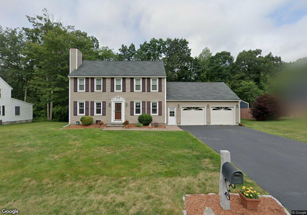
13 Danielle Dr Millbury, MA 01527
Estimated Value: $545,435 - $646,000
3
Beds
2
Baths
1,632
Sq Ft
$372/Sq Ft
Est. Value
About This Home
This home is located at 13 Danielle Dr, Millbury, MA 01527 and is currently estimated at $607,609, approximately $372 per square foot. 13 Danielle Dr is a home located in Worcester County with nearby schools including Elmwood Street Elementary School, Raymond E. Shaw Elementary School, and Millbury Junior/Senior High School.
Ownership History
Date
Name
Owned For
Owner Type
Purchase Details
Closed on
Jul 25, 1996
Sold by
Mcmahon Timothy and Mcmahon Michelle
Bought by
Hebert Steven and Hebert Debra
Current Estimated Value
Purchase Details
Closed on
Mar 19, 1993
Sold by
Quality Home Bldrs
Bought by
Mcmahon Timothy J and Mcmahon Denise
Create a Home Valuation Report for This Property
The Home Valuation Report is an in-depth analysis detailing your home's value as well as a comparison with similar homes in the area
Home Values in the Area
Average Home Value in this Area
Purchase History
| Date | Buyer | Sale Price | Title Company |
|---|---|---|---|
| Hebert Steven | $149,000 | -- | |
| Hebert Steven | $149,000 | -- | |
| Mcmahon Timothy J | $143,120 | -- | |
| Mcmahon Timothy J | $143,120 | -- |
Source: Public Records
Mortgage History
| Date | Status | Borrower | Loan Amount |
|---|---|---|---|
| Open | Mcmahon Timothy J | $100,000 | |
| Closed | Mcmahon Timothy J | $21,000 | |
| Closed | Mcmahon Timothy J | $30,000 |
Source: Public Records
Tax History
| Year | Tax Paid | Tax Assessment Tax Assessment Total Assessment is a certain percentage of the fair market value that is determined by local assessors to be the total taxable value of land and additions on the property. | Land | Improvement |
|---|---|---|---|---|
| 2025 | $6,723 | $502,100 | $138,000 | $364,100 |
| 2024 | $6,164 | $465,900 | $127,800 | $338,100 |
| 2023 | $5,712 | $395,300 | $89,700 | $305,600 |
| 2022 | $5,091 | $339,400 | $86,100 | $253,300 |
| 2021 | $5,029 | $325,900 | $86,100 | $239,800 |
| 2020 | $6,876 | $321,500 | $86,100 | $235,400 |
| 2019 | $4,750 | $299,700 | $75,000 | $224,700 |
| 2018 | $4,364 | $301,500 | $88,000 | $213,500 |
| 2017 | $4,566 | $277,900 | $88,000 | $189,900 |
| 2016 | $4,464 | $271,200 | $88,000 | $183,200 |
| 2015 | $4,413 | $268,100 | $93,600 | $174,500 |
| 2014 | $4,072 | $238,100 | $90,100 | $148,000 |
Source: Public Records
Map
Nearby Homes
- 46 Lexington Rd
- Lot 1 Cooper Rd
- 8 Autumn Gate Cir
- 2 Riverlin Pkwy
- 28 Cortland Way
- 17 Lincoln Ave
- 18 Lincoln Ave
- 7 Canal St
- 37-39 Main St
- 26 Leslie Ln
- 2 Wilson Rd Unit B
- 2 Wilson Rd Unit A
- 75 Main St
- 5 Ann Dr Unit 5
- 75 Potter Hill Rd
- 8 Sycamore Cir
- 5 Lincoln Ln Unit 5
- 9 Danielle Dr
- 2 Jessica j Dr
- 4 John Dr
Your Personal Tour Guide
Ask me questions while you tour the home.