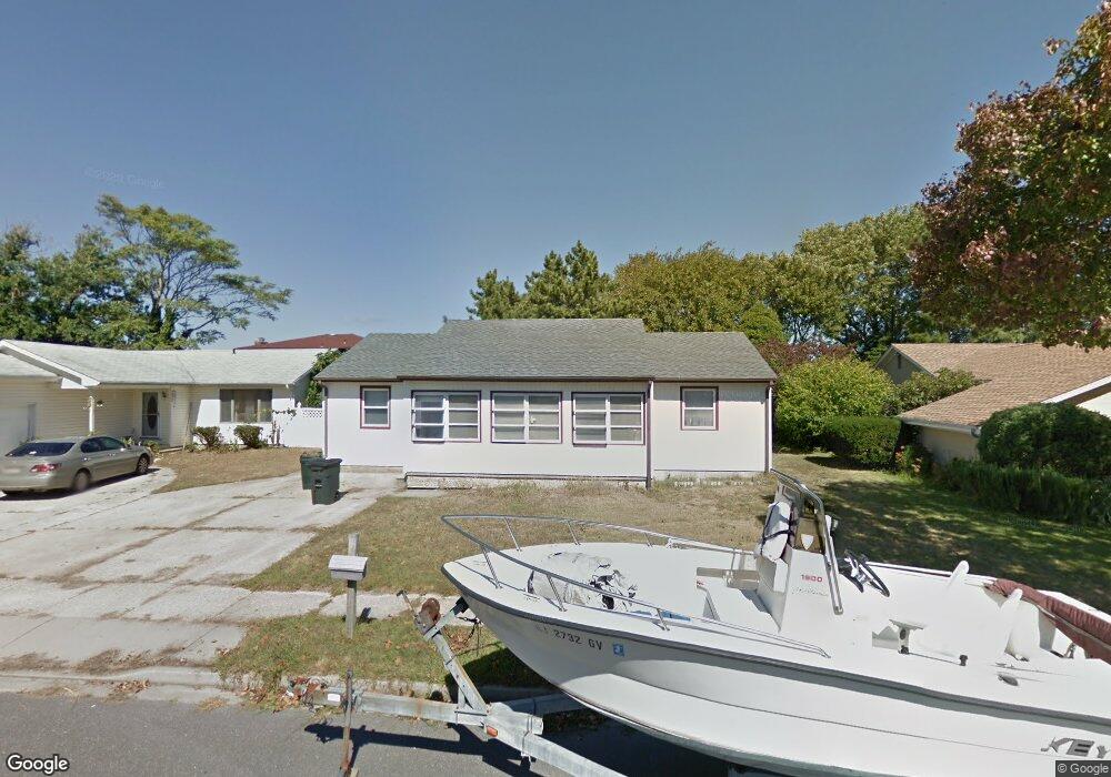
13 Explorer Rd Brigantine, NJ 08203
Estimated Value: $1,284,940 - $1,635,000
3
Beds
2
Baths
1,388
Sq Ft
$1,015/Sq Ft
Est. Value
About This Home
This home is located at 13 Explorer Rd, Brigantine, NJ 08203 and is currently estimated at $1,408,235, approximately $1,014 per square foot. 13 Explorer Rd is a home located in Atlantic County with nearby schools including Brigantine Elementary School and New Hope Christian Academy/Robinson Small Learning Center.
Ownership History
Date
Name
Owned For
Owner Type
Purchase Details
Closed on
Apr 30, 2009
Sold by
Mcmanus Gary Thomas
Bought by
Macready Michael
Current Estimated Value
Home Financials for this Owner
Home Financials are based on the most recent Mortgage that was taken out on this home.
Original Mortgage
$211,500
Outstanding Balance
$133,990
Interest Rate
4.9%
Mortgage Type
Purchase Money Mortgage
Estimated Equity
$1,274,245
Purchase Details
Closed on
Aug 6, 2008
Sold by
Mcmanus Margaret Mary
Bought by
Mcmanus Gary Thomas
Purchase Details
Closed on
Aug 2, 1995
Sold by
Bressler William
Bought by
Mcmanas Gary Thomas and Mcmanas Margaret Mary
Create a Home Valuation Report for This Property
The Home Valuation Report is an in-depth analysis detailing your home's value as well as a comparison with similar homes in the area
Home Values in the Area
Average Home Value in this Area
Purchase History
We collect this data history from publicly available records. To have your information removed, we recommend requesting removal directly through your county’s website.
| Date | Buyer | Sale Price | Title Company |
|---|---|---|---|
| Macready Michael | $235,000 | Fidelity Natl Title Ins Co | |
| Mcmanus Gary Thomas | -- | None Available | |
| Mcmanas Gary Thomas | $90,000 | The Title Company |
Source: Public Records
Mortgage History
We collect this data history from publicly available records. To have your information removed, we recommend requesting removal directly through your county’s website.
| Date | Status | Borrower | Loan Amount |
|---|---|---|---|
| Open | Macready Michael | $211,500 |
Source: Public Records
Tax History
| Year | Tax Paid | Tax Assessment Tax Assessment Total Assessment is a certain percentage of the fair market value that is determined by local assessors to be the total taxable value of land and additions on the property. | Land | Improvement |
|---|---|---|---|---|
| 2025 | $4,027 | $620,500 | $214,200 | $406,300 |
| 2024 | $4,027 | $214,200 | $214,200 | -- |
| 2023 | $5,211 | $300,000 | $214,200 | $85,800 |
| 2022 | $5,211 | $300,000 | $214,200 | $85,800 |
| 2021 | $5,118 | $300,000 | $214,200 | $85,800 |
| 2020 | $5,064 | $300,000 | $214,200 | $85,800 |
| 2019 | $5,296 | $311,000 | $214,200 | $96,800 |
| 2018 | $5,402 | $311,000 | $214,200 | $96,800 |
| 2017 | $5,489 | $311,000 | $214,200 | $96,800 |
| 2016 | $5,486 | $311,000 | $214,200 | $96,800 |
| 2015 | $5,514 | $311,000 | $214,200 | $96,800 |
| 2014 | $5,309 | $311,000 | $214,200 | $96,800 |
Source: Public Records
Map
Nearby Homes
- 313 Seashell Ln
- 301 Gull Cove
- 321 Seashell Ln
- 81 Lagoon Blvd
- 326 Arbegast Dr
- 4311 Harbor Beach Blvd
- 72 Sailfish Dr
- 4240 Atlantic Brigantine Blvd Unit 104
- 108 45th St S
- 4161 Atlantic Brigantine Blvd
- 124 44th St S Unit B
- 4101 Atlantic Brigantine Blvd Unit 6
- 4 Hudson Cove
- 134 44th St S Unit D
- 48 Delmar Dr
- 4501 Atlantic Brigantine Blvd
- 4901 Harbor Beach Blvd Unit L-7
- 4901 Harbor Beach Blvd Unit E-1
- 4901 Harbor Beach Blvd Unit P-8
- 4901 Harbor Beach Blvd Unit Q-8
Your Personal Tour Guide
Ask me questions while you tour the home.