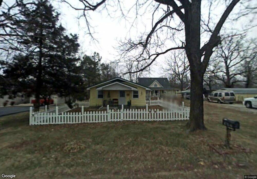
1301 Baker Ln Cassville, MO 65625
Estimated Value: $136,497 - $200,000
2
Beds
1
Bath
1,092
Sq Ft
$157/Sq Ft
Est. Value
About This Home
This home is located at 1301 Baker Ln, Cassville, MO 65625 and is currently estimated at $171,124, approximately $156 per square foot. 1301 Baker Ln is a home with nearby schools including Eunice Thomas Elementary School, Cassville Intermediate School, and Cassville Middle School.
Ownership History
Date
Name
Owned For
Owner Type
Purchase Details
Closed on
Jun 2, 2006
Sold by
Hall Ronal K and Bonner Cynthia S
Bought by
Connella Keith and Connella Barbara
Current Estimated Value
Home Financials for this Owner
Home Financials are based on the most recent Mortgage that was taken out on this home.
Original Mortgage
$50,250
Outstanding Balance
$29,082
Interest Rate
6.58%
Mortgage Type
New Conventional
Estimated Equity
$142,042
Create a Home Valuation Report for This Property
The Home Valuation Report is an in-depth analysis detailing your home's value as well as a comparison with similar homes in the area
Home Values in the Area
Average Home Value in this Area
Purchase History
| Date | Buyer | Sale Price | Title Company |
|---|---|---|---|
| Connella Keith | -- | None Available |
Source: Public Records
Mortgage History
| Date | Status | Borrower | Loan Amount |
|---|---|---|---|
| Open | Connella Keith | $50,250 |
Source: Public Records
Tax History
| Year | Tax Paid | Tax Assessment Tax Assessment Total Assessment is a certain percentage of the fair market value that is determined by local assessors to be the total taxable value of land and additions on the property. | Land | Improvement |
|---|---|---|---|---|
| 2025 | $496 | $11,628 | $1,957 | $9,671 |
| 2024 | $5 | $10,868 | $1,957 | $8,911 |
| 2023 | $496 | $10,868 | $1,957 | $8,911 |
| 2022 | $478 | $10,469 | $1,558 | $8,911 |
| 2020 | $478 | $10,431 | $1,520 | $8,911 |
| 2018 | $425 | $9,500 | $1,520 | $7,980 |
| 2017 | $424 | $9,500 | $1,520 | $7,980 |
| 2016 | $410 | $9,082 | $1,330 | $7,752 |
| 2015 | -- | $9,082 | $1,330 | $7,752 |
| 2014 | -- | $9,082 | $1,330 | $7,752 |
| 2012 | -- | $0 | $0 | $0 |
Source: Public Records
Map
Nearby Homes
- 1000 Hickory St
- 803 Hickory St
- 740 E 13th St
- 300 Crystal View Dr
- 1015 Harold St
- 0000 Farm Road 1135
- 1105 Townsend St
- 304 W 14th St
- 000 Townsend West 9th
- 301 Blackberry Ct Unit Lot 18
- 303 Melton Way
- 000 Luney Dr
- Tbd Holman Rd
- 1101 Sapp St
- 1102 Sapp St
- 16062 Farm Road 1115
- 106 Mountain St
- 501 W 1st St
- 603 W 1st St
- 16329 State Highway 76
Your Personal Tour Guide
Ask me questions while you tour the home.