1301 Cedar Point Rd Sandusky, OH 44870
Estimated Value: $1,375,437 - $1,786,000
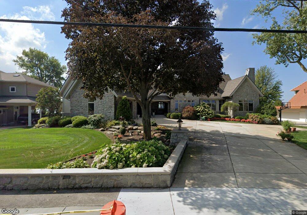
About This Home
This home is located at 1301 Cedar Point Rd, Sandusky, OH 44870 and is currently estimated at $1,523,146, approximately $385 per square foot. 1301 Cedar Point Rd is a home located in Erie County with nearby schools including Sandusky High School.
Ownership History
We collect this data history from publicly available records. To have your information removed, we recommend requesting removal directly through your county’s website.
Purchase Details
Purchase Details
Purchase Details
Home Financials for this Owner
Home Financials are based on the most recent Mortgage that was taken out on this home.Purchase History
We collect this data history from publicly available records. To have your information removed, we recommend requesting removal directly through your county’s website.
| Date | Buyer | Sale Price | Title Company |
|---|---|---|---|
| -- | None Available | ||
| -- | Lawyers Title | ||
| $230,000 | -- |
Mortgage History
We collect this data history from publicly available records. To have your information removed, we recommend requesting removal directly through your county’s website.
| Date | Status | Borrower | Loan Amount |
|---|---|---|---|
| Closed | $172,500 |
Tax History
We collect this data history from publicly available records. To have your information removed, we recommend requesting removal directly through your county’s website.
| Year | Tax Paid | Tax Assessment Tax Assessment Total Assessment is a certain percentage of the fair market value that is determined by local assessors to be the total taxable value of land and additions on the property. | Land | Improvement |
|---|---|---|---|---|
| 2025 | $14,291 | $383,887 | $178,500 | $205,387 |
| 2024 | $14,291 | $383,887 | $178,500 | $205,387 |
| 2023 | $14,775 | $345,646 | $149,625 | $196,021 |
| 2022 | $17,109 | $345,667 | $149,625 | $196,042 |
| 2021 | $17,268 | $345,670 | $149,630 | $196,040 |
| 2020 | $17,632 | $324,540 | $149,630 | $174,910 |
| 2019 | $18,138 | $324,540 | $149,630 | $174,910 |
| 2018 | $18,158 | $324,540 | $149,630 | $174,910 |
| 2017 | $18,079 | $322,110 | $154,610 | $167,500 |
| 2016 | $18,071 | $322,110 | $154,610 | $167,500 |
| 2015 | $16,309 | $322,110 | $154,610 | $167,500 |
| 2014 | $14,784 | $293,750 | $139,650 | $154,100 |
| 2013 | $14,633 | $293,750 | $139,650 | $154,100 |
Map
- 1431 Cedar Point Rd
- 174 Sunset Dr
- 1711 Willow Dr
- 179 Marina Point Dr
- 571 Bimini Dr
- 134 W Birchwood Cir
- 30 Marina Point Dr
- 57 Marina Point Dr
- 31 Marina Point Dr Unit 31
- 32 Marina Point Dr
- 1640 Cleveland Rd W
- 2005 E Oldgate Rd
- 1999 E Oldgate Rd
- 1215 E Farwell St
- 1310 E Larchmont Dr
- 2802 N Bayview Ln
- 3501 Cleveland Rd W
- 2707 Highland Dr
- 2151 Aspen Run Rd
- 2220 Fallen Timber Dr
- 1237 Cedar Point Rd
- 1305 Cedar Point Rd
- 1233 Cedar Point Rd
- 1229 Cedar Point Rd
- 1313 Cedar Point Rd
- 1225 Cedar Point Rd
- 1321 Cedar Point Rd
- 1321 Cedar Point
- 1219 Cedar Point Rd
- 1325 Cedar Point Rd
- 1215 Cedar Point Rd
- 1327 Cedar Point Rd
- 1329 Cedar Point Rd
- 1211 Cedar Point Rd
- 1211 Cedar Point Dr
- 1331 Cedar Point Rd
- 1205 Cedar Point Rd
- 1335 Cedar Point Rd
- 1333 Cedar Point Rd
- 1339 Cedar Point Rd
Ask me questions while you tour the home.