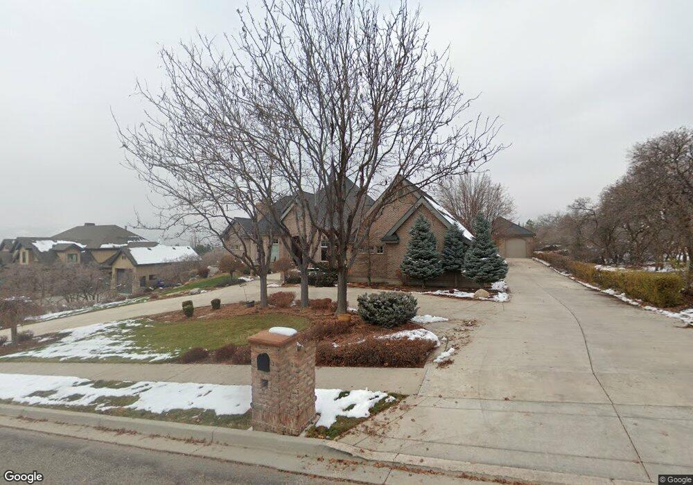
1305 E Lone Peak Dr Alpine, UT 84004
Estimated Value: $3,018,050 - $3,474,000
4
Beds
5
Baths
5,428
Sq Ft
$598/Sq Ft
Est. Value
About This Home
This home is located at 1305 E Lone Peak Dr, Alpine, UT 84004 and is currently estimated at $3,246,025, approximately $598 per square foot. 1305 E Lone Peak Dr is a home located in Utah County with nearby schools including Alpine School, Timberline Middle School, and Lone Peak High School.
Ownership History
Date
Name
Owned For
Owner Type
Purchase Details
Closed on
Aug 30, 2023
Sold by
Sandra S Bradshaw Trust and Warren L Bradshaw Trust
Bought by
Bradshaw Family Trust and Bradshaw
Current Estimated Value
Purchase Details
Closed on
Sep 23, 2005
Sold by
Bradshaw Sandra Gayle and Bradshaw Sandra S
Bought by
Bradshaw Sandra S and Bradshaw Warren L
Purchase Details
Closed on
Sep 29, 2003
Sold by
Dean Karl C
Bought by
Bradshaw Sandra Gayle
Purchase Details
Closed on
Jul 19, 2002
Sold by
Patterson Wayne M and England Charlotte
Bought by
Dean Karl C and Estate Of Dorothy M Schauerhamer
Create a Home Valuation Report for This Property
The Home Valuation Report is an in-depth analysis detailing your home's value as well as a comparison with similar homes in the area
Home Values in the Area
Average Home Value in this Area
Purchase History
| Date | Buyer | Sale Price | Title Company |
|---|---|---|---|
| Bradshaw Family Trust | -- | None Listed On Document | |
| Bradshaw Sandra S | -- | -- | |
| Bradshaw Sandra Gayle | -- | -- | |
| Dean Karl C | -- | Signature Title | |
| Dean Karl C | -- | Signature Title |
Source: Public Records
Tax History
| Year | Tax Paid | Tax Assessment Tax Assessment Total Assessment is a certain percentage of the fair market value that is determined by local assessors to be the total taxable value of land and additions on the property. | Land | Improvement |
|---|---|---|---|---|
| 2025 | $11,465 | $1,555,180 | -- | -- |
| 2024 | $11,465 | $1,336,280 | $0 | $0 |
| 2023 | $9,930 | $1,242,450 | $0 | $0 |
| 2022 | $10,503 | $1,276,330 | $0 | $0 |
| 2021 | $8,864 | $1,673,300 | $571,000 | $1,102,300 |
| 2020 | $8,777 | $1,621,400 | $519,100 | $1,102,300 |
| 2019 | $8,408 | $1,621,400 | $519,100 | $1,102,300 |
| 2018 | $7,554 | $1,439,300 | $435,100 | $1,004,200 |
| 2017 | $7,270 | $737,220 | $0 | $0 |
| 2016 | $7,326 | $692,615 | $0 | $0 |
| 2015 | $7,004 | $626,395 | $0 | $0 |
| 2014 | $6,821 | $603,460 | $0 | $0 |
Source: Public Records
Map
Nearby Homes
- 76 N Bald Mountain Dr
- 1201 E Preston Dr
- 1103 E Lone Peak Dr
- 196 Holly Dr
- 1063 E Alpine Dr
- 1296 Oakwood Cir
- 887 E Village Way
- 202 E Alpine Dr
- 781 N Country Manor Ln
- 499 E 300 N
- 1263 E Chapman Ct
- 986 N Sunbrook Cir
- 475 Grove Dr
- 48 N 100 E
- 13062 N Prospector Way Unit 41
- 682 Healey Blvd
- 358 Eastview Dr
- 512 Eastridge Cir
- 3862 W Oak Hill Dr Unit 7
- 30 S Main St
- 1279 E Lone Peak Dr
- 13 S Wild Flower Dr
- 1310 E Lone Peak Dr
- 87 N Bald Mountain Dr
- 1255 E Lone Peak Dr
- 1290 Pine Ridge Cir
- 1312 Pine Ridge Cir
- 10 S Wild Flower Dr
- 121 N Bald Mountain Dr E Unit 28
- 31 S Wild Flower Dr
- 1260 Pine Ridge Cir
- 1223 E Lone Peak Dr
- 153 N Bald Mountain Dr
- 24 S Bald Mountain Dr
- 1226 E Lone Peak Dr Unit 7
- 36 S Wild Flower Dr
- 51 S Wild Flower Dr
- 44 Bald Mtn Dr E Unit 16
- 1226 E Lone Peak Dr
- 1226 E Lone Peak Dr Unit 7
Your Personal Tour Guide
Ask me questions while you tour the home.