1306 Reid Rd Neosho, MO 64850
Estimated Value: $193,779 - $273,000
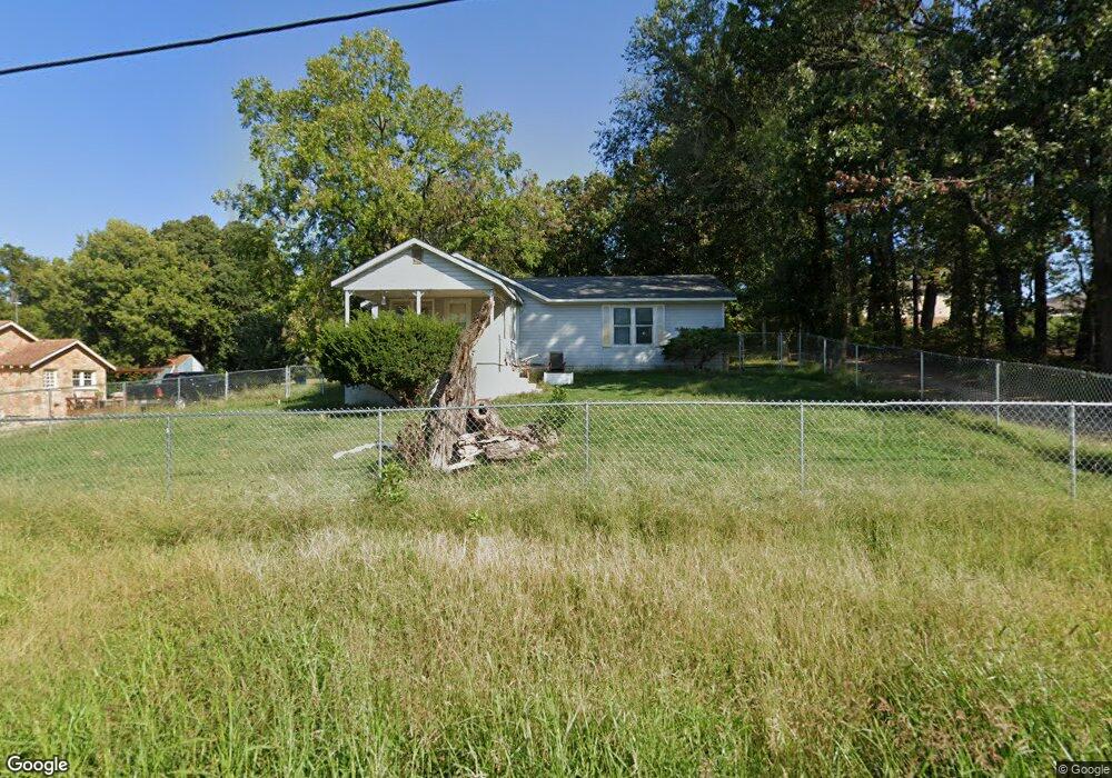
About This Home
This home is located at 1306 Reid Rd, Neosho, MO 64850 and is currently estimated at $227,195, approximately $152 per square foot. 1306 Reid Rd is a home with nearby schools including Neosho High School, Ozark Christian Academy, and Neosho Christian Schools.
Ownership History
We collect this data history from publicly available records. To have your information removed, we recommend requesting removal directly through your county’s website.
Purchase Details
Home Financials for this Owner
Home Financials are based on the most recent Mortgage that was taken out on this home.Purchase Details
Home Values in the Area
Average Home Value in this Area
Purchase History
We collect this data history from publicly available records. To have your information removed, we recommend requesting removal directly through your county’s website.
| Date | Buyer | Sale Price | Title Company |
|---|---|---|---|
| -- | Fidelity Title | ||
| -- | None Listed On Document |
Mortgage History
We collect this data history from publicly available records. To have your information removed, we recommend requesting removal directly through your county’s website.
| Date | Status | Borrower | Loan Amount |
|---|---|---|---|
| Open | $182,400 |
Tax History
We collect this data history from publicly available records. To have your information removed, we recommend requesting removal directly through your county’s website.
| Year | Tax Paid | Tax Assessment Tax Assessment Total Assessment is a certain percentage of the fair market value that is determined by local assessors to be the total taxable value of land and additions on the property. | Land | Improvement |
|---|---|---|---|---|
| 2025 | $908 | $16,990 | -- | -- |
| 2024 | $762 | $16,490 | -- | -- |
| 2023 | $762 | $13,890 | $1,672 | $12,218 |
| 2022 | $762 | $13,890 | -- | -- |
| 2021 | $762 | $13,890 | $0 | $0 |
| 2020 | $664 | $12,150 | $0 | $0 |
| 2019 | $605 | $12,150 | $0 | $0 |
| 2018 | $609 | $12,150 | $0 | $0 |
| 2017 | $594 | $12,150 | $0 | $0 |
| 2016 | $594 | $11,840 | $0 | $0 |
| 2015 | -- | $11,550 | $0 | $0 |
| 2014 | -- | $11,550 | $0 | $0 |
Map
- Tbd-B State Highway 86
- 1258 Circle Dr
- 1302 Marion Dr
- 1310 Reid Rd
- 1094 N Business 49
- 1021 Skyline Dr
- 1431 Greenwood Blvd
- 1604 Greenwood Blvd
- 813 Roundup Hill
- 249 Hillcrest Dr
- 13194 Kirkwood Ln
- 4071 Deer Ridge St
- 527 Morrow St
- Xxx Deer Ridge Rd
- Xxx Deer Ridge Rd Unit 36
- Lot 13 14 Sherry Dr
- Lots 13 14 Sherry Dr
- 0 Sherry Dr
- 717 Benham Ave
- 410 N High St
- 1601 Mayberry Dr Unit D
- 1601 Mayberry Dr
- 1601 Mayberry Dr Unit C
- 1601 Mayberry Dr Unit A
- 1601 Mayberry Dr Unit B
- 1605 Mayberry Dr Unit C
- 1605 Mayberry Dr Unit D
- 1616 Mayberry Dr
- 1655 Mayberry Dr
- 1609 Mayberry Dr
- 1221 Reid Rd
- 1602 Mayberry Dr
- 1205 Reid Rd
- 1606 Mayberry Dr
- 1609 1611
- 1611 Mayberry Dr
- 1227 Reid Rd Unit 2
- 1608 1610 1612 Mayberry
- 1612 Mayberry Dr
- 1678 Mayberry Dr
Ask me questions while you tour the home.