131 Cox St Lagrange, GA 30240
Estimated Value: $93,000 - $165,000
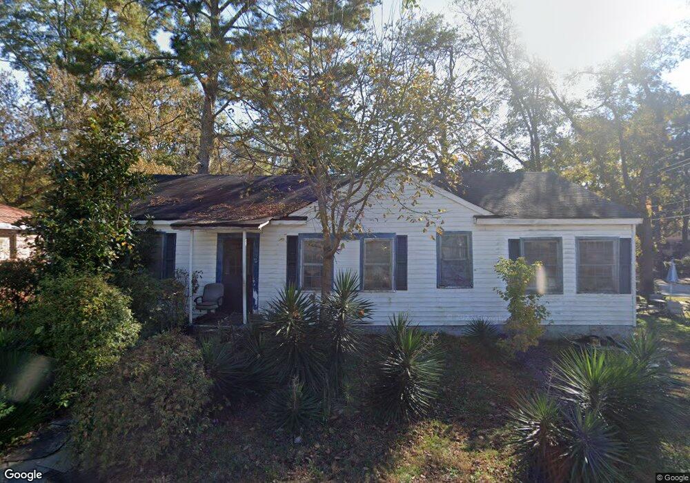
About This Home
This home is located at 131 Cox St, Lagrange, GA 30240 and is currently estimated at $127,675, approximately $100 per square foot. 131 Cox St is a home located in Troup County with nearby schools including Franklin Forest Elementary School, Hollis Hand Elementary School, and Ethel W. Kight Elementary School.
Ownership History
We collect this data history from publicly available records. To have your information removed, we recommend requesting removal directly through your county’s website.
Purchase Details
Purchase Details
Purchase Details
Purchase Details
Purchase Details
Purchase Details
Purchase Details
Purchase Details
Purchase Details
Purchase Details
Purchase History
We collect this data history from publicly available records. To have your information removed, we recommend requesting removal directly through your county’s website.
| Date | Buyer | Sale Price | Title Company |
|---|---|---|---|
| -- | -- | ||
| -- | -- | ||
| $32,000 | -- | ||
| $283,700 | -- | ||
| $10,000 | -- | ||
| -- | -- | ||
| -- | -- | ||
| -- | -- | ||
| $4,500 | -- | ||
| -- | -- |
Tax History
We collect this data history from publicly available records. To have your information removed, we recommend requesting removal directly through your county’s website.
| Year | Tax Paid | Tax Assessment Tax Assessment Total Assessment is a certain percentage of the fair market value that is determined by local assessors to be the total taxable value of land and additions on the property. | Land | Improvement |
|---|---|---|---|---|
| 2025 | $868 | $31,840 | $2,600 | $29,240 |
| 2024 | $823 | $30,160 | $2,600 | $27,560 |
| 2023 | $659 | $24,160 | $2,600 | $21,560 |
| 2022 | $642 | $23,000 | $2,600 | $20,400 |
| 2021 | $555 | $18,400 | $2,600 | $15,800 |
| 2020 | $555 | $18,400 | $2,600 | $15,800 |
| 2019 | $519 | $17,200 | $2,600 | $14,600 |
| 2018 | $538 | $17,840 | $3,240 | $14,600 |
| 2017 | $538 | $17,840 | $3,240 | $14,600 |
| 2016 | $531 | $17,610 | $3,240 | $14,370 |
| 2015 | $514 | $17,001 | $2,631 | $14,370 |
| 2014 | $492 | $16,244 | $2,631 | $13,614 |
| 2013 | -- | $17,525 | $2,656 | $14,869 |
Map
- 725 N Greenwood St
- 222 Beechwood Cir
- 219 Banks St
- 900 North St
- 120 North St
- 0 Ridley Ave Unit 10550104
- 609 Ridley Ave
- 707 Ridley Ave
- 611 Ridley Ave
- 615 Ridley Ave
- 709 Ridley Ave
- 733 Azalea Dr
- 202 Park Hill Dr
- 106 Ewing St
- 450 Gordon Cir
- 105 Dogwood Dr
- 724 Camellia Dr
- 102 Dogwood Dr
- 301 E Bacon St
- 806 New Franklin Rd
- 737 N Greenwood St
- 735 N Greenwood St
- 733 N Greenwood St
- 249 Beechwood Cir
- 731 N Greenwood St
- 732 N Greenwood St Unit 4
- 732 N Greenwood St
- 247 Beechwood Cir
- 734 N Greenwood St
- 736 N Greenwood St
- 251 Beechwood Cir
- 730 N Greenwood St
- 738 N Greenwood St
- 729 N Greenwood St
- 728 N Greenwood St
- 245 Beechwood Cir
- 253 Beechwood Cir
- 129 Cox St
- 226 Beechwood Cir
- 803 N Greenwood St
Ask me questions while you tour the home.