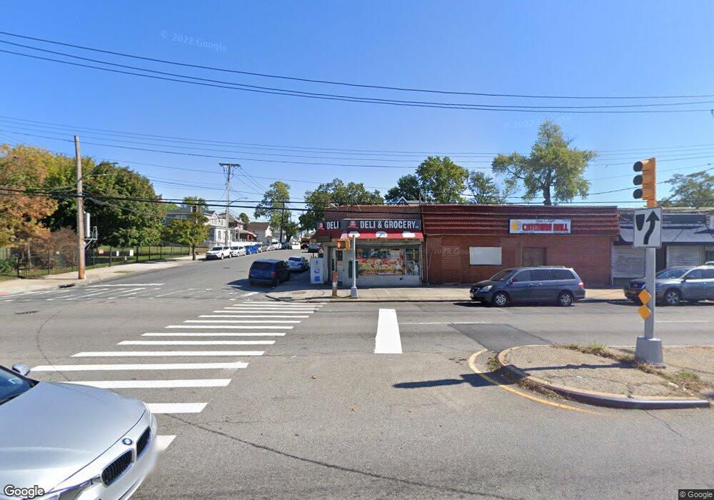
13121 Springfield Blvd Springfield Gardens, NY 11413
Laurelton NeighborhoodEstimated Value: $2,666,646
Studio
--
Bath
12,000
Sq Ft
$222/Sq Ft
Est. Value
About This Home
This home is located at 13121 Springfield Blvd, Springfield Gardens, NY 11413 and is currently estimated at $2,666,646, approximately $222 per square foot. 13121 Springfield Blvd is a home located in Queens County with nearby schools including P.S. 132 - Ralph Bunche, Is 59 Springfield Gardens, and Allen Christian School.
Ownership History
Date
Name
Owned For
Owner Type
Purchase Details
Closed on
Jun 29, 2020
Sold by
Giscombe Ruth
Bought by
131-21 Springfield Llc
Current Estimated Value
Purchase Details
Closed on
Jun 1, 2006
Sold by
Brogdon Brothers
Bought by
Giscombe Ruth
Home Financials for this Owner
Home Financials are based on the most recent Mortgage that was taken out on this home.
Original Mortgage
$825,000
Interest Rate
6.47%
Mortgage Type
Commercial
Create a Home Valuation Report for This Property
The Home Valuation Report is an in-depth analysis detailing your home's value as well as a comparison with similar homes in the area
Home Values in the Area
Average Home Value in this Area
Purchase History
| Date | Buyer | Sale Price | Title Company |
|---|---|---|---|
| 131-21 Springfield Llc | $2,150,000 | -- | |
| Giscombe Ruth | $1,100,000 | -- |
Source: Public Records
Mortgage History
| Date | Status | Borrower | Loan Amount |
|---|---|---|---|
| Previous Owner | Giscombe Ruth | $825,000 |
Source: Public Records
Tax History
| Year | Tax Paid | Tax Assessment Tax Assessment Total Assessment is a certain percentage of the fair market value that is determined by local assessors to be the total taxable value of land and additions on the property. | Land | Improvement |
|---|---|---|---|---|
| 2025 | $59,933 | $553,680 | $208,350 | $345,330 |
| 2024 | $59,933 | $565,830 | $208,350 | $357,480 |
| 2023 | $59,866 | $565,200 | $208,350 | $356,850 |
| 2022 | $59,529 | $553,500 | $208,350 | $345,150 |
| 2021 | $51,973 | $486,000 | $208,350 | $277,650 |
| 2020 | $61,035 | $648,000 | $208,350 | $439,650 |
| 2019 | $57,589 | $616,050 | $208,350 | $407,700 |
| 2018 | $54,221 | $515,700 | $208,350 | $307,350 |
| 2017 | $51,275 | $487,680 | $208,350 | $279,330 |
| 2016 | $48,589 | $487,680 | $208,350 | $279,330 |
| 2015 | $19,932 | $433,320 | $208,350 | $224,970 |
| 2014 | $19,932 | $431,520 | $208,350 | $223,170 |
Source: Public Records
Map
Nearby Homes
- 21706 131st Ave
- 12516 Adair St
- 21614 132nd Rd
- 13024 Springfield Blvd
- 13022 Springfield Blvd
- 13003 Springfield Blvd
- 19410 Nashville Blvd
- 21908 131st Ave
- 194-01 Nashville Blvd
- 19401 Nashville Blvd
- 21910 132nd Rd
- 21621 133rd Rd
- 122-52 Springfield Blvd
- 195-12 122nd Ave
- 195-20 122nd Ave
- 21827 130th Ave
- 187-19 Pineville Ln
- 187-01 Ridgedale St
- 122-14 191st St
- 18806 Nashville Blvd
- 13121 Springfield Blvd
- 13121 Springfield Blvd
- 131-23 Springfield Blvd
- 131-25 Springfield Blvd
- 131-21 Springfield Blvd
- 21614 131st Ave
- 131-35 Springfield Blvd
- 13135 Springfield Blvd
- 21618 131st Ave
- 21615 132nd Ave
- 21622 131st Ave
- 21619 132nd Ave
- 21617 131st Ave
- 21626 131st Ave
- 21626 131st Ave
- 21626 131st Ave
- 131-22 Springfield Blvd
- 13118 Springfield Blvd
- 13055 Springfield Blvd
- 131-18 Springfield Blvd
Your Personal Tour Guide
Ask me questions while you tour the home.