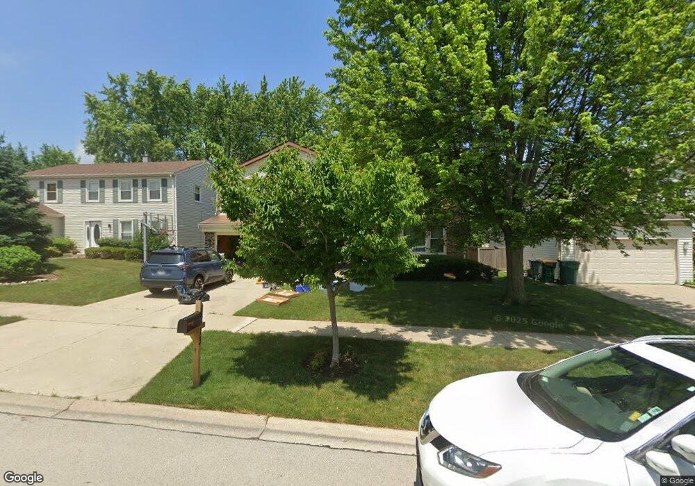
1313 Devonshire Rd Buffalo Grove, IL 60089
Prairie Park-Lake County NeighborhoodEstimated Value: $450,253 - $567,000
Studio
3
Baths
1,485
Sq Ft
$337/Sq Ft
Est. Value
About This Home
This home is located at 1313 Devonshire Rd, Buffalo Grove, IL 60089 and is currently estimated at $500,313, approximately $336 per square foot. 1313 Devonshire Rd is a home located in Lake County with nearby schools including Prairie Elementary School, Twin Groves Middle School, and Adlai E Stevenson High School.
Ownership History
Date
Name
Owned For
Owner Type
Purchase Details
Closed on
Aug 1, 2007
Sold by
Toscano Deborah B
Bought by
Toscano Deborah B and Deborah B Toscano Trust
Current Estimated Value
Purchase Details
Closed on
Jul 31, 2002
Sold by
Shechter Judith R and Shechter Benjamin
Bought by
Toscano Perry A and Toscano Deborah B
Home Financials for this Owner
Home Financials are based on the most recent Mortgage that was taken out on this home.
Original Mortgage
$280,750
Outstanding Balance
$117,609
Interest Rate
6.41%
Estimated Equity
$382,704
Create a Home Valuation Report for This Property
The Home Valuation Report is an in-depth analysis detailing your home's value as well as a comparison with similar homes in the area
Home Values in the Area
Average Home Value in this Area
Purchase History
| Date | Buyer | Sale Price | Title Company |
|---|---|---|---|
| Toscano Deborah B | -- | None Available | |
| Toscano Perry A | $361,000 | Chicago Title Insurance Co |
Source: Public Records
Mortgage History
| Date | Status | Borrower | Loan Amount |
|---|---|---|---|
| Open | Toscano Perry A | $280,750 |
Source: Public Records
Tax History
| Year | Tax Paid | Tax Assessment Tax Assessment Total Assessment is a certain percentage of the fair market value that is determined by local assessors to be the total taxable value of land and additions on the property. | Land | Improvement |
|---|---|---|---|---|
| 2024 | $14,630 | $159,634 | $33,162 | $126,472 |
| 2023 | $13,861 | $150,627 | $31,291 | $119,336 |
| 2022 | $13,861 | $138,927 | $28,860 | $110,067 |
| 2021 | $13,336 | $137,429 | $28,549 | $108,880 |
| 2020 | $13,021 | $137,897 | $28,646 | $109,251 |
| 2019 | $12,842 | $137,388 | $28,540 | $108,848 |
| 2018 | $11,227 | $124,523 | $28,208 | $96,315 |
| 2017 | $11,096 | $121,617 | $27,550 | $94,067 |
| 2016 | $10,725 | $116,458 | $26,381 | $90,077 |
| 2015 | $10,439 | $108,910 | $24,671 | $84,239 |
| 2014 | $7,869 | $82,455 | $26,496 | $55,959 |
| 2012 | $7,801 | $82,620 | $26,549 | $56,071 |
Source: Public Records
Map
Nearby Homes
- 1234 Devonshire Rd
- 962 Thompson Blvd
- 1120 Courtland Dr
- 1135 Thompson Blvd
- 1150 Thompson Blvd
- 327 Lasalle Ln
- 5107 N Arlington Heights Rd
- 5176 Aptakisic Rd
- 5152 Bridlewood Ln
- 600 Thompson Blvd
- 525 Lasalle Ln
- 5135 Bridlewood Ct
- 1217 Franklin Ln Unit G5
- 405 Caren Dr
- 736 Clohesey Dr
- 1480 Fairfax Ln
- 711 Woodhollow Ln
- 1602 Brittany Ln
- 1005 Cooper Ct
- 924 Hidden Lake Dr
- 1315 Devonshire Rd
- 1311 Devonshire Rd
- 908 Chaucer Way
- 1317 Devonshire Rd
- 1309 Devonshire Rd
- 884 Chaucer Way
- 920 Chaucer Way
- 1312 Devonshire Rd
- 1314 Devonshire Rd
- 1310 Devonshire Rd
- 1319 Devonshire Rd
- 1307 Devonshire Rd
- 1316 Devonshire Rd
- 1308 Devonshire Rd
- 872 Chaucer Way
- 934 Chaucer Way
- 1321 Devonshire Rd
- 1320 Devonshire Rd
- 1305 Devonshire Rd
- 1306 Devonshire Rd
Your Personal Tour Guide
Ask me questions while you tour the home.