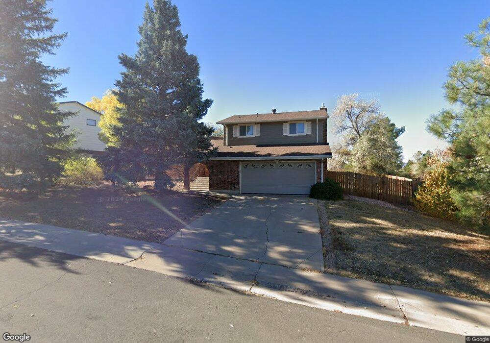
13143 Canopus Dr Lone Tree, CO 80124
Estimated Value: $545,123 - $610,000
3
Beds
3
Baths
1,664
Sq Ft
$347/Sq Ft
Est. Value
About This Home
This home is located at 13143 Canopus Dr, Lone Tree, CO 80124 and is currently estimated at $577,562, approximately $347 per square foot. 13143 Canopus Dr is a home located in Douglas County with nearby schools including Acres Green Elementary School, Cresthill Middle School, and Highlands Ranch High School.
Ownership History
Date
Name
Owned For
Owner Type
Purchase Details
Closed on
Mar 16, 2016
Sold by
Catledge Tom
Bought by
Benner Deborah J
Current Estimated Value
Home Financials for this Owner
Home Financials are based on the most recent Mortgage that was taken out on this home.
Original Mortgage
$205,900
Outstanding Balance
$161,626
Interest Rate
3.65%
Mortgage Type
New Conventional
Estimated Equity
$415,936
Purchase Details
Closed on
May 28, 1999
Sold by
Willis Marvin H and Willis Beverly
Bought by
Catledge Ronald Wayne
Home Financials for this Owner
Home Financials are based on the most recent Mortgage that was taken out on this home.
Original Mortgage
$161,500
Interest Rate
6.92%
Purchase Details
Closed on
Sep 4, 1979
Sold by
Unavailable
Bought by
Unavailable
Create a Home Valuation Report for This Property
The Home Valuation Report is an in-depth analysis detailing your home's value as well as a comparison with similar homes in the area
Home Values in the Area
Average Home Value in this Area
Purchase History
| Date | Buyer | Sale Price | Title Company |
|---|---|---|---|
| Benner Deborah J | $382,200 | None Available | |
| Catledge Ronald Wayne | $170,000 | -- | |
| Unavailable | $67,200 | -- |
Source: Public Records
Mortgage History
| Date | Status | Borrower | Loan Amount |
|---|---|---|---|
| Open | Benner Deborah J | $205,900 | |
| Previous Owner | Catledge Ronald Wayne | $161,500 |
Source: Public Records
Tax History
| Year | Tax Paid | Tax Assessment Tax Assessment Total Assessment is a certain percentage of the fair market value that is determined by local assessors to be the total taxable value of land and additions on the property. | Land | Improvement |
|---|---|---|---|---|
| 2025 | $3,379 | $38,040 | $7,690 | $30,350 |
| 2024 | $3,379 | $40,500 | $8,200 | $32,300 |
| 2023 | $3,414 | $40,500 | $8,200 | $32,300 |
| 2022 | $2,460 | $27,630 | $6,960 | $20,670 |
| 2021 | $2,559 | $27,630 | $6,960 | $20,670 |
| 2020 | $2,445 | $27,050 | $6,590 | $20,460 |
| 2019 | $2,453 | $27,050 | $6,590 | $20,460 |
| 2018 | $1,927 | $22,760 | $5,730 | $17,030 |
| 2017 | $1,959 | $22,760 | $5,730 | $17,030 |
| 2016 | $1,716 | $19,530 | $4,160 | $15,370 |
| 2015 | $878 | $19,530 | $4,160 | $15,370 |
| 2014 | $1,576 | $16,420 | $3,980 | $12,440 |
Source: Public Records
Map
Nearby Homes
- 8872 Chestnut Hill Ln
- 8852 Chestnut Hill Ln
- 811 Altair Dr
- 7057 Chestnut Hill St
- 6945 Mountain Brush Cir
- 8049 Sweet Water Rd
- 9314 Wiltshire Dr
- 8159 Lodgepole Trail
- 642 Scorpio Dr
- 7191 Palisade Dr
- 13673 Libra Ct
- 9377 Newport Ln
- 9320 Miles Dr
- 9445 Cheshire Ct
- 9356 Bauer Ct Unit 3
- 200 Dianna Dr
- 9390 Yale Ln
- 9407 Harvard Dr
- 8666 Ainsdale Ct Unit 12B
- 9395 Princeton Cir
- 13153 Canopus Dr
- 13133 Canopus Dr
- 867 Hamal Dr
- 13144 Canopus Dr
- 13144 Hadar Dr
- 13134 Canopus Dr
- 13154 Canopus Dr
- 13163 Canopus Dr
- 897 Hamal Dr
- 817 Hamal Dr
- 13154 Hadar Dr
- 13164 Canopus Dr
- 868 Hamal Dr
- 848 Hamal Dr
- 13163 Peacock Dr
- 13173 Peacock Dr
- 878 Hamal Dr
- 13173 Canopus Dr
- 838 Hamal Dr
- 13183 Peacock Dr
Your Personal Tour Guide
Ask me questions while you tour the home.