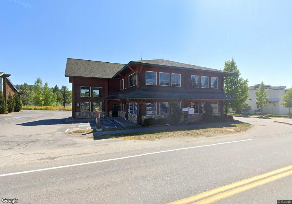
1315 U S 2 Sandpoint, ID 83864
Studio
--
Bath
6,644
Sq Ft
13,068
Sq Ft Lot
About This Home
This home is located at 1315 U S 2, Sandpoint, ID 83864. 1315 U S 2 is a home located in Bonner County with nearby schools including Washington Elementary School, Sandpoint Middle School, and Sandpoint High School.
Ownership History
Date
Name
Owned For
Owner Type
Purchase Details
Closed on
Jul 23, 2019
Sold by
Monheim Shawn A and Monheim Hal
Bought by
Monheim Hal
Purchase Details
Closed on
Jul 3, 2019
Sold by
Wood Llc
Bought by
Eat Four Llc
Purchase Details
Closed on
Sep 14, 2015
Sold by
Miller James R and Miller Nancy L
Bought by
Wood Llc
Home Financials for this Owner
Home Financials are based on the most recent Mortgage that was taken out on this home.
Original Mortgage
$616,347
Interest Rate
3.89%
Mortgage Type
Commercial
Create a Home Valuation Report for This Property
The Home Valuation Report is an in-depth analysis detailing your home's value as well as a comparison with similar homes in the area
Home Values in the Area
Average Home Value in this Area
Purchase History
| Date | Buyer | Sale Price | Title Company |
|---|---|---|---|
| Monheim Hal | -- | Titleone | |
| Monheim Hal | -- | Titleone | |
| Eat Four Llc | -- | None Available | |
| Wood Llc | -- | Alliance Title |
Source: Public Records
Mortgage History
| Date | Status | Borrower | Loan Amount |
|---|---|---|---|
| Previous Owner | Wood Llc | $616,347 |
Source: Public Records
Tax History
| Year | Tax Paid | Tax Assessment Tax Assessment Total Assessment is a certain percentage of the fair market value that is determined by local assessors to be the total taxable value of land and additions on the property. | Land | Improvement |
|---|---|---|---|---|
| 2025 | $6,357 | $1,020,803 | $261,360 | $759,443 |
| 2024 | $6,285 | $1,020,803 | $261,360 | $759,443 |
| 2023 | $6,529 | $1,016,231 | $261,360 | $754,871 |
| 2022 | $7,138 | $1,016,231 | $261,360 | $754,871 |
| 2021 | $6,105 | $583,380 | $130,680 | $452,700 |
| 2020 | $5,975 | $583,380 | $130,680 | $452,700 |
| 2019 | $6,756 | $583,380 | $130,680 | $452,700 |
| 2018 | $7,101 | $564,871 | $130,680 | $434,191 |
| 2017 | $7,101 | $563,869 | $0 | $0 |
| 2016 | $8,054 | $611,317 | $0 | $0 |
| 2015 | -- | $811,916 | $0 | $0 |
| 2014 | -- | $811,916 | $0 | $0 |
Source: Public Records
Map
Nearby Homes
- 424 S Olive Ave
- 403 S Olive Ave
- 515 S Lavina Ave
- 1215 Church St
- 724 Pine St
- 1309 Westwood Ln
- 215 N Forest Ave
- 917 Cedar St
- 1619 Gondola Ct
- 1623 Gondola Ct
- 1607 Gondola Ct
- 1216 Alder St
- 1619 Mosshart St
- 417 Pine St
- 1210 Main St
- 231 S 4th Ave
- NNA W Pine St
- Lot 2 W Pine St
- 503 Cedar St
- 503 Cedar St Unit 203
- 1315 Highway 2
- 1305 Highway 2
- 1319 U S 2 Unit Highway 2 / Division
- 1319 U S 2
- 1319 Hwy 2 (Retail Building-2 Warehouses-4 3 Acres)
- 1319 Highway 2 [Retail Center]
- 1305 U S 2
- 1319 Highway 2
- NNA Ontario (Land Only 3 18 Ac)
- NNA Ontario (2 Warehouses On 4 3 Ac)
- 419 S Division Ave
- 1323 U S 2
- 1323 U S 2 Unit Division at Highway
- 1323 U S 2 Unit Highway 2 / Division
- 1323 U S 2 Unit Highway 2 / Division
- NNA S Division Ave
- 517 Hawkeye Dr
- 0 Ontario (2 Warehouses On 1 12 Ac) Unit 20200692
- 424 S Olive Ave Unit 101
- 424 S Olive Ave Unit 203
Your Personal Tour Guide
Ask me questions while you tour the home.